Enable Location

We need your location to show you interesting places around you

Discover nearby places

Find interesting locations and hidden gems around you

Precise directions

Get accurate directions and distances to places

Your location is never shared with other users. It's only used when you tap the location button.

Interstate 89

Log in to your account

Start exploring — it's free

Trusted by 63,113 travelers worldwide

Continue with Google
Continue with Apple
or

We will send you a code to connect

By continuing, you accept our Terms and Conditions and our Privacy Policy

Check your inbox

We've sent a pincode in your inbox. Please enter the code below.

Interstate 89
Discussion Reviews 1 Photos
31.9k Popularity

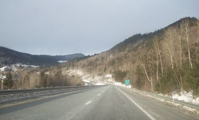
Interstate 89, Interstate highway in New Hampshire and Vermont, United States

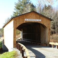
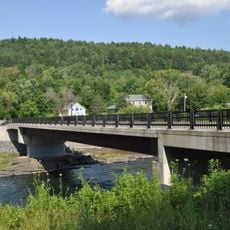
Interstate 89 runs for 191 miles through northern New England, connecting Concord, Lebanon, Montpelier, and Burlington before reaching the Canadian border. The road maintains two lanes in each direction and provides direct access to ski resorts, state parks, and outdoor recreation areas across both states.

Construction began in New Hampshire in 1967 and continued with sections through Vermont in the years that followed. This phased completion improved connections between the two states and toward the Canadian border.

The highway connects important educational centers like Dartmouth College in Hanover and the University of Vermont in Burlington. It shapes daily life for students, commuters, and visitors traveling between these two states.

The road is passable year-round, though winter conditions are common in both states and regular clearing is maintained. Travelers should watch for wildlife crossing in forested sections, especially during early morning and dusk hours.

This highway is the only interstate in the United States that links the capital cities of two states without crossing any other major interstate. This makes it an unusually direct route between Concord and Montpelier.

The community of curious travelers

AroundUs brings together thousands of curated places, local tips, and hidden gems, enriched daily by 60,000 contributors worldwide.

Start exploring
Location
Location
Inception
1967
GPS coordinates
43.78305,-72.46845
Latest update
December 20, 2025 00:56
Around this place
Joseph Smith Birthplace Memorial
United States of America

Joseph Smith Birthplace Memorial

4.5 km
Gile Mountain
United States of America

Gile Mountain

9.4 km
Justin Smith Morrill Homestead
United States of America

Justin Smith Morrill Homestead

11.6 km
Silver Lake State Park
United States of America

Silver Lake State Park

13.2 km
Mill Covered Bridge
United States of America

Mill Covered Bridge

12.2 km
Joseph Fessenden House
United States of America

Joseph Fessenden House

7.3 km
Kingsbury Covered Bridge
United States of America

Kingsbury Covered Bridge

14.2 km
West Hartford Bridge
United States of America

West Hartford Bridge

8.9 km
Cilley Covered Bridge
United States of America

Cilley Covered Bridge

11.5 km
Howe Covered Bridge
United States of America

Howe Covered Bridge

9.4 km
Beaver Meadow Union Chapel
United States of America

Beaver Meadow Union Chapel

7.9 km
Jericho Rural Historic District
United States of America

Jericho Rural Historic District

11.5 km
Beaver Meadow School
United States of America

Beaver Meadow School

8.1 km
St. Paul's Episcopal Church
United States of America

St. Paul's Episcopal Church

7.2 km
Fox Stand
United States of America

Fox Stand

8.9 km
South Tunbridge Methodist Episcopal Church
United States of America

South Tunbridge Methodist Episcopal Church

8.6 km
South Royalton Historic District
United States of America

South Royalton Historic District

6 km
Aiken Stand Complex
United States of America

Aiken Stand Complex

11.3 km
Harrington House
United States of America

Harrington House

13.8 km
Bridge 15
United States of America

Bridge 15

690 m
Hayward and Kibby Mill
United States of America

Hayward and Kibby Mill

12.2 km
Chelsea Street Bridge
United States of America

Chelsea Street Bridge

6 km
Strafford Village Historic District
United States of America

Strafford Village Historic District

11.6 km
Gate of the Hills
United States of America

Gate of the Hills

13.7 km
Bethel Village Historic District
United States of America

Bethel Village Historic District

14.3 km
Tunbridge Village Historic District
United States of America

Tunbridge Village Historic District

11.8 km
Royalton Mill Complex
United States of America

Royalton Mill Complex

6.6 km
Joseph Smith Monument
United States of America

Joseph Smith Monument

4.5 km
Show the full map
Reviews
Share your experience

No review yet

Discussions
Start a discussion...

No discussion yet

« Interstate 89 - Interstate highway in New Hampshire and Vermont, United States » is provided by Around Us (aroundus.com). Images and texts are derived from Wikimedia project under a Creative Commons license. You are allowed to copy, distribute, and modify copies of this page, under the conditions set by the license, as long as this note is clearly visible.

Discover hidden gems everywhere you go!

From secret cafés to breathtaking viewpoints, skip the crowded tourist spots and find places that match your style. Our app makes it easy with voice search, smart filtering, route optimization, and insider tips from travelers worldwide. Download now for the complete mobile experience.

Around Us App Screenshot

A unique approach to discovering new places

Le Figaro

All the places worth exploring

France Info

A tailor-made excursion in just a few clicks

20 Minutes

Around Us
Travel Guide & Maps
Download

Send to your phone

QR Code
1

Open the camera app on your mobile.

2

Point at the QR code with your camera. A notification will appear.

3

Tap the notification to open the link.