Craig County

Log in to your account

AroundUs is a community-driven map of interesting places, built by curious explorers like you. It grows with every review, story, and photo you share.
Connect to save your favorite spots, contribute locations, and create personalized routes.
By continuing, you accept our Terms and Conditions and our Privacy Policy
Add to collection
Map
Suggest a change
Share

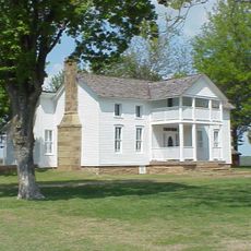
Craig County, Administrative county in northeastern Oklahoma, US

Craig County is an administrative county in northeastern Oklahoma with Vinita serving as its government center, covering an area with diverse terrain. The town houses the courthouse and primary administrative facilities that serve the entire county.

The county was established on July 16, 1907, when Oklahoma achieved statehood, emerging from territories previously inhabited by Native American nations. This founding represented a major administrative shift in the region.

The county maintains strong ties to Cherokee heritage through local traditions and community gatherings where indigenous history remains part of everyday life.

Visitors can find local information and services in Vinita, where the courthouse and key administrative facilities are centered. Access to these places is straightforward for most visitors since everything is located in the town's central area.

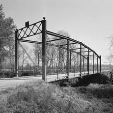
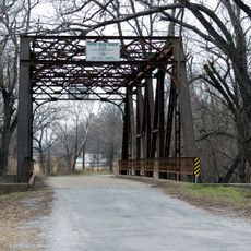
The area contains multiple archaeological sites showing evidence of early indigenous settlement and providing insights into prehist oric human activity. These locations document a long history of habitation by different cultures over thousands of years.

Location: Oklahoma

Inception: July 16, 1907

Capital city: Vinita

Shares border with: Labette County, Mayes County, Cherokee County, Ottawa County, Delaware County, Rogers County, Nowata County

GPS coordinates: 36.76000,-95.22000

Latest update: December 10, 2025 15:52

Photos
Around this place
Ghost light
United States of America

Ghost light

55.3 km
Grand Lake o' the Cherokees
United States of America

Grand Lake o' the Cherokees

37.6 km
Rainbow Bridge
United States of America

Rainbow Bridge

55.1 km
Dog Iron Ranch
United States of America

Dog Iron Ranch

50.7 km
Ed Galloway's Totem Pole Park
United States of America

Ed Galloway's Totem Pole Park

41.3 km
Afton Station Packard Museum
United States of America

Afton Station Packard Museum

24.1 km
Coleman Theatre
United States of America

Coleman Theatre

33.1 km
Splitlog Church
United States of America

Splitlog Church

50.2 km
Attucks School
United States of America

Attucks School

15.7 km
John Patrick McNaughton Barn
United States of America

John Patrick McNaughton Barn

41.7 km
First Methodist Episcopal Church, South
United States of America

First Methodist Episcopal Church, South

14.7 km
Foyil Filling Station
United States of America

Foyil Filling Station

45.1 km
George L. Coleman Sr. House
United States of America

George L. Coleman Sr. House

34.8 km
Diamond Point School
United States of America

Diamond Point School

45.9 km
Oswego Public Library
United States of America

Oswego Public Library

46.4 km
McDougal Filling Station
United States of America

McDougal Filling Station

18.8 km
Onion Creek Bridge (Coffeyville, Kansas)
United States of America

Onion Creek Bridge (Coffeyville, Kansas)

48.8 km
Baxter Springs Independent Oil and Gas Service Station
United States of America

Baxter Springs Independent Oil and Gas Service Station

52.4 km
Miami Marathon Oil Company Service Station
United States of America

Miami Marathon Oil Company Service Station

32.9 km
Johnston Library
United States of America

Johnston Library

52.3 km
Bethel African Methodist Episcopal Church
United States of America

Bethel African Methodist Episcopal Church

46.6 km
Ed Galloway's Totem Pole Park
United States of America

Ed Galloway's Totem Pole Park

41.3 km
Rial A. Niles House
United States of America

Rial A. Niles House

52.7 km
Coffeyville Carnegie Public Library Building
United States of America

Coffeyville Carnegie Public Library Building

47.2 km
Statue of Mickey Mantle
United States of America

Statue of Mickey Mantle

36 km
Eastern Trails Museum
United States of America

Eastern Trails Museum

14.6 km
Pryor Creek Bridge
United States of America

Pryor Creek Bridge

30.2 km
Allen's Fillin' Station
United States of America

Allen's Fillin' Station

36.1 km
Show the full map
Reviews

Visited this place? Tap the stars to rate it and share your experience / photos with the community! Try now! You can cancel it anytime.

Administrative divisions
« Craig County - Administrative county in northeastern Oklahoma, US » is provided by Around Us (aroundus.com). Images and texts are derived from Wikimedia project under a Creative Commons license. You are allowed to copy, distribute, and modify copies of this page, under the conditions set by the license, as long as this note is clearly visible.

Discover hidden gems everywhere you go!

From secret cafés to breathtaking viewpoints, skip the crowded tourist spots and find places that match your style. Our app makes it easy with voice search, smart filtering, route optimization, and insider tips from travelers worldwide. Download now for the complete mobile experience.

Around Us App Screenshot

A unique approach to discovering new places

Le Figaro

All the places worth exploring

France Info

A tailor-made excursion in just a few clicks

20 Minutes