Coffre ${chestReward.rarityLabel}
+${chestReward.xp} XP
Explorer
NOUVEAU ×${chestReward.collectible.quantity}
tapez pour fermer
Coffre
Épique Rare Commun
XP
+${(chestInfoModal.chest && chestInfoModal.chest.xp) || 0}
Expire
expiré ${chestInfoExpiresMinutes()} min ${Math.floor(chestInfoExpiresMinutes() / 60)} h ${chestInfoExpiresMinutes() % 60} min

Tu es dans la zone de fouille. Une fois ouvert, le contenu n'est révélé qu'après le tirage.

🔑
Cet item nécessite une clé Illustrator Ambassador Guide . Tu n'en as pas pour l'instant. Tu en as ${chestInfoMatchingKeyCount()} — réessaie pour la consommer.

Tu peux mettre ce coffre en attente : il restera dans ta file (${(collectibles_meta.savedChests || []).length} / ${collectibles_meta.savedChestsMax || 10}) jusqu'à ce que tu décroches la clé manquante.

Coffre

Trouve la paire

Gratte 4 cases. Deux symboles identiques = coffre ouvert.

⚠ Pas de paire en 4 grattages → contenu perdu.

Grattages
${(chestScratchModal.max - chestScratchModal.used)} / ${chestScratchModal.max}

Glisse pour gratter — révèle ~ la moitié et la case s'ouvre.

Coffre ·

Trouvé !

Coffre perdu

Voici le contenu du coffre.

Le contenu de ce coffre est définitivement perdu.

🎁
Virtual representation of a real collectible item. No face, monetary or commercial value.
Prochain coffre ici

Un nouveau coffre apparaîtra dans cette même zone à la prochaine heure pleine.

Encore en chasse ? Pas envie d'attendre ?
Déplace-toi jusqu'à la zone de fouille voisine pour ouvrir un autre coffre tout de suite.
Voir dans mon inventaire →

Enable Location

We need your location to show you interesting places around you

Discover nearby places

Find interesting locations and hidden gems around you

Precise directions

Get accurate directions and distances to places

Your location is never shared with other users. It's only used when you tap the location button.

Clinton County

Log in to your account

Start exploring — it's free

Trusted by 70,554 travelers worldwide

Continue with Google
Continue with Apple
or

We will send you a code to connect

By continuing, you accept our Terms and Conditions and our Privacy Policy

Check your inbox

We've sent a pincode in your inbox. Please enter the code below.

Discussion Reviews 1 Photos
11.7k Popularity

Clinton County, Administrative county in northwestern Missouri, United States

Clinton County is an administrative county in northwestern Missouri encompassing agricultural land and residential communities positioned between Kansas City and St. Joseph. The area includes several towns connected by major regional roads and highways.

The county was established in 1833 and took its name from a New York political figure known for infrastructure projects. This founding position it among the region's earlier organized divisions.

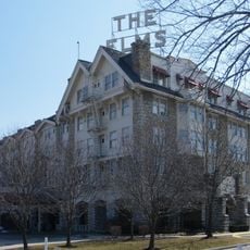
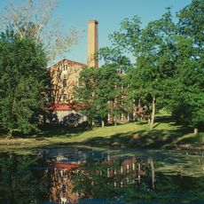
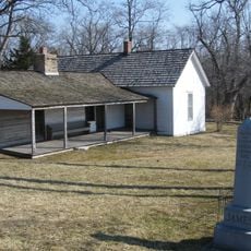
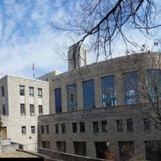
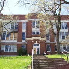
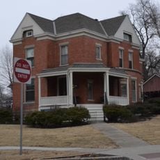
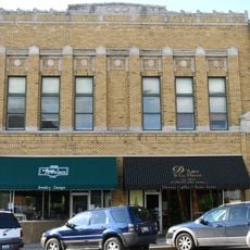
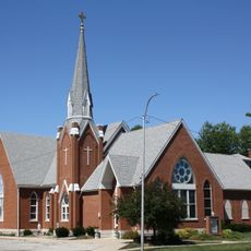
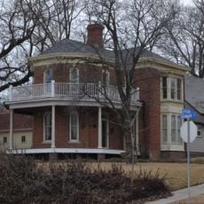
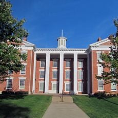
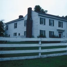
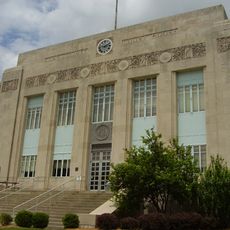
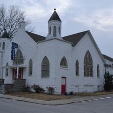
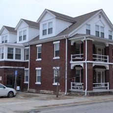
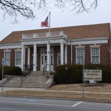
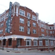
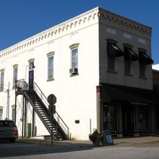
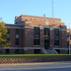
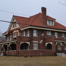
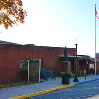
The limestone courthouse and surrounding Victorian buildings reflect how early residents shaped their communities with distinctive architecture. These structures remain visible landmarks that residents and visitors encounter in the county's central areas.

The county's main communities are connected by Interstate 35 and Highway 169, making travel between towns straightforward by car. Having your own transportation is helpful since settlements are spread across the area.

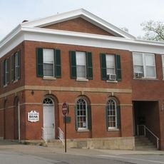
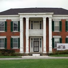
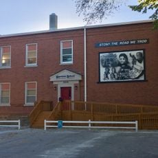
The county seat contains approximately 85 protected historical structures spread across ten blocks designated as a national historic area. This concentration of preserved buildings makes the downtown core stand out as an unusual architectural collection.

The community of curious travelers

AroundUs brings together thousands of curated places, local tips, and hidden gems, enriched daily by 60,000 contributors worldwide.

Start exploring
Location
Inception
January 2, 1833
Capital city
Plattsburg
Shares border with
DeKalb County, Caldwell County, Ray County, Clay County, Platte County, Buchanan County
GPS coordinates
39.60000,-94.40000
Latest update
December 7, 2025 20:49
Around this place
Elms Hotel
United States of America

Elms Hotel

32.9 km
Watkins Woolen Mill State Park and State Historic Site
United States of America

Watkins Woolen Mill State Park and State Historic Site

25.2 km
United States of America

Spratt Stadium

37.7 km
Wallace State Park
United States of America

Wallace State Park

17.3 km
James Brothers' House and Farm
United States of America

James Brothers' House and Farm

24 km
Hall of Waters
United States of America

Hall of Waters

32.6 km
United States of America

David L. and Sallie Ann Stoutimore House

6.2 km
Clay County Savings Association Building
United States of America

Clay County Savings Association Building

39.3 km
Woodneath
United States of America

Woodneath

39 km
Wyman School
United States of America

Wyman School

32 km
Dougherty–Prospect Heights Historic District
United States of America

Dougherty–Prospect Heights Historic District

39.3 km
IOOF Liberty Lodge No. 49
United States of America

IOOF Liberty Lodge No. 49

39.3 km
St. Munchin Catholic Church
United States of America

St. Munchin Catholic Church

20.8 km
Clinton House
United States of America

Clinton House

40.1 km
Jewell Hall
United States of America

Jewell Hall

39.3 km
Claybrook House
United States of America

Claybrook House

24.2 km
South Liberty Courthouse Square Historic District
United States of America

South Liberty Courthouse Square Historic District

39.5 km
First Methodist Church
United States of America

First Methodist Church

32.2 km
Ligon Apartments
United States of America

Ligon Apartments

32.3 km
Excelsior Springs Hall of Waters Commercial East Historic District
United States of America

Excelsior Springs Hall of Waters Commercial East Historic District

32.3 km
Garrison School Historic District
United States of America

Garrison School Historic District

38.6 km
Frank Hughes Memorial Library
United States of America

Frank Hughes Memorial Library

39.3 km
Belt Bowl
United States of America

Belt Bowl

39.3 km
Excelsior Springs Hall of Waters Commercial West Historic District
United States of America

Excelsior Springs Hall of Waters Commercial West Historic District

31.9 km
Miller Building
United States of America

Miller Building

39.3 km
DeKalb County Courthouse
United States of America

DeKalb County Courthouse

32.5 km
Arthur-Leonard Historic District
United States of America

Arthur-Leonard Historic District

39.6 km
Nelson-Pettis Farmsteads Historic District
United States of America

Nelson-Pettis Farmsteads Historic District

37.7 km
Show the full map
Reviews
Share your experience

No review yet

Discussions
Start a discussion...

No discussion yet

Administrative divisions
« Clinton County - Administrative county in northwestern Missouri, United States » is provided by Around Us (aroundus.com). Images and texts are derived from Wikimedia project under a Creative Commons license. You are allowed to copy, distribute, and modify copies of this page, under the conditions set by the license, as long as this note is clearly visible.

Discover hidden gems everywhere you go!

From secret cafés to breathtaking viewpoints, skip the crowded tourist spots and find places that match your style. Our app makes it easy with voice search, smart filtering, route optimization, and insider tips from travelers worldwide. Download now for the complete mobile experience.

Around Us App Screenshot

A unique approach to discovering new places

Le Figaro

All the places worth exploring

France Info

A tailor-made excursion in just a few clicks

20 Minutes

Around Us
Travel Guide & Maps
Download

Send to your phone

QR Code
1

Open the camera app on your mobile.

2

Point at the QR code with your camera. A notification will appear.

3

Tap the notification to open the link.