Enable Location

We need your location to show you interesting places around you

Discover nearby places

Find interesting locations and hidden gems around you

Precise directions

Get accurate directions and distances to places

Your location is never shared with other users. It's only used when you tap the location button.

LaRue County

Log in to your account

Start exploring — it's free

Trusted by 62,994 travelers worldwide

Continue with Google
Continue with Apple
or

We will send you a code to connect

By continuing, you accept our Terms and Conditions and our Privacy Policy

Check your inbox

We've sent a pincode in your inbox. Please enter the code below.

Discussion Reviews 1 Photos
16.8k Popularity

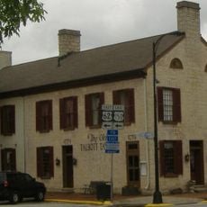
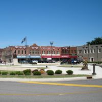
LaRue County, County seat in Central Kentucky, United States

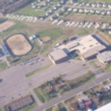
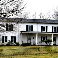
LaRue County is an administrative division in central Kentucky that encompasses agricultural land, small communities, and two national parks. The terrain consists mostly of open fields, forests, and scattered farms throughout the region.

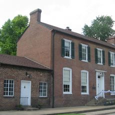
The region was established in 1843 and named after an early settler, John P. LaRue. Its growth was tied to the expansion of settlements across central Kentucky.

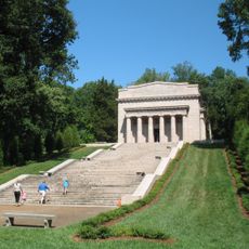
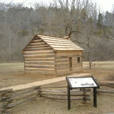
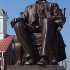
The birthplace of a U.S. president shapes how locals think about their county, and you often hear references to this connection when visiting. This historical link remains woven into community conversations and local pride.

Major roads like US 31E, US 31W, and Interstate 65 connect the area to larger cities nearby. Having a car makes it easy to explore the region and reach surrounding metropolitan areas.

The county operates as a dry region, meaning alcohol sales are prohibited here. This restriction sets it apart from most other areas in the country.

The community of curious travelers

AroundUs brings together thousands of curated places, local tips, and hidden gems, enriched daily by 60,000 contributors worldwide.

Start exploring
Location
Inception
March 4, 1843
Capital city
Hodgenville
Shares border with
Hart County, Hardin County, Taylor County, Green County, Marion County, Nelson County
GPS coordinates
37.57667,-85.68667
Latest update
December 7, 2025 19:26
Around this place
Abraham Lincoln Birthplace National Historical Park
United States of America

Abraham Lincoln Birthplace National Historical Park

6.8 km
The Abbey of Our Lady of Gethsemani
United States of America

The Abbey of Our Lady of Gethsemani

16.9 km
Bernheim Forest and  Arboretum
United States of America

Bernheim Forest and Arboretum

26.2 km
Knob Creek Farm
United States of America

Knob Creek Farm

5.8 km
Old Talbott Tavern
United States of America

Old Talbott Tavern

32.3 km
Basilica of St. Joseph Proto-Cathedral
United States of America

Basilica of St. Joseph Proto-Cathedral

32.2 km
Louisville and Nashville Railroad 152
United States of America

Louisville and Nashville Railroad 152

12.2 km
Statue of Abraham Lincoln
United States of America

Statue of Abraham Lincoln

4.8 km
Central Hardin High School
United States of America

Central Hardin High School

22.3 km
Spalding Hall
United States of America

Spalding Hall

32.3 km
Louisville and Nashville Combine Car Number 665
United States of America

Louisville and Nashville Combine Car Number 665

12.2 km
Brown Pusey House Community Center
United States of America

Brown Pusey House Community Center

19.9 km
Helm Place
United States of America

Helm Place

22.2 km
St. Thomas Roman Catholic Church and Howard-Flaget House
United States of America

St. Thomas Roman Catholic Church and Howard-Flaget House

27.7 km
First Baptist Church
United States of America

First Baptist Church

20 km
Benjamin Helm House
United States of America

Benjamin Helm House

20.3 km
William Bush House
United States of America

William Bush House

21.4 km
Christ Episcopal Church
United States of America

Christ Episcopal Church

20 km
Larue-Layman House
United States of America

Larue-Layman House

20.1 km
First Presbyterian Church
United States of America

First Presbyterian Church

17.8 km
Embry Chapel Church
United States of America

Embry Chapel Church

20.2 km
Morrison Lodge
United States of America

Morrison Lodge

20 km
Elizabethtown Courthouse Square and Commercial District
United States of America

Elizabethtown Courthouse Square and Commercial District

19.9 km
J. Roy Bond House
United States of America

J. Roy Bond House

20.5 km
Kentucky Railway Museum
United States of America

Kentucky Railway Museum

12.2 km
State Theater
United States of America

State Theater

20.1 km
Bonn Theater
United States of America

Bonn Theater

23.3 km
Samuel B. Thomas House
United States of America

Samuel B. Thomas House

20.7 km
Show the full map
Reviews
Share your experience

No review yet

Discussions
Start a discussion...

No discussion yet

Administrative divisions
« LaRue County - County seat in Central Kentucky, United States » is provided by Around Us (aroundus.com). Images and texts are derived from Wikimedia project under a Creative Commons license. You are allowed to copy, distribute, and modify copies of this page, under the conditions set by the license, as long as this note is clearly visible.

Discover hidden gems everywhere you go!

From secret cafés to breathtaking viewpoints, skip the crowded tourist spots and find places that match your style. Our app makes it easy with voice search, smart filtering, route optimization, and insider tips from travelers worldwide. Download now for the complete mobile experience.

Around Us App Screenshot

A unique approach to discovering new places

Le Figaro

All the places worth exploring

France Info

A tailor-made excursion in just a few clicks

20 Minutes

Around Us
Travel Guide & Maps
Download

Send to your phone

QR Code
1

Open the camera app on your mobile.

2

Point at the QR code with your camera. A notification will appear.

3

Tap the notification to open the link.