Enable Location

We need your location to show you interesting places around you

Discover nearby places

Find interesting locations and hidden gems around you

Precise directions

Get accurate directions and distances to places

Your location is never shared with other users. It's only used when you tap the location button.

Gallia County

Log in to your account

Start exploring — it's free

Trusted by 61,863 travelers worldwide

Continue with Google
Continue with Apple
or

We will send you a code to connect

By continuing, you accept our Terms and Conditions and our Privacy Policy

Check your inbox

We've sent a pincode in your inbox. Please enter the code below.

Gallia County, County in southeastern Ohio, United States

Description

Gallia County is an administrative division in southeastern Ohio comprising communities and villages spread across a large rural area. The region is defined by Gallipolis as the county seat and various smaller towns scattered throughout the landscape.

History

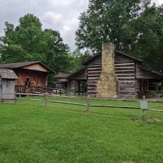
The area was founded in 1803 and named after a Latin term referring to the region of Gaul. Its creation came from dividing parts of Adams and Washington counties.

Culture

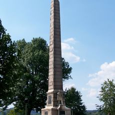
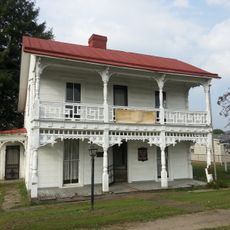
Welsh settlers shaped the region deeply, giving many towns Welsh names and maintaining their traditions for generations. This cultural connection remains visible today through street names, local monuments, and community celebrations.

Practical

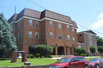
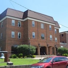
The administrative center in Gallipolis is easily accessible and offers main services and information for visitors. The area is reachable by highway and provides basic facilities in towns throughout the region.

Did you know?

Several settlements served as refuge for freed African Americans and those escaping enslavement during the 1800s. This role as a place of sanctuary and new beginnings remains an overlooked yet important part of regional history.

Location
Inception
March 25, 1803
Capital city
Gallipolis
Shares border with
Vinton County, Cabell County, Meigs County, Mason County, Lawrence County, Jackson County
GPS coordinates
38.83000,-82.32000
Latest update
December 7, 2025 10:08

AroundUs brings together thousands of curated places, local tips, and hidden gems, enriched daily by 60,000 contributors worldwide. Discover all places nearby (Ohio).

Around this place
Silver Memorial Bridge
United States of America

Silver Memorial Bridge

15 km
Fort Randolph
United States of America

Fort Randolph

17.2 km
Tu-Endie-Wei State Park
United States of America

Tu-Endie-Wei State Park

15.6 km
Wood Old Homestead
United States of America

Wood Old Homestead

7.1 km
Mothman Museum
United States of America

Mothman Museum

15.8 km
Jackson Lake State Park
United States of America

Jackson Lake State Park

25.6 km
Pomeroy–Mason Bridge
United States of America

Pomeroy–Mason Bridge

31.6 km
Gen. John McCausland House
United States of America

Gen. John McCausland House

35.9 km
Ponn Humpback Covered Bridge
United States of America

Ponn Humpback Covered Bridge

24.7 km
Robert C. Byrd Lock and Dam
United States of America

Robert C. Byrd Lock and Dam

20 km
Point Pleasant Rail Bridge
United States of America

Point Pleasant Rail Bridge

15.6 km
Meigs County Courthouse
United States of America

Meigs County Courthouse

33.1 km
Point Pleasant Historic District
United States of America

Point Pleasant Historic District

15.8 km
Lewis-Capehart-Roseberry House
United States of America

Lewis-Capehart-Roseberry House

16.9 km
Gallia County Courthouse
United States of America

Gallia County Courthouse

10.5 km
The Gold Houses
United States of America

The Gold Houses

33.5 km
John Downing, Jr., House
United States of America

John Downing, Jr., House

30.5 km
Middleport Public Library
United States of America

Middleport Public Library

30.1 km
Shumaker-Lewis House
United States of America

Shumaker-Lewis House

32.7 km
Couch-Artrip House
United States of America

Couch-Artrip House

33.7 km
William H. Grant House
United States of America

William H. Grant House

29.6 km
Olive Furnace
United States of America

Olive Furnace

28 km
Buckeye Furnace Covered Bridge
United States of America

Buckeye Furnace Covered Bridge

27.7 km
Scottown Covered Bridge
United States of America

Scottown Covered Bridge

31.9 km
Powell-Redmond House
United States of America

Powell-Redmond House

30.9 km
West Virginia State Farm Museum
United States of America

West Virginia State Farm Museum

22.3 km
Skatopia/CIA
United States of America

Skatopia/CIA

31.3 km
Buckeye Furnace
United States of America

Buckeye Furnace

27.9 km
Show the full map
Administrative divisions
« Gallia County - County in southeastern Ohio, United States » is provided by Around Us (aroundus.com). Images and texts are derived from Wikimedia project under a Creative Commons license. You are allowed to copy, distribute, and modify copies of this page, under the conditions set by the license, as long as this note is clearly visible.

Discover hidden gems everywhere you go!

From secret cafés to breathtaking viewpoints, skip the crowded tourist spots and find places that match your style. Our app makes it easy with voice search, smart filtering, route optimization, and insider tips from travelers worldwide. Download now for the complete mobile experience.

Around Us App Screenshot

A unique approach to discovering new places

Le Figaro

All the places worth exploring

France Info

A tailor-made excursion in just a few clicks

20 Minutes

Around Us
Travel Guide & Maps
Download

Send to your phone

QR Code
1

Open the camera app on your mobile.

2

Point at the QR code with your camera. A notification will appear.

3

Tap the notification to open the link.