Enable Location

We need your location to show you interesting places around you

Discover nearby places

Find interesting locations and hidden gems around you

Precise directions

Get accurate directions and distances to places

Your location is never shared with other users. It's only used when you tap the location button.

Rusk County

Log in to your account

Start exploring — it's free

Trusted by 62,937 travelers worldwide

Continue with Google
Continue with Apple
or

We will send you a code to connect

By continuing, you accept our Terms and Conditions and our Privacy Policy

Check your inbox

We've sent a pincode in your inbox. Please enter the code below.

Discussion Reviews 1 Photos
11.2k Popularity

Rusk County, Administrative county in Wisconsin, United States.

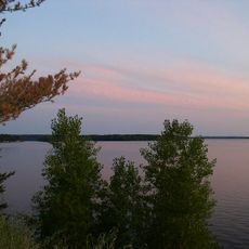
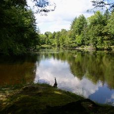
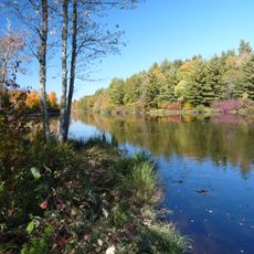
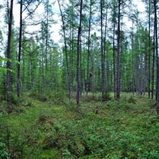
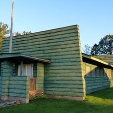
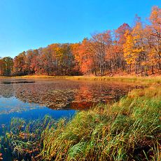
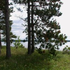
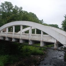
Rusk County is an administrative county in north-central Wisconsin shaped by the Chippewa and Flambeau rivers. The landscape combines wooded areas with open farmland and gentle rolling terrain.

The area became a separate county in 1901 when the Wisconsin legislature divided a northern section into an independent administrative unit. The original name was quickly changed to honor local heritage.

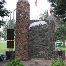
The land holds deep roots in Ojibwe tradition and presence, shaping how the community relates to the natural surroundings. Local place names and practices still reflect this long-standing connection to the region.

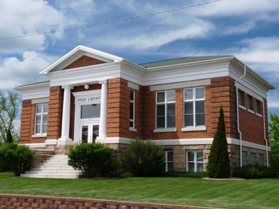
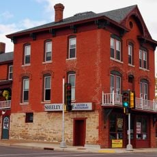
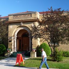
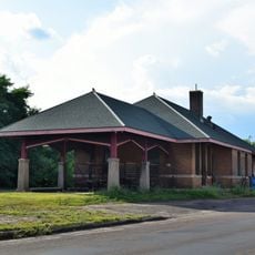
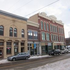
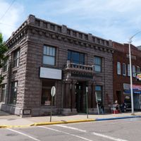
The county government offices are located in Ladysmith, providing public services and information to residents. It is helpful to check office hours before visiting and bring necessary documentation for any official matters.

A copper, gold, and silver mining operation brought significant industrial activity to the region during the 1990s before closing in 1999. The landscape still shows traces of this mining era in its topography.

The community of curious travelers

AroundUs brings together thousands of curated places, local tips, and hidden gems, enriched daily by 60,000 contributors worldwide.

Start exploring
Location
Inception
1901
Capital city
Ladysmith
Shares border with
Washburn County, Sawyer County, Price County, Taylor County, Chippewa County, Barron County
GPS coordinates
45.48000,-91.14000
Latest update
December 8, 2025 13:42
Around this place
Lake Wissota
United States of America

Lake Wissota

61.2 km
National Fresh Water Fishing Hall of Fame
United States of America

National Fresh Water Fishing Hall of Fame

64.4 km
Brunet Island State Park
United States of America

Brunet Island State Park

33.5 km
Lidice Memorial
United States of America

Lidice Memorial

61.9 km
James Sheeley House
United States of America

James Sheeley House

64 km
Flambeau River State Forest
United States of America

Flambeau River State Forest

41.8 km
Wisconsin Concrete Park
United States of America

Wisconsin Concrete Park

62.3 km
Cornell Pulpwood Stacker
United States of America

Cornell Pulpwood Stacker

34 km
Lake Hayward
United States of America

Lake Hayward

64.1 km
Twin Lakes Bog State Natural Area
United States of America

Twin Lakes Bog State Natural Area

59.6 km
Z. C. B. J. Hall
United States of America

Z. C. B. J. Hall

49.1 km
Edward N. and Mary T. Stebbins House
United States of America

Edward N. and Mary T. Stebbins House

56.6 km
Flambeau Mission Church
United States of America

Flambeau Mission Church

20.3 km
Cook-Rutledge House
United States of America

Cook-Rutledge House

64.3 km
ZCBJ Hall
United States of America

ZCBJ Hall

51.8 km
Jump River Town Hall
United States of America

Jump River Town Hall

30 km
D. R. Moon Memorial Library
United States of America

D. R. Moon Memorial Library

59.8 km
West Hill Residential Historic District
United States of America

West Hill Residential Historic District

64.2 km
L.I. Roe House
United States of America

L.I. Roe House

59.8 km
Chippewa Moraine Lakes State Natural Area
United States of America

Chippewa Moraine Lakes State Natural Area

33.6 km
Rice Lake station
United States of America

Rice Lake station

46.8 km
Bridge Street Commercial Historic District
United States of America

Bridge Street Commercial Historic District

63.6 km
Lake Wissota State Park
United States of America

Lake Wissota State Park

58.1 km
Stanley Bar & Bowl
United States of America

Stanley Bar & Bowl

61.7 km
Pioneer Village Museum
United States of America

Pioneer Village Museum

50.2 km
Notre Dame Church and Goldsmith Memorial Chapel
United States of America

Notre Dame Church and Goldsmith Memorial Chapel

63.6 km
Scheer's Lumberjack Shows
United States of America

Scheer's Lumberjack Shows

64.1 km
Marsh Rainbow Arch Bridge
United States of America

Marsh Rainbow Arch Bridge

63.6 km
Show the full map
Reviews
Share your experience

No review yet

Discussions
Start a discussion...

No discussion yet

Administrative divisions
« Rusk County - Administrative county in Wisconsin, United States » is provided by Around Us (aroundus.com). Images and texts are derived from Wikimedia project under a Creative Commons license. You are allowed to copy, distribute, and modify copies of this page, under the conditions set by the license, as long as this note is clearly visible.

Discover hidden gems everywhere you go!

From secret cafés to breathtaking viewpoints, skip the crowded tourist spots and find places that match your style. Our app makes it easy with voice search, smart filtering, route optimization, and insider tips from travelers worldwide. Download now for the complete mobile experience.

Around Us App Screenshot

A unique approach to discovering new places

Le Figaro

All the places worth exploring

France Info

A tailor-made excursion in just a few clicks

20 Minutes

Around Us
Travel Guide & Maps
Download

Send to your phone

QR Code
1

Open the camera app on your mobile.

2

Point at the QR code with your camera. A notification will appear.

3

Tap the notification to open the link.