Enable Location

We need your location to show you interesting places around you

Discover nearby places

Find interesting locations and hidden gems around you

Precise directions

Get accurate directions and distances to places

Your location is never shared with other users. It's only used when you tap the location button.

Tazewell

Log in to your account

Start exploring — it's free

Trusted by 64,523 travelers worldwide

Continue with Google
Continue with Apple
or

We will send you a code to connect

By continuing, you accept our Terms and Conditions and our Privacy Policy

Check your inbox

We've sent a pincode in your inbox. Please enter the code below.

Discussion Reviews 1 Photos
18.7k Popularity

Tazewell, town in Tazewell County, Virginia, United States

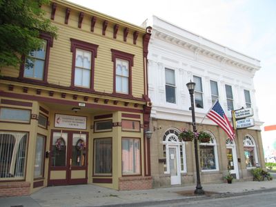
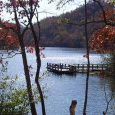
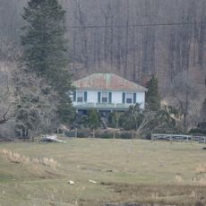
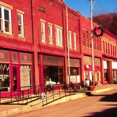
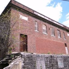
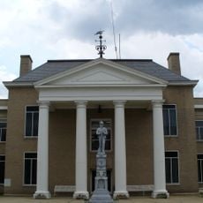
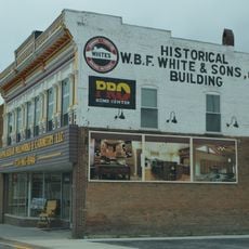
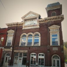
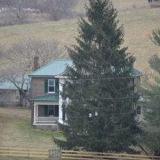
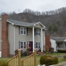
Tazewell is a small town in Tazewell County, Virginia, nestled among rolling hills, the Clinch River, and farmland. Main Street features well-maintained historic buildings housing local shops and restaurants, with a restored train station serving as the community hub.

The town developed as a trading center and railroad hub in the 1800s, driving its growth in the region. The train station, still visible today, was crucial to connecting the area with distant towns and shaped the community's long-term development.

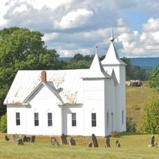
The name reflects early settlement roots in the Appalachian region. Local traditions remain visible through community gatherings, folk crafts, and the ways residents connect with one another in daily life.

The small size means you can walk from one side to the other with ease, making exploration straightforward. The visitor center on Railroad Avenue provides information about the area, and flat streets remain pedestrian-friendly with ample parking near shops and parks.

The town hosts seasonal events such as Music on Main in summer, Oktobrewfest in October, and a December holiday market featuring local artisans. The Lincolnshire Rink in winter converts the park into a gathering place where families and friends skate together during the cold months.

The community of curious travelers

AroundUs brings together thousands of curated places, local tips, and hidden gems, enriched daily by 60,000 contributors worldwide.

Start exploring
Location
Inception
1800
Elevation above the sea
763 m
GPS coordinates
37.11484,-81.51955
Latest update
February 16, 2026 23:20
Around this place
Hungry Mother State Park
United States of America

Hungry Mother State Park

26.1 km
Big Walker Lookout
United States of America

Big Walker Lookout

27 km
Mountain Glen
United States of America

Mountain Glen

20.9 km
United States of America

Beartown Wilderness

8.7 km
Maiden Spring
United States of America

Maiden Spring

17.1 km
Pocahontas Fuel Company Store and Office Buildings
United States of America

Pocahontas Fuel Company Store and Office Buildings

21.4 km
Walter McDonald Sanders House
United States of America

Walter McDonald Sanders House

26.8 km
James Wynn House
United States of America

James Wynn House

76 m
Bramwell Historic District
United States of America

Bramwell Historic District

29.8 km
Big Crab Orchard Site
United States of America

Big Crab Orchard Site

4.9 km
Sharon Lutheran Church and Cemetery
United States of America

Sharon Lutheran Church and Cemetery

18.7 km
Alexander St. Clair House
United States of America

Alexander St. Clair House

22.4 km
Page Coal and Coke Company Store
United States of America

Page Coal and Coke Company Store

26.5 km
Kimberling Lutheran Cemetery
United States of America

Kimberling Lutheran Cemetery

29.1 km
George Oscar Thompson House
United States of America

George Oscar Thompson House

5.8 km
Chimney Rock Farm
United States of America

Chimney Rock Farm

9 km
Tazewell Historic District
United States of America

Tazewell Historic District

316 m
Capt. James Moore Homestead
United States of America

Capt. James Moore Homestead

20.4 km
Richlands Historic District
United States of America

Richlands Historic District

25.5 km
Bramwell Additions Historic District
United States of America

Bramwell Additions Historic District

29.8 km
Pocahontas Historic District
United States of America

Pocahontas Historic District

26.6 km
Easley House
United States of America

Easley House

29.3 km
Williams House
United States of America

Williams House

24.9 km
Clinch Valley Roller Mills
United States of America

Clinch Valley Roller Mills

22.1 km
Old Kentucky Turnpike Historic District
United States of America

Old Kentucky Turnpike Historic District

21.9 km
Clynchdale
United States of America

Clynchdale

5.5 km
Tazewell Avenue Historic District
United States of America

Tazewell Avenue Historic District

25.5 km
Pocahontas Exhibition Coal Mine & Museum
United States of America

Pocahontas Exhibition Coal Mine & Museum

26.4 km
Show the full map
Reviews
Share your experience

No review yet

Discussions
Start a discussion...

No discussion yet

« Tazewell - town in Tazewell County, Virginia, United States » is provided by Around Us (aroundus.com). Images and texts are derived from Wikimedia project under a Creative Commons license. You are allowed to copy, distribute, and modify copies of this page, under the conditions set by the license, as long as this note is clearly visible.

Discover hidden gems everywhere you go!

From secret cafés to breathtaking viewpoints, skip the crowded tourist spots and find places that match your style. Our app makes it easy with voice search, smart filtering, route optimization, and insider tips from travelers worldwide. Download now for the complete mobile experience.

Around Us App Screenshot

A unique approach to discovering new places

Le Figaro

All the places worth exploring

France Info

A tailor-made excursion in just a few clicks

20 Minutes

Around Us
Travel Guide & Maps
Download

Send to your phone

QR Code
1

Open the camera app on your mobile.

2

Point at the QR code with your camera. A notification will appear.

3

Tap the notification to open the link.