Tazewell County

Log in to your account

AroundUs is a community-driven map of interesting places, built by curious explorers like you. It grows with every review, story, and photo you share.
Connect to save your favorite spots, contribute locations, and create personalized routes.
Continue with Google
Continue with Apple
Continue with X
Continue with Facebook
Continue with email
By continuing, you accept our Terms and Conditions and our Privacy Policy
Create an account
Add to collection
Map
Suggest a change
Share

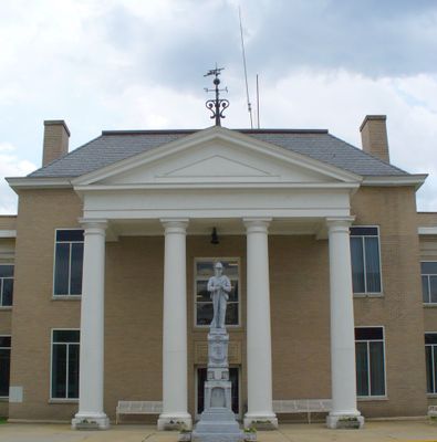
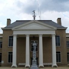
Tazewell County, County administration center in Tazewell, Virginia, US.

Tazewell County is an administrative division in the mountainous region of southwestern Virginia. The terrain consists of rolling hills and valleys formed by the Appalachian mountains.

The county was established in December 1799 as an independent administrative unit during Virginia's westward expansion into the Appalachian region. This founding reflected the early settlement patterns moving inland from the coast.

The county seat serves as a gathering place where residents connect through public meetings and community participation in local affairs. This direct engagement shapes how people relate to their government and each other.

The county seat is easily accessible and houses the main administrative offices where residents can handle property tax matters and other local government services. Most public services are concentrated in the downtown area.

The county's Sheriff's Office operates under a structured leadership system with specific divisions for patrol, investigations, and detention facility management.

Location: Virginia

Inception: December 20, 1799

Capital city: Tazewell

Shares border with: McDowell County, Smyth County, Mercer County, Buchanan County, Russell County, Bland County

Website: http://tazewellcounty.org

GPS coordinates: 37.13000,-81.56000

Latest update: December 20, 2025 16:05

Photos
Around this place
Big Walker Lookout
United States of America

Big Walker Lookout

30.9 km
Pinnacle Rock State Park
United States of America

Pinnacle Rock State Park

32.2 km
Mountain Glen
United States of America

Mountain Glen

24.8 km
United States of America

Beartown Wilderness

12.6 km
Maiden Spring
United States of America

Maiden Spring

15.1 km
Pocahontas Fuel Company Store and Office Buildings
United States of America

Pocahontas Fuel Company Store and Office Buildings

21.6 km
Walter McDonald Sanders House
United States of America

Walter McDonald Sanders House

29.2 km
United States of America

Hunting Camp Creek Wilderness

27.9 km
United States of America

Garden Mountain Wilderness

22.5 km
James Wynn House
United States of America

James Wynn House

4 km
Bramwell Historic District
United States of America

Bramwell Historic District

31 km
Carter Coal Company Store
United States of America

Carter Coal Company Store

24.8 km
Big Crab Orchard Site
United States of America

Big Crab Orchard Site

1.7 km
Sharon Lutheran Church and Cemetery
United States of America

Sharon Lutheran Church and Cemetery

22.6 km
Alexander St. Clair House
United States of America

Alexander St. Clair House

24.6 km
United States of America

Hatter Hall

32.6 km
George Oscar Thompson House
United States of America

George Oscar Thompson House

6.5 km
Chimney Rock Farm
United States of America

Chimney Rock Farm

7.3 km
Tazewell Historic District
United States of America

Tazewell Historic District

3.7 km
Capt. James Moore Homestead
United States of America

Capt. James Moore Homestead

21.3 km
Richlands Historic District
United States of America

Richlands Historic District

22.2 km
United States of America

John Harriman House

23.4 km
Bramwell Additions Historic District
United States of America

Bramwell Additions Historic District

31 km
United States of America

Lynn Camp Creek Wilderness Study Area

20.5 km
Pocahontas Historic District
United States of America

Pocahontas Historic District

27.6 km
Easley House
United States of America

Easley House

31.6 km
Williams House
United States of America

Williams House

21.6 km
Clinch Valley Roller Mills
United States of America

Clinch Valley Roller Mills

18.9 km
Show the full map
Reviews

Visited this place? Tap the stars to rate it and share your experience / photos with the community! Try now! You can cancel it anytime.

« Tazewell County - County administration center in Tazewell, Virginia, US » is provided by Around Us (aroundus.com). Images and texts are derived from Wikimedia project under a Creative Commons license. You are allowed to copy, distribute, and modify copies of this page, under the conditions set by the license, as long as this note is clearly visible.

Discover hidden gems everywhere you go!

From secret cafés to breathtaking viewpoints, skip the crowded tourist spots and find places that match your style. Our app makes it easy with voice search, smart filtering, route optimization, and insider tips from travelers worldwide. Download now for the complete mobile experience.

Around Us App Screenshot

A unique approach to discovering new places

Le Figaro

All the places worth exploring

France Info

A tailor-made excursion in just a few clicks

20 Minutes