·

Enable Location

We need your location to show you interesting places around you

Discover nearby places

Find interesting locations and hidden gems around you

Precise directions

Get accurate directions and distances to places

Your location is never shared with other users. It's only used when you tap the location button.

Hillsdale Lake

Log in to your account

Start exploring — it's free

Trusted by 62,655 travelers worldwide

Continue with Google
Continue with Apple
or

We will send you a code to connect

By continuing, you accept our Terms and Conditions and our Privacy Policy

Check your inbox

We've sent a pincode in your inbox. Please enter the code below.

Hillsdale Lake

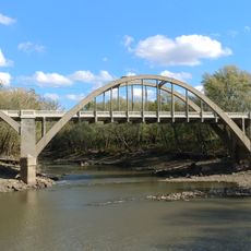
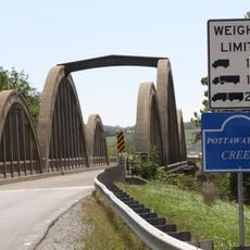
Hillsdale Lake, lake in Kansas, United States of America

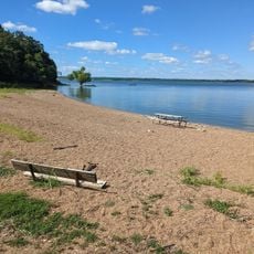
Hillsdale Lake is a large reservoir in Kansas with thousands of acres of water and extensive shoreline for recreation. The site offers fishing, boating, walking trails, and picnic areas alongside camping facilities managed by the state park system.

The reservoir was completed in the early 1980s by the US Army Corps of Engineers as part of a regional water management and flood control plan. Its construction transformed the local landscape and created an important water storage resource that protects nearby communities from flooding.

The lake is easy to reach from nearby towns with parking areas close to the water and visitor facilities available. Guests should wear life jackets on the water, follow local regulations, and avoid glass containers, pets, and open fires in designated swimming and activity zones.

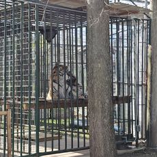
The lake hosts impressive bird migration events with flocks of ducks, geese, and pelicans passing through during certain seasons, offering exceptional viewing opportunities. Horseback riders can explore designated equestrian trails that wind through the landscape where native plants and wildlife are visible in their natural habitat.

The community of curious travelers

AroundUs brings together thousands of curated places, local tips, and hidden gems, enriched daily by 60,000 contributors worldwide.

Start exploring
Location
GPS coordinates
38.65440,-94.90548
Latest update
February 7, 2026 11:01
Around this place
Blue Valley Northwest High School
United States of America

Blue Valley Northwest High School

31.4 km
Blue Valley West High School
United States of America

Blue Valley West High School

27.3 km
United States of America

Overland Park Arboretum and Botanical Gardens

24.6 km
United States of America

Kansas City Air Route Traffic Control Center

27 km
Mahaffie House
United States of America

Mahaffie House

28 km
United States of America

Powell Observatory

17.9 km
Cedar Cove Feline Conservatory & Sanctuary
United States of America

Cedar Cove Feline Conservatory & Sanctuary

24.4 km
Liston Stadium
United States of America

Liston Stadium

27.3 km
Peoples Bank Field
United States of America

Peoples Bank Field

31.6 km
Jackson Hotel
United States of America

Jackson Hotel

9.4 km
William Thomas Turner Barn
United States of America

William Thomas Turner Barn

12.8 km
Tauy Jones House
United States of America

Tauy Jones House

27.4 km
I. O. Pickering House
United States of America

I. O. Pickering House

26.5 km
Old Castle Hall
United States of America

Old Castle Hall

27.8 km
Albert Ott House
United States of America

Albert Ott House

26.1 km
Franklin R. Lanter House
United States of America

Franklin R. Lanter House

26.3 km
Ottawa Library
United States of America

Ottawa Library

31.5 km
Martin Van Buren Parker House
United States of America

Martin Van Buren Parker House

26.3 km
Miami County Courthouse
United States of America

Miami County Courthouse

9.6 km
Mahaffie Stagecoach Stop-Farm
United States of America

Mahaffie Stagecoach Stop-Farm

28 km
Carey’s Ford Bridge
United States of America

Carey’s Ford Bridge

18.6 km
Midland Railway Baldwin City Depot
United States of America

Midland Railway Baldwin City Depot

29 km
John Brown Museum State Historic Site
United States of America

John Brown Museum State Historic Site

18 km
Black Jack Battlefield
United States of America

Black Jack Battlefield

22.9 km
Creamery Bridge
United States of America

Creamery Bridge

17.4 km
Windsurfer Beach
United States of America

Windsurfer Beach

1.7 km
Pottawatomie Creek Bridge
United States of America

Pottawatomie Creek Bridge

19.2 km
Asylum Bridge
United States of America

Asylum Bridge

16.9 km
Show the full map
« Hillsdale Lake - lake in Kansas, United States of America » is provided by Around Us (aroundus.com). Images and texts are derived from Wikimedia project under a Creative Commons license. You are allowed to copy, distribute, and modify copies of this page, under the conditions set by the license, as long as this note is clearly visible.

Discover hidden gems everywhere you go!

From secret cafés to breathtaking viewpoints, skip the crowded tourist spots and find places that match your style. Our app makes it easy with voice search, smart filtering, route optimization, and insider tips from travelers worldwide. Download now for the complete mobile experience.

Around Us App Screenshot

A unique approach to discovering new places

Le Figaro

All the places worth exploring

France Info

A tailor-made excursion in just a few clicks

20 Minutes

Around Us
Travel Guide & Maps
Download

Send to your phone

QR Code
1

Open the camera app on your mobile.

2

Point at the QR code with your camera. A notification will appear.

3

Tap the notification to open the link.