Enable Location

We need your location to show you interesting places around you

Discover nearby places

Find interesting locations and hidden gems around you

Precise directions

Get accurate directions and distances to places

Your location is never shared with other users. It's only used when you tap the location button.

Log in to your account

Start exploring — it's free

Trusted by 60,651 travelers worldwide

Continue with Google
Continue with Apple
or

We will send you a code to connect

By continuing, you accept our Terms and Conditions and our Privacy Policy

Check your inbox

We've sent a pincode in your inbox. Please enter the code below.

Kansas City Air Route Traffic Control Center

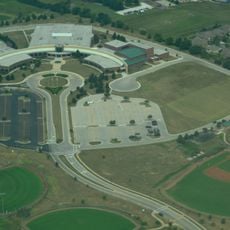
Kansas City Air Route Traffic Control Center, Air traffic control center in Olathe, Kansas, United States

Description

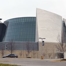
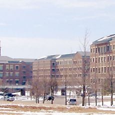
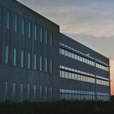
The Kansas City Air Route Traffic Control Center is an air traffic facility in Olathe, Kansas that oversees flight operations across a vast region of the central United States. The facility uses radar technology and electronic systems to track aircraft and maintain safe spacing between them throughout their journeys.

History

The center was established as part of the United States air traffic system and expanded with the growth of commercial aviation after the Second World War. Its creation marked a key step in building modern infrastructure to safely manage increasing flight operations across the nation.

Culture

Air traffic controllers at Kansas City Center follow specific communication protocols and phraseology to maintain clear interactions with pilots during all flight phases.

Practical

The facility operates around the clock with skilled personnel monitoring radar displays and coordinating flight routes. Visitors should know that the center is highly restricted for security reasons, and its operations are rarely visible from outside the building.

Did you know?

The facility works closely with seven neighboring air traffic centers and handles over 1.8 million aircraft movements each year. This high volume shows how important the center is for air traffic across America's mid-section.

GPS coordinates
38.88030,-94.79080
Latest update
December 12, 2025 07:56

AroundUs brings together thousands of curated places, local tips, and hidden gems, enriched daily by 60,000 contributors worldwide. Discover all places nearby (United States of America).

Around this place
United Methodist Church of the Resurrection
United States of America

United Methodist Church of the Resurrection

12.9 km
Sprint World Headquarters Campus
United States of America

Sprint World Headquarters Campus

12.2 km
Blue Valley Northwest High School
United States of America

Blue Valley Northwest High School

7.6 km
Kansas City National Security Campus
United States of America

Kansas City National Security Campus

21.1 km
Bannister Federal Complex
United States of America

Bannister Federal Complex

21.1 km
Blue Valley West High School
United States of America

Blue Valley West High School

9.9 km
Shawnee Methodist Mission
United States of America

Shawnee Methodist Mission

22.3 km
United States of America

Overland Park Arboretum and Botanical Gardens

12.4 km
United States of America

Mack B. Nelson House

23 km
Harry S. Truman Farm Home
United States of America

Harry S. Truman Farm Home

22.6 km
Grinter Place
United States of America

Grinter Place

21.9 km
United States of America

Marine Corps Individual Reserve Support Activity

21.1 km
Mahaffie House
United States of America

Mahaffie House

1.6 km
Waldo Water Tower
United States of America

Waldo Water Tower

21.8 km
Trailside Center
United States of America

Trailside Center

19.6 km
Highway 2 Bridge
United States of America

Highway 2 Bridge

18.9 km
William Thomas Turner Barn
United States of America

William Thomas Turner Barn

16 km
I. O. Pickering House
United States of America

I. O. Pickering House

2.9 km
Albert Ott House
United States of America

Albert Ott House

2.2 km
Rio Theatre
United States of America

Rio Theatre

15.6 km
Franklin R. Lanter House
United States of America

Franklin R. Lanter House

3.1 km
Martin Van Buren Parker House
United States of America

Martin Van Buren Parker House

3.4 km
Wolcott House
United States of America

Wolcott House

22.3 km
Herman J. and Ella B. Voigts House
United States of America

Herman J. and Ella B. Voigts House

16.4 km
Mahaffie Stagecoach Stop-Farm
United States of America

Mahaffie Stagecoach Stop-Farm

1.5 km
Horn–Vincent–Russell Estate
United States of America

Horn–Vincent–Russell Estate

20.2 km
Shawnee Town 1929 Museum
United States of America

Shawnee Town 1929 Museum

17.3 km
Deer Creek Golf Course
United States of America

Deer Creek Golf Course

11.1 km
Show the full map
« Kansas City Air Route Traffic Control Center - Air traffic control center in Olathe, Kansas, United States » is provided by Around Us (aroundus.com). Images and texts are derived from Wikimedia project under a Creative Commons license. You are allowed to copy, distribute, and modify copies of this page, under the conditions set by the license, as long as this note is clearly visible.

Discover hidden gems everywhere you go!

From secret cafés to breathtaking viewpoints, skip the crowded tourist spots and find places that match your style. Our app makes it easy with voice search, smart filtering, route optimization, and insider tips from travelers worldwide. Download now for the complete mobile experience.

Around Us App Screenshot

A unique approach to discovering new places

Le Figaro

All the places worth exploring

France Info

A tailor-made excursion in just a few clicks

20 Minutes

Around Us
Travel Guide & Maps
Download

Send to your phone

QR Code
1

Open the camera app on your mobile.

2

Point at the QR code with your camera. A notification will appear.

3

Tap the notification to open the link.