Chest opened
+${chestReward.xp} XP
Explorer
NOUVEAU ×${chestReward.collectible.quantity}
tapez pour fermer
Chest locked

Open chests in the app

Around Us is built for your phone — chests unlock when you walk, explore and capture nearby places.

Enable Location

We need your location to show you interesting places around you

Discover nearby places

Find interesting locations and hidden gems around you

Precise directions

Get accurate directions and distances to places

Your location is never shared with other users. It's only used when you tap the location button.

Love Canal

Log in to your account

Start exploring — it's free

Trusted by 72,889 travelers worldwide

Continue with Google
Continue with Apple
or

We will send you a code to connect

By continuing, you accept our Terms and Conditions and our Privacy Policy

Check your inbox

We've sent a pincode in your inbox. Please enter the code below.

Discussion Reviews 1 Photos
318k Popularity

Love Canal, Contaminated residential area in Niagara Falls, United States.

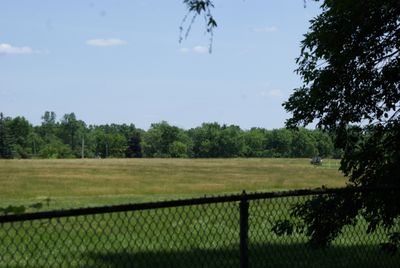
Love Canal is a residential neighborhood in Niagara Falls built on land that was previously used as a chemical waste dump. The area consists of single-family homes that were constructed directly above the buried hazardous materials.

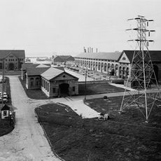
A chemical company used this land as a disposal site for decades, burying thousands of tons of waste before selling the property to local authorities. In the 1970s, consequences emerged as chemicals seeped into soil and groundwater, causing health issues for residents.

This place symbolizes community resistance to environmental harm and remains a focal point for discussions about industrial responsibility toward residential areas. Visitors can observe how ordinary residents mobilized to address threats to their neighborhood's safety.

Access to the area is possible, though many original homes have been demolished as part of remediation efforts. The site is open to visitors who want to learn about environmental cleanup and understand how the landscape has changed.

The crisis here directly led to federal legislation establishing rules for managing hazardous waste sites across the nation. This single neighborhood became the catalyst for major changes in how the country handles industrial contamination.

The community of curious travelers

AroundUs brings together thousands of curated places, local tips, and hidden gems, enriched daily by 60,000 contributors worldwide.

Start exploring
Location
GPS coordinates
43.08052,-78.94896
Latest update
December 18, 2025 11:41
Around this place
Erie Canal
United States of America

Erie Canal

8.5 km
Niagara Amusement Park and Splash World
United States of America

Niagara Amusement Park and Splash World

6.6 km

Adams Power Plant Transformer House
United States of America

Adams Power Plant Transformer House

7.6 km
North Grand Island Bridge
United States of America

North Grand Island Bridge

3.6 km
Old Stone Chimney
United States of America

Old Stone Chimney

7.8 km
Niagara Falls Convention and Civic Center
United States of America

Niagara Falls Convention and Civic Center

8.8 km
Herschell Carrousel Factory Museum
United States of America

Herschell Carrousel Factory Museum

8.4 km
Riviera Theatre
United States of America

Riviera Theatre

8.6 km
Fort Schlosser
Canada

Fort Schlosser

5.4 km
Silver Comet
United States of America

Silver Comet

6.2 km
Buckhorn Island State Park
United States of America

Buckhorn Island State Park

2.8 km
Niagara Falls Public Library
United States of America

Niagara Falls Public Library

8.7 km
Ira G. Ross Aerospace Museum
United States of America

Ira G. Ross Aerospace Museum

2.3 km
Holy Trinity Roman Catholic Church Complex
United States of America

Holy Trinity Roman Catholic Church Complex

7.8 km
Hyde Park
United States of America

Hyde Park

6.1 km
Ghostlight Theatre
United States of America

Ghostlight Theatre

8.2 km
Mount St. Mary's Hospital
United States of America

Mount St. Mary's Hospital

8.7 km
Holley-Rankine House
United States of America

Holley-Rankine House

8.7 km
Tonawanda Armory
United States of America

Tonawanda Armory

7.4 km
Niagara Falls School District Administration Building
United States of America

Niagara Falls School District Administration Building

8.8 km
St. Mary's Nurses' Residence
United States of America

St. Mary's Nurses' Residence

8.8 km
Town of Niagara District School No. 2
United States of America

Town of Niagara District School No. 2

4.6 km
Johann Williams Farm
United States of America

Johann Williams Farm

1.3 km
Cummington Square
Canada

Cummington Square

8.6 km
Chippawa Town Hall
Canada

Chippawa Town Hall

8.7 km
Prophet Isaiah's Second Coming House
United States of America

Prophet Isaiah's Second Coming House

8.5 km
Laura Secord House
Canada

Laura Secord House

8.7 km
Show the full map
Reviews
Share your experience

No review yet

Discussions
Start a discussion...

No discussion yet

« Love Canal - Contaminated residential area in Niagara Falls, United States » is provided by Around Us (aroundus.com). Images and texts are derived from Wikimedia project under a Creative Commons license. You are allowed to copy, distribute, and modify copies of this page, under the conditions set by the license, as long as this note is clearly visible.

Discover hidden gems everywhere you go!

From secret cafés to breathtaking viewpoints, skip the crowded tourist spots and find places that match your style. Our app makes it easy with voice search, smart filtering, route optimization, and insider tips from travelers worldwide. Download now for the complete mobile experience.

Around Us App Screenshot

A unique approach to discovering new places

Le Figaro

All the places worth exploring

France Info

A tailor-made excursion in just a few clicks

20 Minutes

Around Us
Travel Guide & Maps
Download

Send to your phone

QR Code
1

Open the camera app on your mobile.

2

Point at the QR code with your camera. A notification will appear.

3

Tap the notification to open the link.