Enable Location

We need your location to show you interesting places around you

Discover nearby places

Find interesting locations and hidden gems around you

Precise directions

Get accurate directions and distances to places

Your location is never shared with other users. It's only used when you tap the location button.

Erie Canal

Log in to your account

Start exploring — it's free

Trusted by 61,769 travelers worldwide

Continue with Google
Continue with Apple
or

We will send you a code to connect

By continuing, you accept our Terms and Conditions and our Privacy Policy

Check your inbox

We've sent a pincode in your inbox. Please enter the code below.

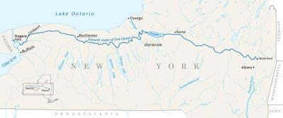
Erie Canal, Historic waterway in upstate New York, United States

Description

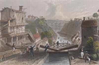
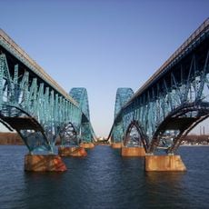
The Erie Canal is a historic waterway in New York State that stretches 363 miles (584 kilometers) from Buffalo on Lake Erie to Albany on the Hudson River. The system includes 36 locks and several stone aqueducts that cross rivers and valleys, including the Genesee River.

History

Construction began in 1817 and was completed in 1825, creating the first navigable link between the Atlantic Ocean and the Great Lakes. The project turned New York into the main trading hub of the young nation and encouraged settlement of the western territories.

Culture

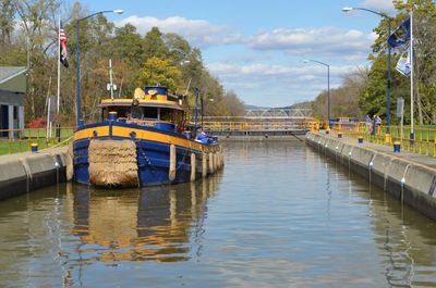
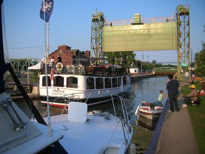
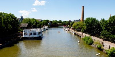
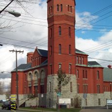
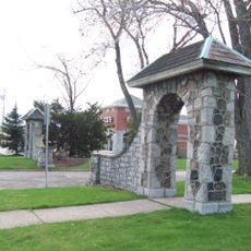
Communities along the waterway still celebrate their connection to the canal through festivals, boat tours, and walking paths that follow the old towpaths. Many of these small towns maintain the historic character of the canal era, with local shops and museums where visitors can learn about life during the shipping age.

Practical

The waterway is now mainly accessible for recreational activities, with walking and cycling paths running alongside much of the route. Several sections also offer boat rides that let visitors see the preserved locks and bridges up close.

Did you know?

The cost of moving goods between Albany and Buffalo dropped by around 95 percent after the canal opened, while travel time fell from several weeks to about ten days. This change made the waterway one of the most important transport routes in 19th century North America.

Location
Elevation above the sea
113 m
GPS coordinates
43.02227,-78.88083
Latest update
December 12, 2025 19:13

AroundUs brings together thousands of curated places, local tips, and hidden gems, enriched daily by 60,000 contributors worldwide. Discover all places nearby (New York).

Around this place
Niagara Amusement Park and Splash World
United States of America

Niagara Amusement Park and Splash World

7.7 km
University at Buffalo Stadium
United States of America

University at Buffalo Stadium

8.8 km
South Grand Island Bridge
United States of America

South Grand Island Bridge

5.3 km
Beaver Island State Park
United States of America

Beaver Island State Park

8.9 km
Walter V. Davidson House
United States of America

Walter V. Davidson House

9.2 km
Strawberry Island
United States of America

Strawberry Island

8.4 km
Herschell Carrousel Factory Museum
United States of America

Herschell Carrousel Factory Museum

1.1 km
Riviera Theatre
United States of America

Riviera Theatre

344 m
North Tonawanda Barrel Organ Factory
United States of America

North Tonawanda Barrel Organ Factory

5.3 km
Silver Comet
United States of America

Silver Comet

7.6 km
Edmund B. Hayes Hall
United States of America

Edmund B. Hayes Hall

9.1 km
Pierce Arrow Factory Complex
United States of America

Pierce Arrow Factory Complex

8.9 km
Town of Tonawanda Veterans Memorial
United States of America

Town of Tonawanda Veterans Memorial

4.1 km
Riverside Park
United States of America

Riverside Park

7.8 km
All Saints Roman Catholic Church
United States of America

All Saints Roman Catholic Church

7.5 km
Herschell–Spillman Motor Company Complex
United States of America

Herschell–Spillman Motor Company Complex

572 m
The Museum of disABILITY History
United States of America

The Museum of disABILITY History

9 km
Ghostlight Theatre
United States of America

Ghostlight Theatre

1.1 km
Carnegie Library
United States of America

Carnegie Library

1.1 km
Public School No. 60
United States of America

Public School No. 60

8.1 km
Eberhardt Mansion
United States of America

Eberhardt Mansion

7.1 km
Tonawanda Municipal Building
United States of America

Tonawanda Municipal Building

6.6 km
Tonawanda Armory
United States of America

Tonawanda Armory

2.5 km
Entranceway at Main Street at Lafayette Boulevard
United States of America

Entranceway at Main Street at Lafayette Boulevard

9.2 km
Entranceway at Main Street at High Park Boulevard
United States of America

Entranceway at Main Street at High Park Boulevard

9.2 km
Johann Williams Farm
United States of America

Johann Williams Farm

9.2 km
Edward A. Diebolt House
United States of America

Edward A. Diebolt House

8.8 km
Beaver Island Beach
United States of America

Beaver Island Beach

9 km
Show the full map
« Erie Canal - Historic waterway in upstate New York, United States » is provided by Around Us (aroundus.com). Images and texts are derived from Wikimedia project under a Creative Commons license. You are allowed to copy, distribute, and modify copies of this page, under the conditions set by the license, as long as this note is clearly visible.

Discover hidden gems everywhere you go!

From secret cafés to breathtaking viewpoints, skip the crowded tourist spots and find places that match your style. Our app makes it easy with voice search, smart filtering, route optimization, and insider tips from travelers worldwide. Download now for the complete mobile experience.

Around Us App Screenshot

A unique approach to discovering new places

Le Figaro

All the places worth exploring

France Info

A tailor-made excursion in just a few clicks

20 Minutes

Around Us
Travel Guide & Maps
Download

Send to your phone

QR Code
1

Open the camera app on your mobile.

2

Point at the QR code with your camera. A notification will appear.

3

Tap the notification to open the link.