Chest opened
+${chestReward.xp} XP
Explorer
NOUVEAU ×${chestReward.collectible.quantity}
tapez pour fermer
Chest locked

Open chests in the app

Around Us is built for your phone — chests unlock when you walk, explore and capture nearby places.

Enable Location

We need your location to show you interesting places around you

Discover nearby places

Find interesting locations and hidden gems around you

Precise directions

Get accurate directions and distances to places

Your location is never shared with other users. It's only used when you tap the location button.

Leith

Log in to your account

Start exploring — it's free

Trusted by 72,887 travelers worldwide

Continue with Google
Continue with Apple
or

We will send you a code to connect

By continuing, you accept our Terms and Conditions and our Privacy Policy

Check your inbox

We've sent a pincode in your inbox. Please enter the code below.

Discussion Reviews 1 Photos
39.8k Popularity

Leith, Small city in Grant County, North Dakota, United States

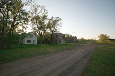
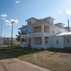
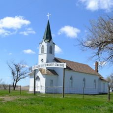
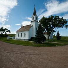
Leith is a small city in Grant County, North Dakota, situated at an elevation of about 714 meters (2,345 feet) in the northern Great Plains. The settlement consists of scattered residential buildings surrounded by vast open prairie landscape.

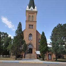
The Milwaukee Road railway established Leith in 1910, naming it after a Scottish port town near Edinburgh during the era of western expansion. The rail line was central to bringing settlement to this remote region.

Native American groups and local residents joined forces in September 2013 to demonstrate their commitment to maintaining community values through organized protests.

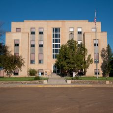
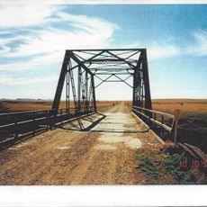
The city maintains basic municipal services and road access, though the area has very few accommodation options nearby. Visitors planning to stay should arrange lodging in larger communities in Grant County or surrounding areas.

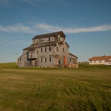
The population had dropped to around sixteen residents by 2010, making it one of North Dakota's smallest incorporated communities. This tiny size reflects the long-term challenges faced by remote railroad towns after shifts in transportation patterns.

The community of curious travelers

AroundUs brings together thousands of curated places, local tips, and hidden gems, enriched daily by 60,000 contributors worldwide.

Start exploring
Location
Inception
1910
Elevation above the sea
714 m
GPS coordinates
46.35889,-101.63611
Latest update
December 19, 2025 21:52
Around this place
Hell Creek Formation
United States of America

Hell Creek Formation

61.1 km
Salem Sue
United States of America

Salem Sue

57.3 km
Richardton meteorite
United States of America

Richardton meteorite

57 km
Heart Butte Dam
United States of America

Heart Butte Dam

29.7 km
Pretty Rock National Wildlife Refuge
United States of America

Pretty Rock National Wildlife Refuge

26.4 km
Lemmon Petrified Park
United States of America

Lemmon Petrified Park

61.5 km
United States of America

Lake Patricia National Wildlife Refuge

36.9 km
Hotel Brown
United States of America

Hotel Brown

32.8 km
German Evangelical St. Johns Church
United States of America

German Evangelical St. Johns Church

68.3 km
United States of America

Hope Lutheran Church

23.4 km
Hettinger County Courthouse
United States of America

Hettinger County Courthouse

53.2 km
Evangelical Lutheran Trinity Church
United States of America

Evangelical Lutheran Trinity Church

29.9 km
Cedar Creek Bridge
United States of America

Cedar Creek Bridge

57 km
Carson Roller Mill
United States of America

Carson Roller Mill

8.6 km
United States of America

L.F. Harriman House

61.4 km
United States of America

G.E. Lemmon House

61.9 km
Sims Lutheran Church
United States of America

Sims Lutheran Church

47.2 km
Petrified Wood Park & Museum
United States of America

Petrified Wood Park & Museum

61.7 km
Neuburg Congregational Church
United States of America

Neuburg Congregational Church

47.3 km
United States of America

Golden Rule Department Store

61.5 km
United States of America

Lake Tschida

33.7 km
United States of America

Morristown East Lake

48 km
United States of America

Mallard Lake

52.8 km
United States of America

Storm Creek Lake

60.1 km
United States of America

Lemmon Country Club

61.6 km
United States of America

Crossroads Golf Course Glen Ullin ND

53.7 km
United States of America

Kokomo Art Gallary

61.5 km
United States of America

Cowboy Riding a Dinosaur

62.2 km
Show the full map
Reviews
Share your experience

No review yet

Discussions
Start a discussion...

No discussion yet

« Leith - Small city in Grant County, North Dakota, United States » is provided by Around Us (aroundus.com). Images and texts are derived from Wikimedia project under a Creative Commons license. You are allowed to copy, distribute, and modify copies of this page, under the conditions set by the license, as long as this note is clearly visible.

Discover hidden gems everywhere you go!

From secret cafés to breathtaking viewpoints, skip the crowded tourist spots and find places that match your style. Our app makes it easy with voice search, smart filtering, route optimization, and insider tips from travelers worldwide. Download now for the complete mobile experience.

Around Us App Screenshot

A unique approach to discovering new places

Le Figaro

All the places worth exploring

France Info

A tailor-made excursion in just a few clicks

20 Minutes

Around Us
Travel Guide & Maps
Download

Send to your phone

QR Code
1

Open the camera app on your mobile.

2

Point at the QR code with your camera. A notification will appear.

3

Tap the notification to open the link.