Enable Location

We need your location to show you interesting places around you

Discover nearby places

Find interesting locations and hidden gems around you

Precise directions

Get accurate directions and distances to places

Your location is never shared with other users. It's only used when you tap the location button.

Williamson

Log in to your account

Start exploring — it's free

Trusted by 63,013 travelers worldwide

Continue with Google
Continue with Apple
or

We will send you a code to connect

By continuing, you accept our Terms and Conditions and our Privacy Policy

Check your inbox

We've sent a pincode in your inbox. Please enter the code below.

Discussion Reviews 1 Photos
19.7k Popularity

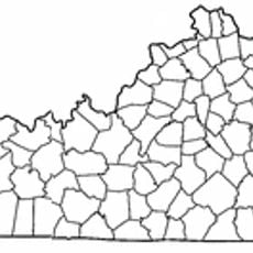
Williamson, county seat of Mingo County, West Virginia, United States

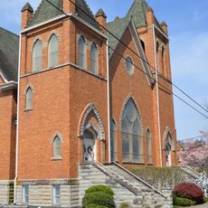
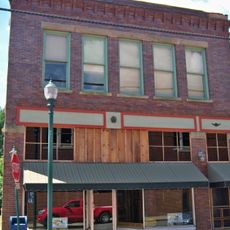
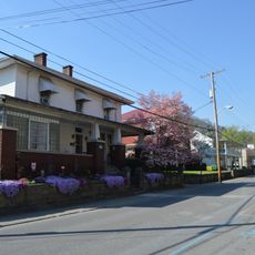
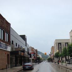
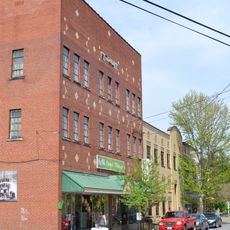
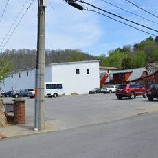
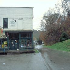
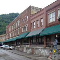
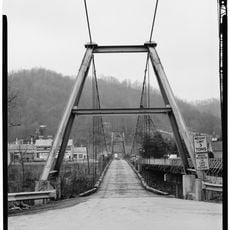
Williamson is a city in Mingo County, West Virginia, located along the Tug Fork River and near the Kentucky border. The city has mostly low-rise buildings, walkable streets, and is connected by two main highways that bring traffic and commerce to the region.

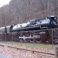
Williamson was incorporated as a city in 1905 as the coal industry was growing and a railroad line had been built around 1890, drawing workers to the area. The population grew significantly after World War II but then declined as coal mining jobs decreased.

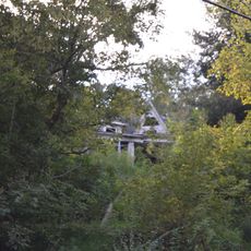
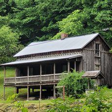
The name Williamson comes from a family that once owned the land in this area. Today, the mining heritage shapes how the town looks and feels, with old structures and rail lines still running through, reminding visitors of how central this industry was to building the place.

The city is best reached by car since there is no public transit, and highways US-119 and US-52 connect it to larger towns. Once in the city center, visitors can walk around, but a car is needed for trips to nearby outdoor spots and hiking trails.

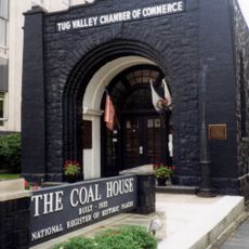
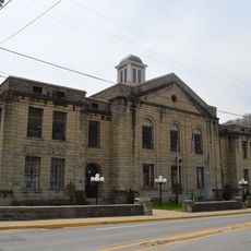
The Coal House, built in 1933, is made entirely from hundreds of tons of coal and now houses the local chamber of commerce. The building was carefully restored after a fire in 2010 and stands as a striking reminder of the region's mining past.

The community of curious travelers

AroundUs brings together thousands of curated places, local tips, and hidden gems, enriched daily by 60,000 contributors worldwide.

Start exploring
Location
Elevation above the sea
199 m
GPS coordinates
37.67389,-82.27972
Latest update
February 16, 2026 22:20
Around this place
Breaks Interstate Park
United States of America

Breaks Interstate Park

42 km
United States of America

Pikeville Cut-Through

31.8 km
Jenny Wiley State Resort Park
United States of America

Jenny Wiley State Resort Park

39.3 km
Dewey Lake
United States of America

Dewey Lake

40.1 km
Coal House
United States of America

Coal House

276 m
Chief Logan State Park
United States of America

Chief Logan State Park

33.6 km
Fishtrap Lake
United States of America

Fishtrap Lake

29.5 km
Cabwaylingo State Forest
United States of America

Cabwaylingo State Forest

34.1 km
Chesapeake and Ohio 2755
United States of America

Chesapeake and Ohio 2755

34.1 km
Samuel May House
United States of America

Samuel May House

44.1 km
Elkhorn City Railroad Museum
United States of America

Elkhorn City Railroad Museum

41.4 km
Fishtrap Lake State Park
United States of America

Fishtrap Lake State Park

29.3 km
Big Sandy Heritage Center
United States of America

Big Sandy Heritage Center

30.3 km
Martin Himler House
United States of America

Martin Himler House

23.2 km
Methodist Episcopal Church, South
United States of America

Methodist Episcopal Church, South

43.5 km
Foster Hardware
United States of America

Foster Hardware

40.9 km
College Street Historic District
United States of America

College Street Historic District

30.5 km
Pikeville College Academy Building
United States of America

Pikeville College Academy Building

30.7 km
Williamson Historic District
United States of America

Williamson Historic District

444 m
Front Street Historic District
United States of America

Front Street Historic District

43.7 km
Martin County Courthouse
United States of America

Martin County Courthouse

31.3 km
Pikeville Commercial Historic District
United States of America

Pikeville Commercial Historic District

30.2 km
Fitzpatrick-Harmon House
United States of America

Fitzpatrick-Harmon House

43.4 km
Loretta Lynn's Homeplace
United States of America

Loretta Lynn's Homeplace

39.3 km
Matewan Depot Replica Welcome Center and Museum
United States of America

Matewan Depot Replica Welcome Center and Museum

11.3 km
Mine No. 5 Store
United States of America

Mine No. 5 Store

41 km
Matewan Historic District
United States of America

Matewan Historic District

11.6 km
Boldman Bridge
United States of America

Boldman Bridge

33.8 km
Show the full map
Reviews
Share your experience

No review yet

Discussions
Start a discussion...

No discussion yet

« Williamson - county seat of Mingo County, West Virginia, United States » is provided by Around Us (aroundus.com). Images and texts are derived from Wikimedia project under a Creative Commons license. You are allowed to copy, distribute, and modify copies of this page, under the conditions set by the license, as long as this note is clearly visible.

Discover hidden gems everywhere you go!

From secret cafés to breathtaking viewpoints, skip the crowded tourist spots and find places that match your style. Our app makes it easy with voice search, smart filtering, route optimization, and insider tips from travelers worldwide. Download now for the complete mobile experience.

Around Us App Screenshot

A unique approach to discovering new places

Le Figaro

All the places worth exploring

France Info

A tailor-made excursion in just a few clicks

20 Minutes

Around Us
Travel Guide & Maps
Download

Send to your phone

QR Code
1

Open the camera app on your mobile.

2

Point at the QR code with your camera. A notification will appear.

3

Tap the notification to open the link.