Chest opened
+${chestReward.xp} XP
Explorer
NOUVEAU ×${chestReward.collectible.quantity}
tapez pour fermer
Chest locked

Open chests in the app

Around Us is built for your phone — chests unlock when you walk, explore and capture nearby places.

Enable Location

We need your location to show you interesting places around you

Discover nearby places

Find interesting locations and hidden gems around you

Precise directions

Get accurate directions and distances to places

Your location is never shared with other users. It's only used when you tap the location button.

Log in to your account

Start exploring — it's free

Trusted by 72,881 travelers worldwide

Continue with Google
Continue with Apple
or

We will send you a code to connect

By continuing, you accept our Terms and Conditions and our Privacy Policy

Check your inbox

We've sent a pincode in your inbox. Please enter the code below.

Discussion Reviews Photo
18.4k Popularity

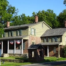
Kaser, village in Rockland County, New York, United States

Kaser is a small village in Rockland County, New York, built on very dense land with houses standing close together. The streets are filled with families and young children, creating an active and tightly-knit neighborhood along State Route 306.

The village was founded in 1990 when members of the Viznitz group sought more housing space for their growing community. Since then, the population has grown significantly as more families moved in to be part of the close religious network.

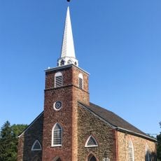
The village is shaped by the Viznitz Hasidic community, whose religious practices guide daily life and public gatherings. Walking through the streets, you see families in traditional dress and notice how religious celebrations and community events form the backbone of neighborhood activity.

The village is easily accessible by New York State Route 306 and sits near other surrounding communities. The streets are narrow and activity is strongest in evenings and on weekends when families gather outside.

The village spans less than a tenth of a square mile, making it one of the most densely packed religious community centers in the region. Despite the tight quarters, families have created a fully functioning neighborhood with schools and institutions.

The community of curious travelers

AroundUs brings together thousands of curated places, local tips, and hidden gems, enriched daily by 60,000 contributors worldwide.

Start exploring
Location
Inception
1990
Elevation above the sea
165 m
GPS coordinates
41.11667,-74.06667
Latest update
February 16, 2026 23:40
Around this place
Ramapo Mountains
United States of America

Ramapo Mountains

6.8 km
Novo-Diveevo
United States of America

Novo-Diveevo

3.6 km
Lafayette Theatre
United States of America

Lafayette Theatre

7 km
Monsey Church
United States of America

Monsey Church

541 m
Rockland County Courthouse and Dutch Gardens
United States of America

Rockland County Courthouse and Dutch Gardens

7.2 km
North Main Street School
United States of America

North Main Street School

2 km
Washington Avenue Soldier's Monument and Triangle
United States of America

Washington Avenue Soldier's Monument and Triangle

7 km
Houser-Conklin House
United States of America

Houser-Conklin House

2 km
Hopper-Goetschius House
United States of America

Hopper-Goetschius House

6.8 km
New North Reformed Low Dutch Church
United States of America

New North Reformed Low Dutch Church

5.4 km
Contempora House
United States of America

Contempora House

8.4 km
Torne Brook Farm
United States of America

Torne Brook Farm

8.5 km
United States Post Office
United States of America

United States Post Office

7.2 km
New City Free Library
United States of America

New City Free Library

8.1 km
John A. DeBaun Mill
United States of America

John A. DeBaun Mill

3.2 km
Richard Pousette-Dart House and Studio
United States of America

Richard Pousette-Dart House and Studio

5.9 km
Hopper House
United States of America

Hopper House

5.3 km
Eckerson House
United States of America

Eckerson House

5.1 km
Forshee-Van Orden House
United States of America

Forshee-Van Orden House

6.4 km
Holdrum-Van Houten House
United States of America

Holdrum-Van Houten House

7.3 km
Gurnee–Sherwood House
United States of America

Gurnee–Sherwood House

5.4 km
Long Path
United States of America

Long Path

7.9 km
New Hempstead Presbyterian Church
United States of America

New Hempstead Presbyterian Church

4.7 km
Holocaust Museum & Center for Tolerance and Education
United States of America

Holocaust Museum & Center for Tolerance and Education

2.5 km
United States of America

Scenic viewpoint

7.4 km
United States of America

Scenic viewpoint

7.6 km
United States of America

Scenic viewpoint

6.9 km
United States of America

Scenic viewpoint

7.4 km
Show the full map
Reviews
Share your experience

No review yet

Discussions
Start a discussion...

No discussion yet

« Kaser - village in Rockland County, New York, United States » is provided by Around Us (aroundus.com). Images and texts are derived from Wikimedia project under a Creative Commons license. You are allowed to copy, distribute, and modify copies of this page, under the conditions set by the license, as long as this note is clearly visible.

Discover hidden gems everywhere you go!

From secret cafés to breathtaking viewpoints, skip the crowded tourist spots and find places that match your style. Our app makes it easy with voice search, smart filtering, route optimization, and insider tips from travelers worldwide. Download now for the complete mobile experience.

Around Us App Screenshot

A unique approach to discovering new places

Le Figaro

All the places worth exploring

France Info

A tailor-made excursion in just a few clicks

20 Minutes

Around Us
Travel Guide & Maps
Download

Send to your phone

QR Code
1

Open the camera app on your mobile.

2

Point at the QR code with your camera. A notification will appear.

3

Tap the notification to open the link.