Chest opened
+${chestReward.xp} XP
Explorer
NOUVEAU ×${chestReward.collectible.quantity}
tapez pour fermer
Chest locked

Open chests in the app

Around Us is built for your phone — chests unlock when you walk, explore and capture nearby places.

Enable Location

We need your location to show you interesting places around you

Discover nearby places

Find interesting locations and hidden gems around you

Precise directions

Get accurate directions and distances to places

Your location is never shared with other users. It's only used when you tap the location button.

McKinley Park, Chicago

Log in to your account

Start exploring — it's free

Trusted by 72,881 travelers worldwide

Continue with Google
Continue with Apple
or

We will send you a code to connect

By continuing, you accept our Terms and Conditions and our Privacy Policy

Check your inbox

We've sent a pincode in your inbox. Please enter the code below.

McKinley Park, Chicago
Discussion Reviews 1 Photos
16.5k Popularity

McKinley Park, Chicago, Residential district in Southwest Chicago, United States

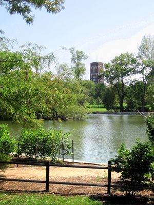
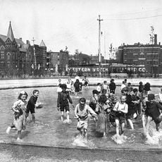
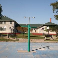
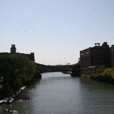
McKinley Park is a residential neighborhood in Southwest Chicago bounded by Interstate 55, the Chicago River, Pershing Road, and railroad tracks. The district includes a public park with a swimming pool, ice skating rink, tennis courts, and recreational facilities for residents.

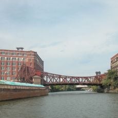
The area began in the 1830s when Irish workers settled while building the Illinois and Michigan Canal. The neighborhood grew into an industrial hub during the 19th century, shaped by water routes and railroad connections.

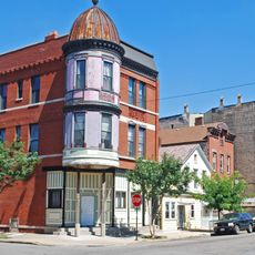
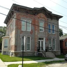
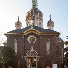
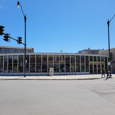
The neighborhood today is a residential area shaped by different communities living side by side, each bringing their own traditions and ways of using the local streets and public spaces. This diversity is visible in the shops, restaurants, and how people spend their time in the district.

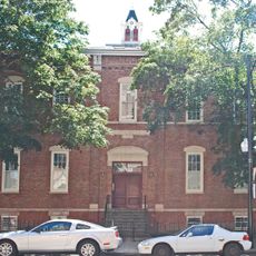
The neighborhood is easy to explore on foot, with good walking connections between the park and surrounding residential streets. Visitors should know that industrial areas along Pershing Road are less accessible for walking and better viewed from a vehicle.

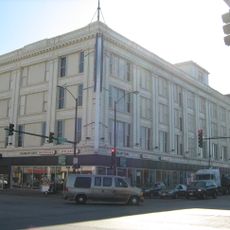
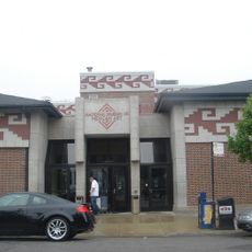
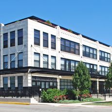
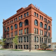
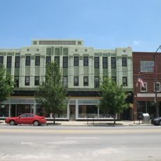
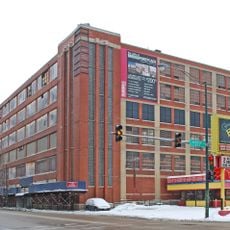
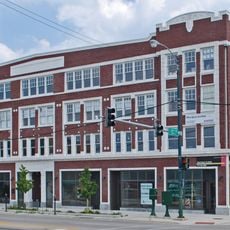
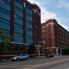
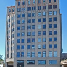
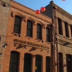
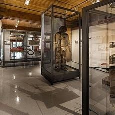
The neighborhood contains the Central Manufacturing District, a 19th-century industrial zone that preserves dozens of old factory buildings. Many of these structures are now protected landmarks that tell the story of Chicago's early industrial era.

The community of curious travelers

AroundUs brings together thousands of curated places, local tips, and hidden gems, enriched daily by 60,000 contributors worldwide.

Start exploring
Location
Shares border with
Lower West Side, Chicago
GPS coordinates
41.83000,-87.67000
Latest update
March 5, 2026 21:06
Around this place
Cook County Jail
United States of America

Cook County Jail

2.6 km
S. R. Crown Hall
United States of America

S. R. Crown Hall

3.6 km
Union Stock Yard Gate
United States of America

Union Stock Yard Gate

2.2 km
Pilsen Historic District
United States of America

Pilsen Historic District

2.8 km
Goldblatt's Building
United States of America

Goldblatt's Building

2.4 km
National Museum of Mexican Art
United States of America

National Museum of Mexican Art

2.9 km
Thalia Hall
United States of America

Thalia Hall

3.3 km
St. Adalbert's in Chicago
United States of America

St. Adalbert's in Chicago

3.2 km
Wabash Avenue YMCA
United States of America

Wabash Avenue YMCA

3.8 km
South Water Market
United States of America

South Water Market

3.8 km
Illinois Institute of Technology Academic Campus
United States of America

Illinois Institute of Technology Academic Campus

3.5 km
Chicago Bee Building
United States of America

Chicago Bee Building

3.6 km
Armour Square Park
United States of America

Armour Square Park

3 km
Spiegel Office Building
United States of America

Spiegel Office Building

1.5 km
Ramova Theater
United States of America

Ramova Theater

1.9 km
Overton Hygienic Building
United States of America

Overton Hygienic Building

3.6 km
Cornell Square
United States of America

Cornell Square

3.1 km
Cermak Road Bridge Historic District
United States of America

Cermak Road Bridge Historic District

3.5 km
Central Manufacturing District–Original East Historic District
United States of America

Central Manufacturing District–Original East Historic District

1.1 km
DuPont-Whitehouse House
United States of America

DuPont-Whitehouse House

1.4 km
Central Manufacturing District–Pershing Road Development Historic District
United States of America

Central Manufacturing District–Pershing Road Development Historic District

960 m
St. Matthew Evangelical Lutheran School
United States of America

St. Matthew Evangelical Lutheran School

2.7 km
Produce Terminal Cold Storage Company Building
United States of America

Produce Terminal Cold Storage Company Building

3.5 km
Chinese American Museum of Chicago
United States of America

Chinese American Museum of Chicago

3.8 km
Apostolic House of Prayer
United States of America

Apostolic House of Prayer

3 km
Chicago Maritime Museum
United States of America

Chicago Maritime Museum

1.1 km
Cermak Road Bridge
United States of America

Cermak Road Bridge

3.5 km
Rudy Lozano Branch
United States of America

Rudy Lozano Branch

3.2 km
Show the full map
Reviews
Share your experience

No review yet

Discussions
Start a discussion...

No discussion yet

« McKinley Park, Chicago - Residential district in Southwest Chicago, United States » is provided by Around Us (aroundus.com). Images and texts are derived from Wikimedia project under a Creative Commons license. You are allowed to copy, distribute, and modify copies of this page, under the conditions set by the license, as long as this note is clearly visible.

Discover hidden gems everywhere you go!

From secret cafés to breathtaking viewpoints, skip the crowded tourist spots and find places that match your style. Our app makes it easy with voice search, smart filtering, route optimization, and insider tips from travelers worldwide. Download now for the complete mobile experience.

Around Us App Screenshot

A unique approach to discovering new places

Le Figaro

All the places worth exploring

France Info

A tailor-made excursion in just a few clicks

20 Minutes

Around Us
Travel Guide & Maps
Download

Send to your phone

QR Code
1

Open the camera app on your mobile.

2

Point at the QR code with your camera. A notification will appear.

3

Tap the notification to open the link.