Enable Location

We need your location to show you interesting places around you

Discover nearby places

Find interesting locations and hidden gems around you

Precise directions

Get accurate directions and distances to places

Your location is never shared with other users. It's only used when you tap the location button.

Log in to your account

Start exploring — it's free

Trusted by 64,553 travelers worldwide

Continue with Google
Continue with Apple
or

We will send you a code to connect

By continuing, you accept our Terms and Conditions and our Privacy Policy

Check your inbox

We've sent a pincode in your inbox. Please enter the code below.

Albert Pike Recreation Area
Discussion Reviews Photo
3.1k Popularity

Albert Pike Recreation Area, Forest recreation area in Ouachita Mountains, Arkansas.

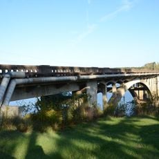
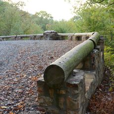
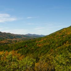
Albert Pike Recreation Area is a forested park along the Little Missouri River in the Ouachita Mountains of Arkansas. It offers campsites, picnic areas, and hiking trails spread across the riverbank.

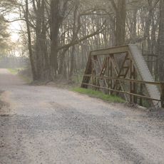
The area was named after Albert Pike, a lawyer, poet, and general from the Civil War era who had ties to the region. A major flood in 2010 destroyed much of the campground and reshaped the riverbed, leading to a long rebuilding process.

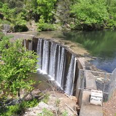
Local people come to swim and paddle on the river, especially during summer months when the water is warm. The place draws in those who enjoy outdoor activities and spending time in nature.

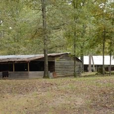
Some campsites come with electric and water hookups while others are more basic, so it is worth checking availability before arriving. Summer and fall tend to offer the most stable conditions for being outdoors and using the river.

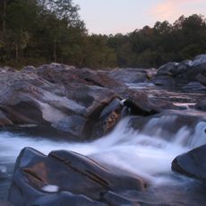
The Little Missouri River has short stretches of whitewater that are among the few technically demanding paddling runs in Arkansas. These sections shifted after the 2010 flood, as the riverbed changed shape in ways that paddlers still navigate today.

The community of curious travelers

AroundUs brings together thousands of curated places, local tips, and hidden gems, enriched daily by 60,000 contributors worldwide.

Start exploring
Location
GPS coordinates
34.37230,-93.87960
Latest update
March 3, 2026 13:54
Around this place
Crater of Diamonds State Park
United States of America

Crater of Diamonds State Park

42.4 km
Cossatot River State Park-Natural Area
United States of America

Cossatot River State Park-Natural Area

27.9 km
Shady Lake Recreation Area
United States of America

Shady Lake Recreation Area

13.9 km
Ebenezer Campground
United States of America

Ebenezer Campground

36.1 km
Huddleston Store and McKinzie Store
United States of America

Huddleston Store and McKinzie Store

23.6 km
Ebenezer Monument
United States of America

Ebenezer Monument

40.8 km
Bard Springs Bathhouse
United States of America

Bard Springs Bathhouse

12.2 km
Mena City Hall
United States of America

Mena City Hall

40.5 km
Tall Peak Fire Tower
United States of America

Tall Peak Fire Tower

15.1 km
Janssen Park
United States of America

Janssen Park

40.6 km
Mount Ida Cities Service Filling Station
United States of America

Mount Ida Cities Service Filling Station

30.5 km
Old Bank of Amity
United States of America

Old Bank of Amity

40.3 km
Hale Creek Bridge
United States of America

Hale Creek Bridge

43.1 km
Montgomery County Courthouse
United States of America

Montgomery County Courthouse

30.7 km
Polk County Courthouse
United States of America

Polk County Courthouse

40.7 km
Conway Hotel
United States of America

Conway Hotel

39.2 km
Self Creek Bridge
United States of America

Self Creek Bridge

18.9 km
Murfreesboro Cities Service Station
United States of America

Murfreesboro Cities Service Station

38.7 km
Judge Benjamin Shaver House
United States of America

Judge Benjamin Shaver House

40.9 km
Caddo Valley Academy Complex
United States of America

Caddo Valley Academy Complex

20.6 km
Elks Lodge
United States of America

Elks Lodge

40.6 km
Buckeye Vista Overlook
United States of America

Buckeye Vista Overlook

14.9 km
Mena Commercial Historic District
United States of America

Mena Commercial Historic District

40.2 km
Sugar Creek Vista Overlook
United States of America

Sugar Creek Vista Overlook

17.4 km
Norman Town Square
United States of America

Norman Town Square

20.5 km
Pike County Courthouse
United States of America

Pike County Courthouse

38.7 km
Shelton-Lockeby House
United States of America

Shelton-Lockeby House

37.1 km
Womble District Administration House No. 1
United States of America

Womble District Administration House No. 1

31.5 km
Show the full map
Reviews
Share your experience

No review yet

Discussions
Start a discussion...

No discussion yet

« Albert Pike Recreation Area - Forest recreation area in Ouachita Mountains, Arkansas » is provided by Around Us (aroundus.com). Images and texts are derived from Wikimedia project under a Creative Commons license. You are allowed to copy, distribute, and modify copies of this page, under the conditions set by the license, as long as this note is clearly visible.

Discover hidden gems everywhere you go!

From secret cafés to breathtaking viewpoints, skip the crowded tourist spots and find places that match your style. Our app makes it easy with voice search, smart filtering, route optimization, and insider tips from travelers worldwide. Download now for the complete mobile experience.

Around Us App Screenshot

A unique approach to discovering new places

Le Figaro

All the places worth exploring

France Info

A tailor-made excursion in just a few clicks

20 Minutes

Around Us
Travel Guide & Maps
Download

Send to your phone

QR Code
1

Open the camera app on your mobile.

2

Point at the QR code with your camera. A notification will appear.

3

Tap the notification to open the link.