Log in to your account

AroundUs is a community-driven map of interesting places, built by curious explorers like you. It grows with every review, story, and photo you share.
Connect to save your favorite spots, contribute locations, and create personalized routes.
Continue with Google
Continue with Apple
Continue with X
Continue with Facebook
Continue with email
By continuing, you accept our Terms and Conditions and our Privacy Policy
Create an account

Allegheny Highlands Trail of Maryland

Add to collection
Map
Suggest a change
Share

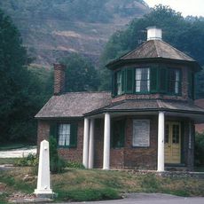
Allegheny Highlands Trail of Maryland, Protected nature trail in Western Maryland, United States

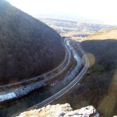
The Allegheny Highlands Trail is a 20.47-mile (33-km) route through forests and mountainous terrain, connecting Cumberland with the Mason-Dixon line. The path offers varied landscapes with tree cover, rolling sections, and open areas suitable for both hiking and cycling.

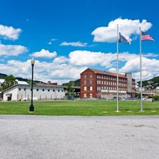
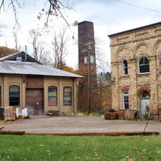
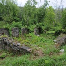
The route follows the former Western Maryland Railway, which transported goods and passengers through the Allegheny Mountains during the industrial era. The rails were later removed, but the corridor was converted into a walking path that preserves the legacy of this important transportation line.

The trail serves as a gathering space for outdoor enthusiasts from the surrounding region who come to experience the natural landscape. Locals frequently use the route for daily exercise or as a weekend destination with family and friends.

The trail features multiple access points with parking and rest facilities distributed along its length. The path is open year-round and requires no special permits or advanced arrangements for visiting.

The Western Maryland Scenic Railroad runs parallel to sections of the trail between Cumberland and Frostburg, allowing visitors to combine train and hiking experiences simultaneously. This rare setup enables people to experience two different modes of travel in the same natural setting.

Location: Maryland

GPS coordinates: 39.69560,-78.84650

Latest update: December 13, 2025 17:01

Photos
Around this place
Canal Place
United States of America

Canal Place

8.8 km
Inns on the National Road
United States of America

Inns on the National Road

2.6 km
B'er Chayim Temple
United States of America

B'er Chayim Temple

8.9 km
Downtown Cumberland Historic District
United States of America

Downtown Cumberland Historic District

8.8 km
Wills Mountain State Park
United States of America

Wills Mountain State Park

6.6 km
La Vale Tollgate House
United States of America

La Vale Tollgate House

6.5 km
Washington Street Historic District
United States of America

Washington Street Historic District

8.1 km
Allegany County Courthouse
United States of America

Allegany County Courthouse

8.4 km
Town Clock Church
United States of America

Town Clock Church

8.5 km
Cumberland YMCA
United States of America

Cumberland YMCA

8.9 km
Public Safety Building
United States of America

Public Safety Building

8.6 km
African Methodist Episcopal Church
United States of America

African Methodist Episcopal Church

8.6 km
Bell Tower Building
United States of America

Bell Tower Building

8.6 km
Mount Savage Historic District
United States of America

Mount Savage Historic District

2.9 km
Folck's Mill
United States of America

Folck's Mill

10.8 km
Greene Street Historic District
United States of America

Greene Street Historic District

8 km
City Hall
United States of America

City Hall

8.6 km
First Baptist Church
United States of America

First Baptist Church

8.5 km
Francis Haley House
United States of America

Francis Haley House

9.5 km
Rolling Mill Historic District
United States of America

Rolling Mill Historic District

9.5 km
George Truog House
United States of America

George Truog House

8.9 km
Thomas Koon House
United States of America

Thomas Koon House

8.9 km
Decatur Heights Historic District
United States of America

Decatur Heights Historic District

8.8 km
16 Altamont Terrace
United States of America

16 Altamont Terrace

9.1 km
Wright Butler House
United States of America

Wright Butler House

8.3 km
200-208 Decatur Street
United States of America

200-208 Decatur Street

8.8 km
Chapel Hill Historic District
United States of America

Chapel Hill Historic District

9.7 km
United States of America

Washington Street Library

8.5 km
Show the full map
Reviews

Visited this place? Tap the stars to rate it and share your experience / photos with the community! Try now! You can cancel it anytime.

« Allegheny Highlands Trail of Maryland - Protected nature trail in Western Maryland, United States » is provided by Around Us (aroundus.com). Images and texts are derived from Wikimedia project under a Creative Commons license. You are allowed to copy, distribute, and modify copies of this page, under the conditions set by the license, as long as this note is clearly visible.

Discover hidden gems everywhere you go!

From secret cafés to breathtaking viewpoints, skip the crowded tourist spots and find places that match your style. Our app makes it easy with voice search, smart filtering, route optimization, and insider tips from travelers worldwide. Download now for the complete mobile experience.

Around Us App Screenshot

A unique approach to discovering new places

Le Figaro

All the places worth exploring

France Info

A tailor-made excursion in just a few clicks

20 Minutes