Enable Location

We need your location to show you interesting places around you

Discover nearby places

Find interesting locations and hidden gems around you

Precise directions

Get accurate directions and distances to places

Your location is never shared with other users. It's only used when you tap the location button.

Log in to your account

Start exploring — it's free

Trusted by 68,016 travelers worldwide

Continue with Google
Continue with Apple
or

We will send you a code to connect

By continuing, you accept our Terms and Conditions and our Privacy Policy

Check your inbox

We've sent a pincode in your inbox. Please enter the code below.

Appekunny Formation
Discussion Reviews Photo
1.2k Popularity

Appekunny Formation, Geological formation in Glacier National Park, Montana, United States.

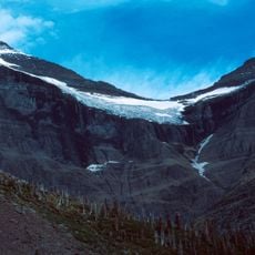
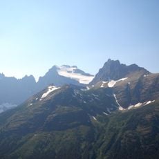
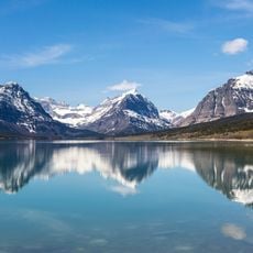
The Appekunny Formation is a geological layer in Glacier National Park made up of gray, black, and greenish argillite with thin, distinct bedding patterns. These rock layers spread across the Lewis Range and show clear changes in their composition throughout.

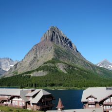
This formation took shape about 1.4 billion years ago when this area sat under a shallow ancient sea that slowly deposited layers of sediment. Geologist Bailey Willis first documented and named these rock layers in 1902 while surveying the Lewis and Livingston Ranges.

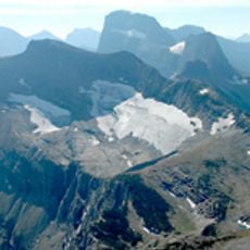
Scientists and geologists travel to this formation to study ancient sedimentary structures that provide evidence of early multicellular life forms.

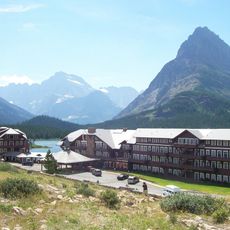
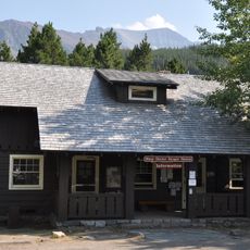
The formation is most visible along Going-to-the-Sun Road and on the lower section of Grinnell Glacier Trail. Early morning or late afternoon light works best to see the different colors and layering patterns clearly.

You can still spot ancient mud cracks and ripple marks in the formation that were pressed into the seafloor about 1.4 billion years ago during tidal movements. These old marks are like footprints left by waves and water level changes from that distant time.

The community of curious travelers

AroundUs brings together thousands of curated places, local tips, and hidden gems, enriched daily by 60,000 contributors worldwide.

Start exploring
Location
Part of
Ravalli Group, Belt Supergroup
GPS coordinates
48.83640,-113.65400
Latest update
March 24, 2026 00:01
Around this place
Many Glacier Hotel
United States of America

Many Glacier Hotel

4.4 km
Ptarmigan Tunnel
United States of America

Ptarmigan Tunnel

4.2 km
Swiftcurrent Fire Lookout
United States of America

Swiftcurrent Fire Lookout

10 km
Ahern Glacier
United States of America

Ahern Glacier

9.6 km
Old Sun Glacier
United States of America

Old Sun Glacier

9.9 km
Grinnell Point
United States of America

Grinnell Point

5.8 km
Swiftcurrent Glacier
United States of America

Swiftcurrent Glacier

10.2 km
Swiftcurrent Auto Camp Historic District
United States of America

Swiftcurrent Auto Camp Historic District

4.5 km
Many Glacier Campground Camptender's Cabin
United States of America

Many Glacier Campground Camptender's Cabin

4.7 km
Many Glacier Barn and Bunkhouse
United States of America

Many Glacier Barn and Bunkhouse

3.9 km
Sherburne Ranger Station Historic District
United States of America

Sherburne Ranger Station Historic District

5.7 km
Slide Lake-Otatso Creek Patrol Cabin and Woodshed
United States of America

Slide Lake-Otatso Creek Patrol Cabin and Woodshed

9.1 km
United States of America

North Swiftcurrent Glacier

10 km
Morning Eagle
United States of America

Morning Eagle

5.6 km
Swiftcurrent Ranger Station Historic District
United States of America

Swiftcurrent Ranger Station Historic District

4.6 km
United States of America

Iceberg Lake

7.3 km
Many Glacier Campground Amphitheater
United States of America

Many Glacier Campground Amphitheater

4.7 km
United States of America

Snow Moon Lake

6.9 km
United States of America

Natoas Peak

9.1 km
United States of America

Swiftcurrent Mountain

10.2 km
United States of America

Altyn Peak

2.6 km
Lake Sherburne
United States of America

Lake Sherburne

5.9 km
United States of America

Scenic viewpoint

10.1 km
United States of America

Redrock Falls

6.2 km
United States of America

Scenic viewpoint

7.6 km
United States of America

Scenic viewpoint

9 km
United States of America

Redrock Falls

6.2 km
United States of America

Hidden Falls

8.4 km
Show the full map
Reviews
Share your experience

No review yet

Discussions
Start a discussion...

No discussion yet

« Appekunny Formation - Geological formation in Glacier National Park, Montana, United States » is provided by Around Us (aroundus.com). Images and texts are derived from Wikimedia project under a Creative Commons license. You are allowed to copy, distribute, and modify copies of this page, under the conditions set by the license, as long as this note is clearly visible.

Discover hidden gems everywhere you go!

From secret cafés to breathtaking viewpoints, skip the crowded tourist spots and find places that match your style. Our app makes it easy with voice search, smart filtering, route optimization, and insider tips from travelers worldwide. Download now for the complete mobile experience.

Around Us App Screenshot

A unique approach to discovering new places

Le Figaro

All the places worth exploring

France Info

A tailor-made excursion in just a few clicks

20 Minutes

Around Us
Travel Guide & Maps
Download

Send to your phone

QR Code
1

Open the camera app on your mobile.

2

Point at the QR code with your camera. A notification will appear.

3

Tap the notification to open the link.