Enable Location

We need your location to show you interesting places around you

Discover nearby places

Find interesting locations and hidden gems around you

Precise directions

Get accurate directions and distances to places

Your location is never shared with other users. It's only used when you tap the location button.

Bear Mountain Bridge Road

Log in to your account

Start exploring — it's free

Trusted by 62,543 travelers worldwide

Continue with Google
Continue with Apple
or

We will send you a code to connect

By continuing, you accept our Terms and Conditions and our Privacy Policy

Check your inbox

We've sent a pincode in your inbox. Please enter the code below.

Bear Mountain Bridge Road, Straße in den Vereinigten Staaten

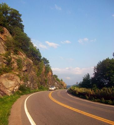
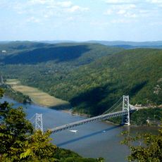
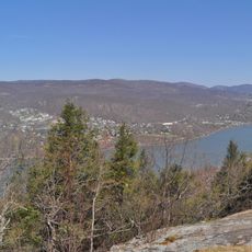
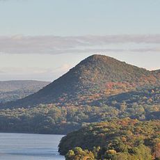
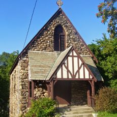
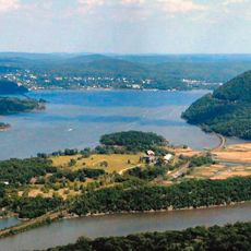
Bear Mountain Bridge Road is a narrow, winding route about three miles long that curves through the rocky slopes of Anthony's Nose and connects the Bear Mountain Bridge to US 9. The road forms part of US 6 and US 202, with views of the Hudson River along the way and a restored Tudor-style toll house near its eastern end.

The road was built in 1923 to connect the newly completed Bear Mountain Bridge to US 9, following the Harriman family's private initiative to construct the bridge. After thirty years, tolls were eliminated and the road became part of the state system, cementing its role as a public transportation route.

The road is called the Goat Trail by locals, reflecting how people experience its steep, winding nature through rocky terrain. This nickname shows how the place has earned its character through its challenging landscape and the way visitors naturally describe their journey here.

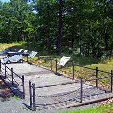
The road curves around the mountain and has a small parking area where visitors can stop and explore trails leading to the top of Anthony's Nose. The toll house now functions as an information center where you can learn about local hiking routes and points of interest in the area.

During construction, workers quarried about 16,000 cubic meters of stone from the mountain to build a massive retaining wall that still supports the road today. This impressive wall made from local stone is a visible reminder of the original engineering effort from the 1920s.

The community of curious travelers

AroundUs brings together thousands of curated places, local tips, and hidden gems, enriched daily by 60,000 contributors worldwide.

Start exploring
Location
GPS coordinates
41.31167,-73.97056
Latest update
February 9, 2026 08:23
« Bear Mountain Bridge Road - Straße in den Vereinigten Staaten » is provided by Around Us (aroundus.com). Images and texts are derived from Wikimedia project under a Creative Commons license. You are allowed to copy, distribute, and modify copies of this page, under the conditions set by the license, as long as this note is clearly visible.

Discover hidden gems everywhere you go!

From secret cafés to breathtaking viewpoints, skip the crowded tourist spots and find places that match your style. Our app makes it easy with voice search, smart filtering, route optimization, and insider tips from travelers worldwide. Download now for the complete mobile experience.

Around Us App Screenshot

A unique approach to discovering new places

Le Figaro

All the places worth exploring

France Info

A tailor-made excursion in just a few clicks

20 Minutes

Around Us
Travel Guide & Maps
Download

Send to your phone

QR Code
1

Open the camera app on your mobile.

2

Point at the QR code with your camera. A notification will appear.

3

Tap the notification to open the link.