Chest opened
+${chestReward.xp} XP
Explorer
NOUVEAU ×${chestReward.collectible.quantity}
tapez pour fermer
Chest locked

Open chests in the app

Around Us is built for your phone — chests unlock when you walk, explore and capture nearby places.

Enable Location

We need your location to show you interesting places around you

Discover nearby places

Find interesting locations and hidden gems around you

Precise directions

Get accurate directions and distances to places

Your location is never shared with other users. It's only used when you tap the location button.

Log in to your account

Start exploring — it's free

Trusted by 72,882 travelers worldwide

Continue with Google
Continue with Apple
or

We will send you a code to connect

By continuing, you accept our Terms and Conditions and our Privacy Policy

Check your inbox

We've sent a pincode in your inbox. Please enter the code below.

Discussion Reviews Photo
1.3k Popularity

Black Farm, human settlement in Rhode Island, United States of America

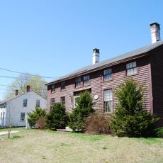
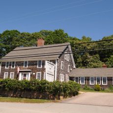
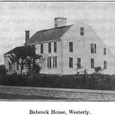
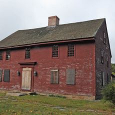
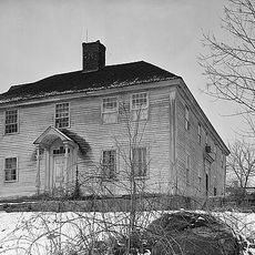
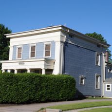
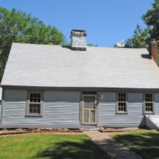
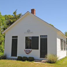
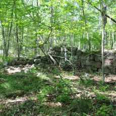
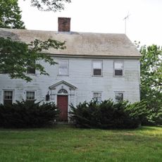
Black Farm, also known as Isaac Collins Farm, is a historic property in Hopkinton, Rhode Island, featuring buildings from different periods and preserved open land. The main house dates to the late 1700s and includes several outbuildings from the 19th century such as barns and a corn crib, along with the remains of a granite-block ice house.

John Collins began farming the land around 1710, and his son Isaac Collins later received a large portion that became known as Black Farm. The property was purchased by Rhode Island in 1991 to preserve its historic character and was listed on the National Register of Historic Places in 1995.

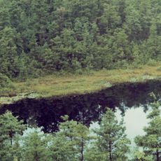
The farm was the economic foundation for families who lived and worked here for generations, shaping the agricultural way of life in the region. Today, visitors can still see the old stone walls and buildings that reflect this work and how farming defined the community.

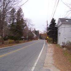
The property is easy to walk with flat trails that wind through fields and woods, suitable for all levels. Visitors should prepare for insects like gnats and take protective measures, especially during warmer months.

The site contains the grave of Charles Collins, a boy of only 15 years old who died in the Civil War and was buried in the woods. Visitors can also see old railroad ties still decomposing among the trees, remnants of the former train line that once crossed the area.

The community of curious travelers

AroundUs brings together thousands of curated places, local tips, and hidden gems, enriched daily by 60,000 contributors worldwide.

Start exploring
Location
GPS coordinates
41.46860,-71.72440
Latest update
February 9, 2026 07:46
Around this place
Yawgoog Scout Reservation
United States of America

Yawgoog Scout Reservation

7.3 km
Burlingame State Park
United States of America

Burlingame State Park

11.9 km
Wilcox Park
United States of America

Wilcox Park

13.3 km
Fort Ninigret
United States of America

Fort Ninigret

11.6 km
Tomaquag Rock Shelters
United States of America

Tomaquag Rock Shelters

5.4 km
Shannock Historic District
United States of America

Shannock Historic District

7.3 km
Ell Pond
United States of America

Ell Pond

6.4 km
Frosty Drew Observatory
United States of America

Frosty Drew Observatory

12.4 km
Westerly Downtown Historic District
United States of America

Westerly Downtown Historic District

13.5 km
Albert S. Potter Octagon House
United States of America

Albert S. Potter Octagon House

5.3 km
Joseph Stanton House
United States of America

Joseph Stanton House

12.5 km
Babcock-Smith House
United States of America

Babcock-Smith House

13.5 km
John Randall House
United States of America

John Randall House

12.7 km
Hopkinton City Historic District
United States of America

Hopkinton City Historic District

4.5 km
Usquepaug Road Historic District
United States of America

Usquepaug Road Historic District

11.1 km
North Stonington Village Historic District
United States of America

North Stonington Village Historic District

13.6 km
Westerly Armory
United States of America

Westerly Armory

12.9 km
Main Street Historic District
United States of America

Main Street Historic District

13.8 km
North End Historic District
United States of America

North End Historic District

12.4 km
Joseph Jeffrey House
United States of America

Joseph Jeffrey House

6.6 km
John Hoxsie House
United States of America

John Hoxsie House

6.5 km
District Schoolhouse No. 2
United States of America

District Schoolhouse No. 2

11.1 km
Hillsdale Historic and Archeological District
United States of America

Hillsdale Historic and Archeological District

9.2 km
Cottrell House
United States of America

Cottrell House

13.6 km
Tomaquag Indian Museum
United States of America

Tomaquag Indian Museum

10.1 km
Bradford Village Historic District
United States of America

Bradford Village Historic District

7.7 km
Hope Valley Historic District
United States of America

Hope Valley Historic District

4.4 km
Browning Mill Pond Area Beach
United States of America

Browning Mill Pond Area Beach

10.1 km
Show the full map
Reviews
Share your experience

No review yet

Discussions
Start a discussion...

No discussion yet

« Black Farm - human settlement in Rhode Island, United States of America » is provided by Around Us (aroundus.com). Images and texts are derived from Wikimedia project under a Creative Commons license. You are allowed to copy, distribute, and modify copies of this page, under the conditions set by the license, as long as this note is clearly visible.

Discover hidden gems everywhere you go!

From secret cafés to breathtaking viewpoints, skip the crowded tourist spots and find places that match your style. Our app makes it easy with voice search, smart filtering, route optimization, and insider tips from travelers worldwide. Download now for the complete mobile experience.

Around Us App Screenshot

A unique approach to discovering new places

Le Figaro

All the places worth exploring

France Info

A tailor-made excursion in just a few clicks

20 Minutes

Around Us
Travel Guide & Maps
Download

Send to your phone

QR Code
1

Open the camera app on your mobile.

2

Point at the QR code with your camera. A notification will appear.

3

Tap the notification to open the link.