Enable Location

We need your location to show you interesting places around you

Discover nearby places

Find interesting locations and hidden gems around you

Precise directions

Get accurate directions and distances to places

Your location is never shared with other users. It's only used when you tap the location button.

Burlingame State Park

Log in to your account

Start exploring — it's free

Trusted by 62,563 travelers worldwide

Continue with Google
Continue with Apple
or

We will send you a code to connect

By continuing, you accept our Terms and Conditions and our Privacy Policy

Check your inbox

We've sent a pincode in your inbox. Please enter the code below.

Burlingame State Park

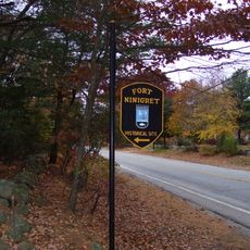
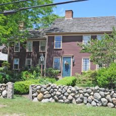
Burlingame State Park, State park in Charlestown, United States.

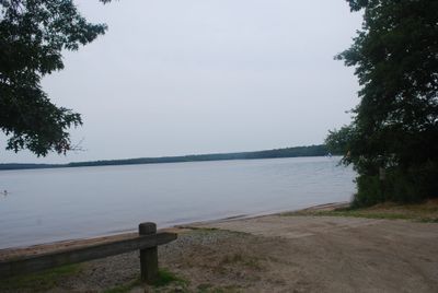
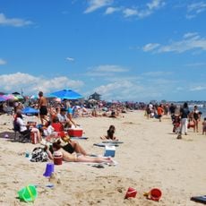
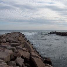
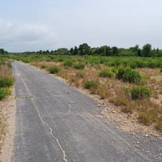
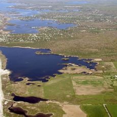
Burlingame State Park is a large natural area in Charlestown, Rhode Island, centered around Watchaug Pond and surrounded by dense woodlands. It features extensive camping facilities with cabins, swimming beaches, boat launch areas, and trails that wind through forested terrain.

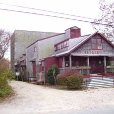
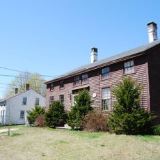
The state parks commission acquired the property in 1930 and named it after commission chairman Edwin A. Burlingame. The area then became a major work site for regional development projects during that decade.

The park remains a gathering place for outdoor recreation and family activities across its woodlands and lakeside areas. People come here to escape daily routines and connect with nature through camping, fishing, and water activities.

The grounds are well equipped with many facilities and designed for extended stays or day visits. Visitors can plan activities around water access, hiking trails, and camp areas to make the most of their time here.

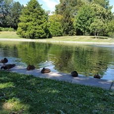
The grounds support diverse wildlife including northern water snakes, box turtles, and over 80 nesting bird species that breed here. This variety of species makes the park a special place for observing different habitats and ecosystems all within one location.

The community of curious travelers

AroundUs brings together thousands of curated places, local tips, and hidden gems, enriched daily by 60,000 contributors worldwide.

Start exploring
Location
Inception
1930
GPS coordinates
41.36280,-71.70030
Latest update
December 10, 2025 16:29
Around this place
Misquamicut State Beach
United States of America

Misquamicut State Beach

9.6 km
Theatre-By-the-Sea
United States of America

Theatre-By-the-Sea

11.6 km
Wilcox Park
United States of America

Wilcox Park

10.7 km
Fort Ninigret
United States of America

Fort Ninigret

4.8 km
Charlestown Breachway State Beach
United States of America

Charlestown Breachway State Beach

5.2 km
Ninigret National Wildlife Refuge
United States of America

Ninigret National Wildlife Refuge

2.6 km
Tomaquag Rock Shelters
United States of America

Tomaquag Rock Shelters

10.5 km
Shannock Historic District
United States of America

Shannock Historic District

10.7 km
Frosty Drew Observatory
United States of America

Frosty Drew Observatory

3.1 km
Westerly Downtown Historic District
United States of America

Westerly Downtown Historic District

10.8 km
Mechanic Street Historic District
United States of America

Mechanic Street Historic District

11.1 km
Albert S. Potter Octagon House
United States of America

Albert S. Potter Octagon House

11.6 km
Joseph Stanton House
United States of America

Joseph Stanton House

749 m
Babcock-Smith House
United States of America

Babcock-Smith House

10.1 km
Babcock House
United States of America

Babcock House

3 km
Browning's Beach Historic District
United States of America

Browning's Beach Historic District

11.4 km
Sheffield House
United States of America

Sheffield House

3.1 km
Westerly Armory
United States of America

Westerly Armory

10.9 km
Main Street Historic District
United States of America

Main Street Historic District

11 km
North End Historic District
United States of America

North End Historic District

11 km
Joseph Jeffrey House
United States of America

Joseph Jeffrey House

8 km
Oak's Inn Military Reservation
United States of America

Oak's Inn Military Reservation

9.4 km
Perry Homestead Historic District
United States of America

Perry Homestead Historic District

11 km
Perry-Carpenter Grist Mill
United States of America

Perry-Carpenter Grist Mill

10.8 km
District Schoolhouse No. 2
United States of America

District Schoolhouse No. 2

4.8 km
Red House
United States of America

Red House

11.6 km
Trustom Pond National Wildlife Refuge
United States of America

Trustom Pond National Wildlife Refuge

9.9 km
Bradford Village Historic District
United States of America

Bradford Village Historic District

6.1 km
Show the full map
« Burlingame State Park - State park in Charlestown, United States » is provided by Around Us (aroundus.com). Images and texts are derived from Wikimedia project under a Creative Commons license. You are allowed to copy, distribute, and modify copies of this page, under the conditions set by the license, as long as this note is clearly visible.

Discover hidden gems everywhere you go!

From secret cafés to breathtaking viewpoints, skip the crowded tourist spots and find places that match your style. Our app makes it easy with voice search, smart filtering, route optimization, and insider tips from travelers worldwide. Download now for the complete mobile experience.

Around Us App Screenshot

A unique approach to discovering new places

Le Figaro

All the places worth exploring

France Info

A tailor-made excursion in just a few clicks

20 Minutes

Around Us
Travel Guide & Maps
Download

Send to your phone

QR Code
1

Open the camera app on your mobile.

2

Point at the QR code with your camera. A notification will appear.

3

Tap the notification to open the link.