Chest opened
+${chestReward.xp} XP
Explorer
NOUVEAU ×${chestReward.collectible.quantity}
tapez pour fermer
Chest locked

Open chests in the app

Around Us is built for your phone — chests unlock when you walk, explore and capture nearby places.

Enable Location

We need your location to show you interesting places around you

Discover nearby places

Find interesting locations and hidden gems around you

Precise directions

Get accurate directions and distances to places

Your location is never shared with other users. It's only used when you tap the location button.

Log in to your account

Start exploring — it's free

Trusted by 73,007 travelers worldwide

Continue with Google
Continue with Apple
or

We will send you a code to connect

By continuing, you accept our Terms and Conditions and our Privacy Policy

Check your inbox

We've sent a pincode in your inbox. Please enter the code below.

Boston Emergency Medical Services
Discussion Reviews Photo
8.5k Popularity

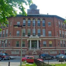
Boston Emergency Medical Services, Emergency medical service facility in Albany Street, Boston, United States

Boston Emergency Medical Services is a public agency that responds to medical emergencies across the city and surrounding areas. The organization operates multiple stations throughout the region and staffs paramedics and emergency medical technicians available around the clock.

The service traces back to an ambulance service started by Boston City Hospital in 1892. Over time it developed into an independent public agency that now coordinates emergency medical response for the city.

The service runs training programs where community members can learn CPR and first aid, making life-saving skills accessible to the public. These courses reflect a commitment to building a safer neighborhood where more people know how to help in emergencies.

The service maintains multiple locations throughout the city and provides rapid response to medical emergencies. Visitors should call for assistance when medical help is needed or seek out the nearest station in case of emergency.

Each vehicle is equipped with computer systems that allow staff to receive directions and track their position in real time. This technology helps drivers navigate quickly to patients and coordinate responses more efficiently.

The community of curious travelers

AroundUs brings together thousands of curated places, local tips, and hidden gems, enriched daily by 60,000 contributors worldwide.

Start exploring
GPS coordinates
42.33430,-71.07240
Latest update
December 10, 2025 16:02
Around this place
Matthews Arena
United States of America

Matthews Arena

1.2 km
Cathedral of the Holy Cross
United States of America

Cathedral of the Holy Cross

736 m
National Emerging Infectious Diseases Laboratories
United States of America

National Emerging Infectious Diseases Laboratories

366 m
United States of America

Hotel Alexandra

492 m
Interdisciplinary Science and Engineering Complex
United States of America

Interdisciplinary Science and Engineering Complex

1.2 km
Harriet Tubman Memorial
United States of America

Harriet Tubman Memorial

1.1 km
Shirley-Eustis House
United States of America

Shirley-Eustis House

1.2 km
Lower Roxbury Historic District
United States of America

Lower Roxbury Historic District

1.2 km
Hibernian Hall
United States of America

Hibernian Hall

1 km
Twelfth Baptist Church, Boston
United States of America

Twelfth Baptist Church, Boston

1.3 km
Harriet Tubman Park
United States of America

Harriet Tubman Park

1.1 km
Eliot Burying Ground
United States of America

Eliot Burying Ground

828 m
Frederick Douglass Square Historic District
United States of America

Frederick Douglass Square Historic District

1 km
Church of the Disciples
United States of America

Church of the Disciples

1.1 km
Tremont Street Methodist Episcopal Church
United States of America

Tremont Street Methodist Episcopal Church

833 m
Odd Fellows Hall, Boston
United States of America

Odd Fellows Hall, Boston

1.2 km
Dearborn School
United States of America

Dearborn School

728 m
Dudley Station Historic District
United States of America

Dudley Station Historic District

1.1 km
Mount Pleasant Historic District
United States of America

Mount Pleasant Historic District

1.1 km
Moreland Street Historic District
United States of America

Moreland Street Historic District

1.3 km
South End District
United States of America

South End District

606 m
Goldsmith Block
United States of America

Goldsmith Block

973 m
Frances and Isabella Apartments
United States of America

Frances and Isabella Apartments

1.1 km
South Boston Boat Clubs Historic District
United States of America

South Boston Boat Clubs Historic District

813 m
Governor Shirley Square Historic District
United States of America

Governor Shirley Square Historic District

972 m
Greenville Street Historic District
United States of America

Greenville Street Historic District

1 km
Joshua Bates School
United States of America

Joshua Bates School

420 m
Lion of South End
United States of America

Lion of South End

1.1 km
Show the full map
Reviews
Share your experience

No review yet

Discussions
Start a discussion...

No discussion yet

« Boston Emergency Medical Services - Emergency medical service facility in Albany Street, Boston, United States » is provided by Around Us (aroundus.com). Images and texts are derived from Wikimedia project under a Creative Commons license. You are allowed to copy, distribute, and modify copies of this page, under the conditions set by the license, as long as this note is clearly visible.

Discover hidden gems everywhere you go!

From secret cafés to breathtaking viewpoints, skip the crowded tourist spots and find places that match your style. Our app makes it easy with voice search, smart filtering, route optimization, and insider tips from travelers worldwide. Download now for the complete mobile experience.

Around Us App Screenshot

A unique approach to discovering new places

Le Figaro

All the places worth exploring

France Info

A tailor-made excursion in just a few clicks

20 Minutes

Around Us
Travel Guide & Maps
Download

Send to your phone

QR Code
1

Open the camera app on your mobile.

2

Point at the QR code with your camera. A notification will appear.

3

Tap the notification to open the link.