Chest opened
+${chestReward.xp} XP
Explorer
NOUVEAU ×${chestReward.collectible.quantity}
tapez pour fermer
Chest locked

Open chests in the app

Around Us is built for your phone — chests unlock when you walk, explore and capture nearby places.

Enable Location

We need your location to show you interesting places around you

Discover nearby places

Find interesting locations and hidden gems around you

Precise directions

Get accurate directions and distances to places

Your location is never shared with other users. It's only used when you tap the location button.

Boston Mountains

Log in to your account

Start exploring — it's free

Trusted by 72,890 travelers worldwide

Continue with Google
Continue with Apple
or

We will send you a code to connect

By continuing, you accept our Terms and Conditions and our Privacy Policy

Check your inbox

We've sent a pincode in your inbox. Please enter the code below.

Boston Mountains
Discussion Reviews 1 Photos
41.8k Popularity

Boston Mountains, Mountain range in northwestern Arkansas, United States.

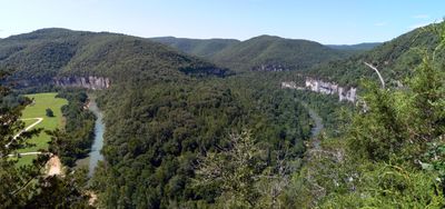
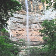
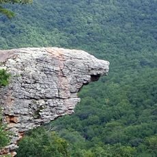
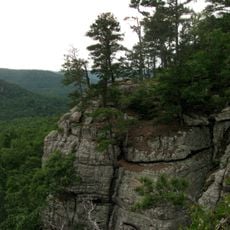
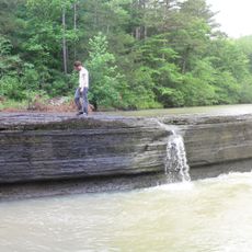
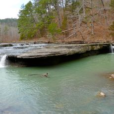
The Boston Mountains stretch across northwestern Arkansas with ridges and valleys shaped by sandstone formations that create visible cliffs and slopes. The tallest peaks rise above 2,400 feet and dominate the region's terrain with their forested covering.

These mountains formed through ancient geological processes when tectonic forces lifted old seabeds and coastlines far above sea level. The rocks and ridges we see today are the result of these massive transformations from millions of years ago.

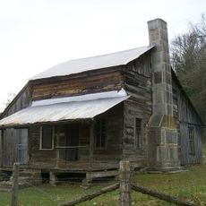
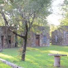
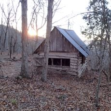
The mountains hold deep meaning for Native American communities whose ancestors lived here and left behind archaeological traces throughout the terrain. The landscape continues to shape how people connect with and understand this region today.

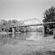
Visitors can access these mountains through multiple trails and recreation areas spread throughout the range, open during all seasons. Plan for changing weather and varied terrain as you move between valleys and ridges across the landscape.

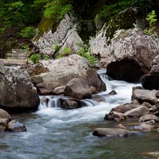
One striking feature is how dramatically the elevation changes as you move through the terrain, creating a different experience compared to other mountain ranges on the continent. The steep slopes and exposed cliff faces are the result of water erosion that continues to shape the landscape today.

The community of curious travelers

AroundUs brings together thousands of curated places, local tips, and hidden gems, enriched daily by 60,000 contributors worldwide.

Start exploring
Location
Part of
Ozark, Oauchita-Appalachian Forests, Ozarks
GPS coordinates
35.79111,-93.10667
Latest update
December 17, 2025 08:01
Around this place
Dogpatch USA
United States of America

Dogpatch USA

35.2 km
Hemmed-In-Hollow Falls
United States of America

Hemmed-In-Hollow Falls

36.1 km
Upper Buffalo Wilderness
United States of America

Upper Buffalo Wilderness

33.8 km
Richland Creek Wilderness
United States of America

Richland Creek Wilderness

33.8 km
Sam's Throne
United States of America

Sam's Throne

9.9 km
Parker-Hickman Farm Historic District
United States of America

Parker-Hickman Farm Historic District

32.8 km
Union School
United States of America

Union School

26.6 km
Big Piney Creek Bridge
United States of America

Big Piney Creek Bridge

17.3 km
St. Paul Lutheran School
United States of America

St. Paul Lutheran School

38.2 km
Henley Hotel
United States of America

Henley Hotel

38.2 km
Little Buffalo River Bridge
United States of America

Little Buffalo River Bridge

22.5 km
Buffalo River Bridge
United States of America

Buffalo River Bridge

30.2 km
Villines Mill
United States of America

Villines Mill

34.4 km
Newton County Courthouse
United States of America

Newton County Courthouse

25.2 km
Harp Creek Bridge
United States of America

Harp Creek Bridge

32.6 km
Ozone School
United States of America

Ozone School

35.2 km
Jasper Commercial Historic District
United States of America

Jasper Commercial Historic District

25.4 km
Dr. Sam G. Daniel House
United States of America

Dr. Sam G. Daniel House

44.8 km
Gates-Helm Farm
United States of America

Gates-Helm Farm

28.5 km
Everton School
United States of America

Everton School

44.2 km
Searcy County Courthouse
United States of America

Searcy County Courthouse

44.8 km
Thomas J. Hankins House
United States of America

Thomas J. Hankins House

7.8 km
Munger House
United States of America

Munger House

37.4 km
Charley Passmore House
United States of America

Charley Passmore House

44.7 km
Willmering Tourist Cabins Historic District
United States of America

Willmering Tourist Cabins Historic District

38 km
Flowers Cabin
United States of America

Flowers Cabin

36.5 km
Haw Creek Falls Recreation Area
United States of America

Haw Creek Falls Recreation Area

18.6 km
Falling Water Falls
United States of America

Falling Water Falls

16.2 km
Show the full map
Reviews
Share your experience

No review yet

Discussions
Start a discussion...

No discussion yet

« Boston Mountains - Mountain range in northwestern Arkansas, United States » is provided by Around Us (aroundus.com). Images and texts are derived from Wikimedia project under a Creative Commons license. You are allowed to copy, distribute, and modify copies of this page, under the conditions set by the license, as long as this note is clearly visible.

Discover hidden gems everywhere you go!

From secret cafés to breathtaking viewpoints, skip the crowded tourist spots and find places that match your style. Our app makes it easy with voice search, smart filtering, route optimization, and insider tips from travelers worldwide. Download now for the complete mobile experience.

Around Us App Screenshot

A unique approach to discovering new places

Le Figaro

All the places worth exploring

France Info

A tailor-made excursion in just a few clicks

20 Minutes

Around Us
Travel Guide & Maps
Download

Send to your phone

QR Code
1

Open the camera app on your mobile.

2

Point at the QR code with your camera. A notification will appear.

3

Tap the notification to open the link.