Enable Location

We need your location to show you interesting places around you

Discover nearby places

Find interesting locations and hidden gems around you

Precise directions

Get accurate directions and distances to places

Your location is never shared with other users. It's only used when you tap the location button.

Bristol Waterfront Historic District

Log in to your account

Start exploring — it's free

Trusted by 62,558 travelers worldwide

Continue with Google
Continue with Apple
or

We will send you a code to connect

By continuing, you accept our Terms and Conditions and our Privacy Policy

Check your inbox

We've sent a pincode in your inbox. Please enter the code below.

Bristol Waterfront Historic District, historic district in Rhode Island, United States

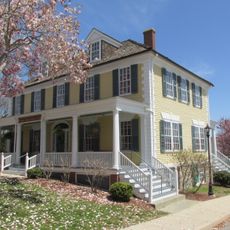
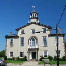
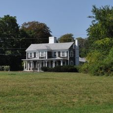
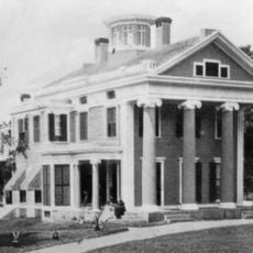
Bristol Waterfront Historic District is a historic area in Bristol, Rhode Island, stretching from the harbor to the east side of Wood Street and running from Washington Street in the north to Walker Cove in the south. The district contains homes, government buildings, and shops spanning multiple centuries, with many 19th-century structures designed by architect Russell Warren.

The area began development in 1680 and remains one of the few planned communities in Rhode Island where the original design has stayed largely intact over centuries. The district gained recognition on the National Register of Historic Places in 1975, highlighting its importance to Rhode Island's heritage.

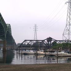
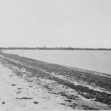
The district's layout and buildings reflect Bristol's deep ties to maritime trade and harbor life that shaped the community for centuries. This connection to water and commerce remains visible in how residents and visitors experience the place today.

You can explore the area on your own using maps from the Bristol Historical & Preservation Society, which start at Burnside Hall and offer two routes for Hope Street North and Hope Street South. Guided tours led by historians are also available and can be arranged in advance for groups or special events.

The district was designed as a planned community and retained its original layout for more than three centuries, making it a rare example of well-preserved early American town planning. Most other planned communities from that era were reshaped by growth and change.

The community of curious travelers

AroundUs brings together thousands of curated places, local tips, and hidden gems, enriched daily by 60,000 contributors worldwide.

Start exploring
Location
GPS coordinates
41.66950,-71.27250
Latest update
February 9, 2026 07:40
Around this place
Mount Hope Bridge
United States of America

Mount Hope Bridge

3.5 km
Colt State Park
United States of America

Colt State Park

2.3 km
Blithewold Mansion, Gardens and Arboretum
United States of America

Blithewold Mansion, Gardens and Arboretum

1.8 km
Sakonnet River Bridge
United States of America

Sakonnet River Bridge

6 km
William G. Low House
United States of America

William G. Low House

2.5 km
Mount Hope Farm
United States of America

Mount Hope Farm

3.1 km
Herreshoff Marine Museum
United States of America

Herreshoff Marine Museum

678 m
Bristol County Jail
United States of America

Bristol County Jail

213 m
Stone Bridge
United States of America

Stone Bridge

6.7 km
Musée Patamécanique
United States of America

Musée Patamécanique

306 m
Bristol Ferry Light
United States of America

Bristol Ferry Light

3.1 km
Sakonnet River Rail Bridge
United States of America

Sakonnet River Rail Bridge

6 km
Juniper Hill Cemetery
United States of America

Juniper Hill Cemetery

1.4 km
Coggeshall Farm Museum
United States of America

Coggeshall Farm Museum

2.1 km
Musselbed Shoals Light
United States of America

Musselbed Shoals Light

3.8 km
Hog Island Shoal Light
United States of America

Hog Island Shoal Light

4.1 km
Benjamin Church House
United States of America

Benjamin Church House

1.9 km
Bristol County Courthouse
United States of America

Bristol County Courthouse

693 m
Barrington Beach
United States of America

Barrington Beach

6.6 km
Poppasquash Farms Historic District
United States of America

Poppasquash Farms Historic District

2.2 km
Benjamin Barker House
United States of America

Benjamin Barker House

6.4 km
Warren Waterfront Historic District
United States of America

Warren Waterfront Historic District

6.9 km
Unitarian Church of Barnstable
United States of America

Unitarian Church of Barnstable

4.1 km
Harold H. Anthony House
United States of America

Harold H. Anthony House

6.8 km
David M. Anthony House
United States of America

David M. Anthony House

6.9 km
Osborn-Bennett Historic District
United States of America

Osborn-Bennett Historic District

6.8 km
Dudek Bowling Lanes
United States of America

Dudek Bowling Lanes

6.6 km
Joseph Reynolds House
United States of America

Joseph Reynolds House

1.7 km
Show the full map
« Bristol Waterfront Historic District - historic district in Rhode Island, United States » is provided by Around Us (aroundus.com). Images and texts are derived from Wikimedia project under a Creative Commons license. You are allowed to copy, distribute, and modify copies of this page, under the conditions set by the license, as long as this note is clearly visible.

Discover hidden gems everywhere you go!

From secret cafés to breathtaking viewpoints, skip the crowded tourist spots and find places that match your style. Our app makes it easy with voice search, smart filtering, route optimization, and insider tips from travelers worldwide. Download now for the complete mobile experience.

Around Us App Screenshot

A unique approach to discovering new places

Le Figaro

All the places worth exploring

France Info

A tailor-made excursion in just a few clicks

20 Minutes

Around Us
Travel Guide & Maps
Download

Send to your phone

QR Code
1

Open the camera app on your mobile.

2

Point at the QR code with your camera. A notification will appear.

3

Tap the notification to open the link.