Enable Location

We need your location to show you interesting places around you

Discover nearby places

Find interesting locations and hidden gems around you

Precise directions

Get accurate directions and distances to places

Your location is never shared with other users. It's only used when you tap the location button.

Colt State Park

Log in to your account

Start exploring — it's free

Trusted by 62,560 travelers worldwide

Continue with Google
Continue with Apple
or

We will send you a code to connect

By continuing, you accept our Terms and Conditions and our Privacy Policy

Check your inbox

We've sent a pincode in your inbox. Please enter the code below.

Colt State Park, Nature reserve along Narragansett Bay in Bristol, United States

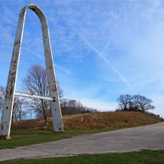
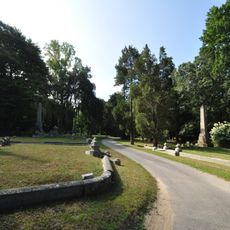
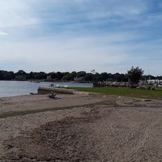
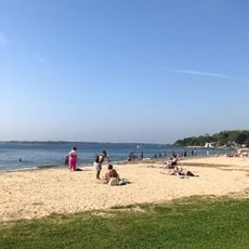
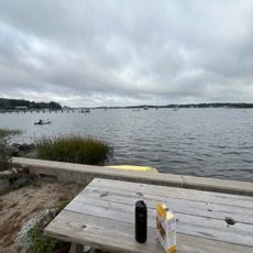
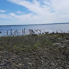
Colt State Park is a nature reserve spanning 464 acres along Narragansett Bay with paved pathways, hiking trails, stone walls, and open lawns overlooking the water. The grounds include fishing piers, picnic pavilions, a boat ramp, and a connection to the East Bay Bike Path for cyclists.

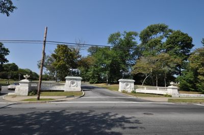
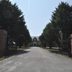
Samuel P. Colt, grandson of the DeWolf family who developed Bristol into a major port, created this showcase farm which became a state park in 1965. The transformation from private estate to public recreation area took place during an era of growing conservation awareness.

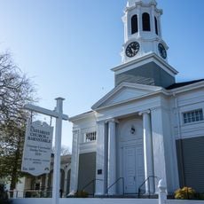
The park sits next to Bristol, home to the nation's oldest Independence Day celebration that has honored patriotic traditions for centuries. Visitors experience this connection to local heritage simply by spending time in the surrounding area.

The park is easy to navigate on foot with well-marked routes suitable for different fitness levels, from flat pathways to more challenging trails. Spring and summer work best for fishing and boating, while fall and winter offer quieter experiences with fewer crowds.

The Chapel by the Sea sits within the park, a waterfront chapel building used for ceremonies and gatherings. In winter, visitors can try cross-country skiing along the coast, an uncommon activity combination that takes advantage of the seasonal landscape.

The community of curious travelers

AroundUs brings together thousands of curated places, local tips, and hidden gems, enriched daily by 60,000 contributors worldwide.

Start exploring
Location
Inception
1965
GPS coordinates
41.67670,-71.29890
Latest update
December 8, 2025 19:53
Around this place
Rocky Point Amusement Park
United States of America

Rocky Point Amusement Park

5.9 km
Mount Hope Bridge
United States of America

Mount Hope Bridge

5.3 km
Blithewold Mansion, Gardens and Arboretum
United States of America

Blithewold Mansion, Gardens and Arboretum

3.7 km
Rocky Point State Park
United States of America

Rocky Point State Park

5.8 km
William G. Low House
United States of America

William G. Low House

4.3 km
Mount Hope Farm
United States of America

Mount Hope Farm

5.2 km
Herreshoff Marine Museum
United States of America

Herreshoff Marine Museum

2.7 km
Bristol County Jail
United States of America

Bristol County Jail

2.1 km
Musée Patamécanique
United States of America

Musée Patamécanique

2.1 km
Bristol Ferry Light
United States of America

Bristol Ferry Light

5 km
Conimicut Light
United States of America

Conimicut Light

5.9 km
Juniper Hill Cemetery
United States of America

Juniper Hill Cemetery

2.6 km
Coggeshall Farm Museum
United States of America

Coggeshall Farm Museum

441 m
Musselbed Shoals Light
United States of America

Musselbed Shoals Light

5.5 km
Hog Island Shoal Light
United States of America

Hog Island Shoal Light

5.4 km
Benjamin Church House
United States of America

Benjamin Church House

2 km
Bristol County Courthouse
United States of America

Bristol County Courthouse

2.7 km
Barrington Beach
United States of America

Barrington Beach

5.1 km
Bristol Waterfront Historic District
United States of America

Bristol Waterfront Historic District

2.3 km
Poppasquash Farms Historic District
United States of America

Poppasquash Farms Historic District

391 m
Warren Waterfront Historic District
United States of America

Warren Waterfront Historic District

6.1 km
Unitarian Church of Barnstable
United States of America

Unitarian Church of Barnstable

2.7 km
Benjamin Aborn Jackson House
United States of America

Benjamin Aborn Jackson House

6.2 km
Warren Town Beach
United States of America

Warren Town Beach

4.6 km
Bristol Town Beach
United States of America

Bristol Town Beach

1.3 km
Joseph Reynolds House
United States of America

Joseph Reynolds House

1.8 km
Juniper Trail Beach
United States of America

Juniper Trail Beach

5.1 km
Longmeadow Beach
United States of America

Longmeadow Beach

6.1 km
Show the full map
« Colt State Park - Nature reserve along Narragansett Bay in Bristol, United States » is provided by Around Us (aroundus.com). Images and texts are derived from Wikimedia project under a Creative Commons license. You are allowed to copy, distribute, and modify copies of this page, under the conditions set by the license, as long as this note is clearly visible.

Discover hidden gems everywhere you go!

From secret cafés to breathtaking viewpoints, skip the crowded tourist spots and find places that match your style. Our app makes it easy with voice search, smart filtering, route optimization, and insider tips from travelers worldwide. Download now for the complete mobile experience.

Around Us App Screenshot

A unique approach to discovering new places

Le Figaro

All the places worth exploring

France Info

A tailor-made excursion in just a few clicks

20 Minutes

Around Us
Travel Guide & Maps
Download

Send to your phone

QR Code
1

Open the camera app on your mobile.

2

Point at the QR code with your camera. A notification will appear.

3

Tap the notification to open the link.