Enable Location

We need your location to show you interesting places around you

Discover nearby places

Find interesting locations and hidden gems around you

Precise directions

Get accurate directions and distances to places

Your location is never shared with other users. It's only used when you tap the location button.

Carvers Creek State Park

Log in to your account

Start exploring — it's free

Trusted by 62,043 travelers worldwide

Continue with Google
Continue with Apple
or

We will send you a code to connect

By continuing, you accept our Terms and Conditions and our Privacy Policy

Check your inbox

We've sent a pincode in your inbox. Please enter the code below.

Carvers Creek State Park

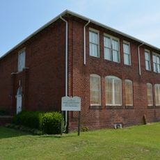
Carvers Creek State Park, State park in Cumberland County, North Carolina, United States

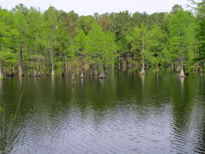
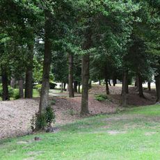
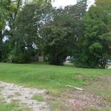
Carvers Creek State Park is a protected area in the Sandhills region covering roughly 4,530 acres with longleaf pine forests, flowing creeks, and a historic millpond. The park divides into two sections, each with its own trail network for walking and biking.

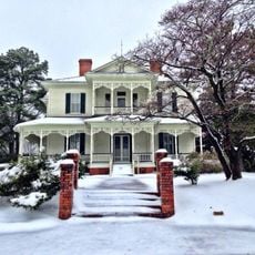
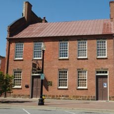
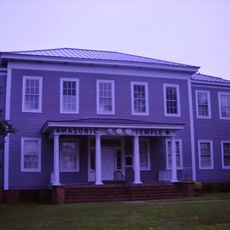
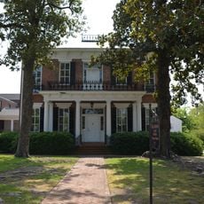
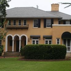
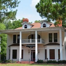
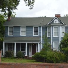
The property began as a winter estate in the 1930s when James Stillman Rockefeller, a descendant of the industrial family, established Long Valley Farm on the site. The land later became protected to preserve its natural habitats.

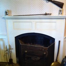
The Rockefeller House reflects how wealthy families built winter retreats in North Carolina during the 1930s. The building and its setting show the lifestyle choices of that era.

The park splits into two areas with different trail lengths: Long Valley Farm offers shorter routes, while Sandhills Property has longer paths for various fitness levels. Plan ahead to pick which section matches your interests and available time.

The park shelters rare animals like the red-cockaded woodpecker and Pine Barrens tree frog that live nowhere else in large numbers. These creatures are why the land receives such careful protection.

The community of curious travelers

AroundUs brings together thousands of curated places, local tips, and hidden gems, enriched daily by 60,000 contributors worldwide.

Start exploring
Location
Inception
2005
GPS coordinates
35.18580,-78.87810
Latest update
December 10, 2025 20:05
Around this place
Fayetteville Ballpark
United States of America

Fayetteville Ballpark

14.5 km
Market House
United States of America

Market House

14.8 km
The Special Warfare Memorial Statue
United States of America

The Special Warfare Memorial Statue

14.1 km
82nd Airborne Division War Memorial Museum
United States of America

82nd Airborne Division War Memorial Museum

12.2 km
Edgar Allan Poe House
United States of America

Edgar Allan Poe House

14.7 km
Airborne & Special Operations Museum Foundation
United States of America

Airborne & Special Operations Museum Foundation

14.5 km
Ellerslie
United States of America

Ellerslie

5 km
Cape Fear Botanical Garden
United States of America

Cape Fear Botanical Garden

14.8 km
Confederate Breastworks
United States of America

Confederate Breastworks

10.8 km
Fayetteville Downtown Historic District
United States of America

Fayetteville Downtown Historic District

14.8 km
Haymount District
United States of America

Haymount District

14.4 km
St. John's Episcopal Church
United States of America

St. John's Episcopal Church

14.6 km
Fayetteville Veterans Administration Hospital Historic District
United States of America

Fayetteville Veterans Administration Hospital Historic District

10.8 km
Phoenix Masonic Lodge No. 8
United States of America

Phoenix Masonic Lodge No. 8

14.5 km
Mansard Roof House
United States of America

Mansard Roof House

14.5 km
Kyle House
United States of America

Kyle House

14.5 km
St. Joseph's Episcopal Church
United States of America

St. Joseph's Episcopal Church

14.5 km
Orange Street School
United States of America

Orange Street School

13.6 km
Frank H. Stedman House
United States of America

Frank H. Stedman House

14.4 km
82nd Airborne Division War Memorial Museum
United States of America

82nd Airborne Division War Memorial Museum

14.6 km
United States Post Office
United States of America

United States Post Office

14.8 km
Belden-Horne House
United States of America

Belden-Horne House

13.9 km
Holt-Harrison House
United States of America

Holt-Harrison House

14.5 km
John Davis House
United States of America

John Davis House

14.7 km
McCall House
United States of America

McCall House

14.6 km
Dr. William C. Verdery House
United States of America

Dr. William C. Verdery House

14.5 km
John E. Patterson House
United States of America

John E. Patterson House

13.9 km
Henry McLean House
United States of America

Henry McLean House

14.5 km
Show the full map
« Carvers Creek State Park - State park in Cumberland County, North Carolina, United States » is provided by Around Us (aroundus.com). Images and texts are derived from Wikimedia project under a Creative Commons license. You are allowed to copy, distribute, and modify copies of this page, under the conditions set by the license, as long as this note is clearly visible.

Discover hidden gems everywhere you go!

From secret cafés to breathtaking viewpoints, skip the crowded tourist spots and find places that match your style. Our app makes it easy with voice search, smart filtering, route optimization, and insider tips from travelers worldwide. Download now for the complete mobile experience.

Around Us App Screenshot

A unique approach to discovering new places

Le Figaro

All the places worth exploring

France Info

A tailor-made excursion in just a few clicks

20 Minutes

Around Us
Travel Guide & Maps
Download

Send to your phone

QR Code
1

Open the camera app on your mobile.

2

Point at the QR code with your camera. A notification will appear.

3

Tap the notification to open the link.