Enable Location

We need your location to show you interesting places around you

Discover nearby places

Find interesting locations and hidden gems around you

Precise directions

Get accurate directions and distances to places

Your location is never shared with other users. It's only used when you tap the location button.

Clarksville Historic District

Log in to your account

Start exploring — it's free

Trusted by 61,961 travelers worldwide

Continue with Google
Continue with Apple
or

We will send you a code to connect

By continuing, you accept our Terms and Conditions and our Privacy Policy

Check your inbox

We've sent a pincode in your inbox. Please enter the code below.

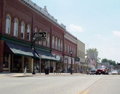
Clarksville Historic District, Historic district in Clarksville, Virginia.

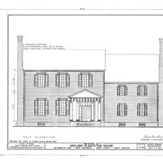
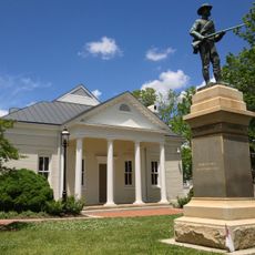
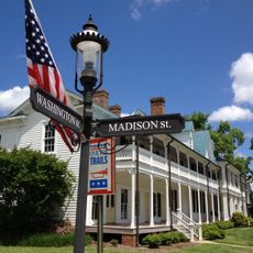
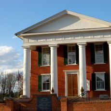
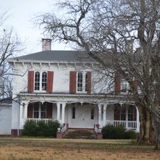
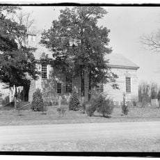
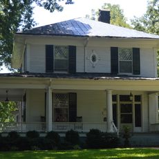
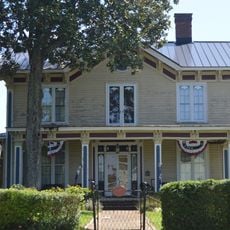
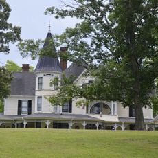
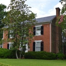
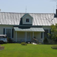
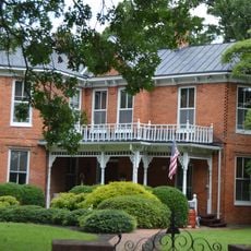
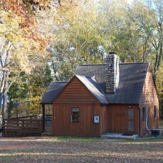
Clarksville Historic District is an area with Greek Revival style buildings spread across central and surrounding residential neighborhoods. The district includes homes and commercial structures alongside religious buildings that reflect the look and character of a typical 19th-century American town.

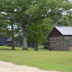
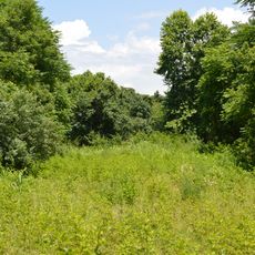
The district developed during the 19th century as a commercial center fueled by tobacco cultivation and banking activity. Its buildings were later recognized and recorded for their architectural and economic role in shaping the region's growth.

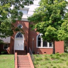
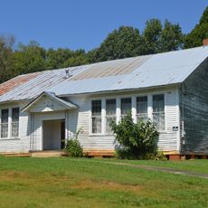
The area holds several religious buildings that have served as community gathering places for generations. Visitors can see how these churches shaped the character and social life of the town.

The best time to visit is during daylight hours when you can clearly see the building details and architectural features. Walking at a relaxed pace allows you to observe the craftsmanship and variety of structures throughout the area.

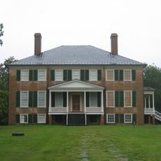
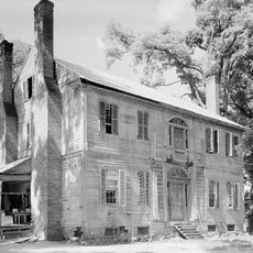
Several buildings are individually listed in the national register, which shows they possess special architectural or historical features beyond the broader district. This reveals how certain homes have distinct importance separate from the larger area.

The community of curious travelers

AroundUs brings together thousands of curated places, local tips, and hidden gems, enriched daily by 60,000 contributors worldwide.

Start exploring
Location
Architectural style
Greek Revival architecture
GPS coordinates
36.62250,-78.55810
Latest update
December 14, 2025 18:06
Around this place
John H. Kerr Dam
United States of America

John H. Kerr Dam

23.3 km
Prestwould
United States of America

Prestwould

3.1 km
Staunton River State Park
United States of America

Staunton River State Park

14 km
Occoneechee State Park
United States of America

Occoneechee State Park

7.4 km
Kerr Lake State Recreation Area
United States of America

Kerr Lake State Recreation Area

25.5 km
United States of America

Long Grass Plantation

20.5 km
Burnside Plantation House
United States of America

Burnside Plantation House

22.7 km
Ashland
United States of America

Ashland

27.1 km
Patrick Robert Sydnor Log Cabin
United States of America

Patrick Robert Sydnor Log Cabin

4.4 km
Mecklenburg County Courthouse
United States of America

Mecklenburg County Courthouse

15.9 km
Boyd's Tavern
United States of America

Boyd's Tavern

16 km
Buckingham Courthouse Historic District
United States of America

Buckingham Courthouse Historic District

7.9 km
Pool Rock Plantation
United States of America

Pool Rock Plantation

22.5 km
St. John's Episcopal Church
United States of America

St. John's Episcopal Church

24.2 km
Buffalo Springs Historical Archeological District
United States of America

Buffalo Springs Historical Archeological District

9.8 km
MacCallum More and Hudgins House Historic District
United States of America

MacCallum More and Hudgins House Historic District

21.9 km
Shadow Lawn
United States of America

Shadow Lawn

21.4 km
Elm Hill
United States of America

Elm Hill

23.7 km
Boydton Historic District
United States of America

Boydton Historic District

15.8 km
On the Hill
United States of America

On the Hill

15.5 km
Clark Royster House
United States of America

Clark Royster House

523 m
Red Fox Farm
United States of America

Red Fox Farm

12.1 km
Buckshoal Farm
United States of America

Buckshoal Farm

19.1 km
Toombs Tobacco Farm
United States of America

Toombs Tobacco Farm

18.3 km
Salem School
United States of America

Salem School

17.8 km
Elm Hill Archaeological Site
United States of America

Elm Hill Archaeological Site

25.8 km
Judge Henry Wood, Jr. House
United States of America

Judge Henry Wood, Jr. House

284 m
Staunton River State Park Historic District
United States of America

Staunton River State Park Historic District

13 km
Show the full map
« Clarksville Historic District - Historic district in Clarksville, Virginia » is provided by Around Us (aroundus.com). Images and texts are derived from Wikimedia project under a Creative Commons license. You are allowed to copy, distribute, and modify copies of this page, under the conditions set by the license, as long as this note is clearly visible.

Discover hidden gems everywhere you go!

From secret cafés to breathtaking viewpoints, skip the crowded tourist spots and find places that match your style. Our app makes it easy with voice search, smart filtering, route optimization, and insider tips from travelers worldwide. Download now for the complete mobile experience.

Around Us App Screenshot

A unique approach to discovering new places

Le Figaro

All the places worth exploring

France Info

A tailor-made excursion in just a few clicks

20 Minutes

Around Us
Travel Guide & Maps
Download

Send to your phone

QR Code
1

Open the camera app on your mobile.

2

Point at the QR code with your camera. A notification will appear.

3

Tap the notification to open the link.