Enable Location

We need your location to show you interesting places around you

Discover nearby places

Find interesting locations and hidden gems around you

Precise directions

Get accurate directions and distances to places

Your location is never shared with other users. It's only used when you tap the location button.

Log in to your account

Start exploring — it's free

Trusted by 62,170 travelers worldwide

Continue with Google
Continue with Apple
or

We will send you a code to connect

By continuing, you accept our Terms and Conditions and our Privacy Policy

Check your inbox

We've sent a pincode in your inbox. Please enter the code below.

Crab Orchard Wilderness

Crab Orchard Wilderness, Wildlife refuge in southern Illinois, United States.

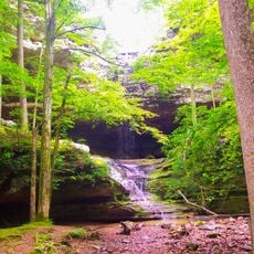
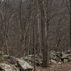
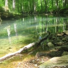
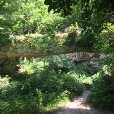
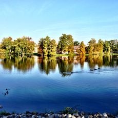
Crab Orchard Wilderness is a protected area in southern Illinois covering about 4,050 acres with forests, creeks, and exposed rock formations of sandstone. The landscape contains multiple types of habitats that support a wide range of wildlife and is part of the larger national refuge system.

This refuge was established in 1947 to protect the land after decades of farming and logging activities had changed the landscape. Creating this sanctuary allowed the damaged ecosystems to begin recovering and provided a safe space for wildlife to return.

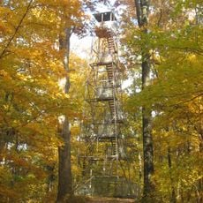
The area serves as an outdoor classroom for school groups and scouts who spend time exploring the landscape and learning about wildlife. Walking through the grounds, you see trails worn by regular visitors and gather spots where people pause to observe birds and other animals.

The visitor center located on Route 148 in Marion provides maps, wildlife information, and exhibits to help you understand the area. Stopping there before exploring gives you guidance on the best trails and what wildlife you might encounter.

The refuge sits along the Mississippi Flyway, a major migration route, and serves as winter shelter for approximately 40,000 Canada geese each year. This large gathering of birds creates a remarkable sight during the colder months when you visit.

The community of curious travelers

AroundUs brings together thousands of curated places, local tips, and hidden gems, enriched daily by 60,000 contributors worldwide.

Start exploring
Location
Inception
1990
GPS coordinates
37.60420,-89.08810
Latest update
December 14, 2025 14:20
Around this place
R. Buckminster Fuller and Anne Hewlett Dome Home
United States of America

R. Buckminster Fuller and Anne Hewlett Dome Home

18 km
Giant City State Park
United States of America

Giant City State Park

8.8 km
Saluki Stadium
United States of America

Saluki Stadium

16.2 km
Bald Knob Cross
United States of America

Bald Knob Cross

23.5 km
Ferne Clyffe State Park
United States of America

Ferne Clyffe State Park

12.5 km
Giant City Stone Fort Site
United States of America

Giant City Stone Fort Site

9.8 km
Panther Den Wilderness
United States of America

Panther Den Wilderness

1.7 km
Trail of Tears State Forest
United States of America

Trail of Tears State Forest

24.4 km
Shryock Auditorium
United States of America

Shryock Auditorium

16.9 km
Faner Hall
United States of America

Faner Hall

16.9 km
Pomona Natural Bridge
United States of America

Pomona Natural Bridge

23 km
Altgeld Hall
United States of America

Altgeld Hall

16.9 km
Stinson Memorial Library
United States of America

Stinson Memorial Library

21.7 km
Willis Allen House
United States of America

Willis Allen House

19.7 km
John Bridges Tavern and Store Site
United States of America

John Bridges Tavern and Store Site

19.9 km
Goddard Chapel
United States of America

Goddard Chapel

20.8 km
Campground Church and Cemetery Site
United States of America

Campground Church and Cemetery Site

16.6 km
Thompson Brothers Rock Art
United States of America

Thompson Brothers Rock Art

9.3 km
Williamson County Courthouse
United States of America

Williamson County Courthouse

20 km
St. Anne's Episcopal Church
United States of America

St. Anne's Episcopal Church

21.7 km
Reef House
United States of America

Reef House

17.7 km
Ed M. Stotlar House
United States of America

Ed M. Stotlar House

19.4 km
West Walnut Street Historic District
United States of America

West Walnut Street Historic District

18.1 km
Carbondale Public Library
United States of America

Carbondale Public Library

17.9 km
John A. Logan College
United States of America

John A. Logan College

16.1 km
AMC Classic Illinois Centre 8
United States of America

AMC Classic Illinois Centre 8

19 km
Varsity Center for the Arts
United States of America

Varsity Center for the Arts

17.5 km
Campus Lake
United States of America

Campus Lake

16.9 km
Show the full map
« Crab Orchard Wilderness - Wildlife refuge in southern Illinois, United States » is provided by Around Us (aroundus.com). Images and texts are derived from Wikimedia project under a Creative Commons license. You are allowed to copy, distribute, and modify copies of this page, under the conditions set by the license, as long as this note is clearly visible.

Discover hidden gems everywhere you go!

From secret cafés to breathtaking viewpoints, skip the crowded tourist spots and find places that match your style. Our app makes it easy with voice search, smart filtering, route optimization, and insider tips from travelers worldwide. Download now for the complete mobile experience.

Around Us App Screenshot

A unique approach to discovering new places

Le Figaro

All the places worth exploring

France Info

A tailor-made excursion in just a few clicks

20 Minutes

Around Us
Travel Guide & Maps
Download

Send to your phone

QR Code
1

Open the camera app on your mobile.

2

Point at the QR code with your camera. A notification will appear.

3

Tap the notification to open the link.