Chest opened
+${chestReward.xp} XP
Explorer
NOUVEAU ×${chestReward.collectible.quantity}
tapez pour fermer
Chest locked

Open chests in the app

Around Us is built for your phone — chests unlock when you walk, explore and capture nearby places.

Enable Location

We need your location to show you interesting places around you

Discover nearby places

Find interesting locations and hidden gems around you

Precise directions

Get accurate directions and distances to places

Your location is never shared with other users. It's only used when you tap the location button.

Log in to your account

Start exploring — it's free

Trusted by 72,903 travelers worldwide

Continue with Google
Continue with Apple
or

We will send you a code to connect

By continuing, you accept our Terms and Conditions and our Privacy Policy

Check your inbox

We've sent a pincode in your inbox. Please enter the code below.

Dean State Forest
Discussion Reviews Photo
1.3k Popularity

Dean State Forest, State forest in Lawrence County, Ohio, United States

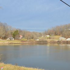
Dean State Forest is a protected woodland area in Lawrence County covering nearly 3000 acres with streams, ponds, and mixed forest types throughout. The forest today provides space for outdoor recreation while demonstrating how land can recover and thrive under careful management.

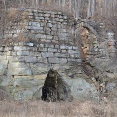
The forest was established in 1916 on land previously cleared and used for charcoal production during the 1800s to fuel local iron ore smelting. In the 1930s a conservation work camp built roads and improved timber stands as part of a national reforestation effort.

The Civilian Conservation Camp operated in the forest during the 1930s, focusing on road construction and improving timber stands for future generations.

Roughly 20 miles of marked trails wind through the forest for hiking and horseback riding with designated hunting areas for deer and wild turkey. Visitors should check local conditions before going since trail quality and access can vary with the seasons.

The forest functions as an experimental reforestation zone displaying successful plantings of white pine, red pine, and tuliptree along State Route 373. These demonstration areas show how foresters selected and planted different species over decades to rebuild depleted land.

The community of curious travelers

AroundUs brings together thousands of curated places, local tips, and hidden gems, enriched daily by 60,000 contributors worldwide.

Start exploring
Location
GPS coordinates
38.70000,-82.60000
Latest update
December 14, 2025 17:00
Around this place
Paramount Arts Center
United States of America

Paramount Arts Center

24.8 km
Wood Old Homestead
United States of America

Wood Old Homestead

28.6 km
Ironton–Russell Bridge
United States of America

Ironton–Russell Bridge

20.2 km
Sciotoville Bridge
United States of America

Sciotoville Bridge

25.5 km
Greenup Lock and Dam
United States of America

Greenup Lock and Dam

23.2 km
Biggs Site
United States of America

Biggs Site

29.3 km
Jackson Lake State Park
United States of America

Jackson Lake State Park

22.1 km
Ben Williamson Memorial Bridge
United States of America

Ben Williamson Memorial Bridge

24.3 km
Highlands Museum and Discovery Center
United States of America

Highlands Museum and Discovery Center

24.9 km
Simeon Willis Memorial Bridge
United States of America

Simeon Willis Memorial Bridge

24.3 km
Jesse Stuart Memorial Bridge
United States of America

Jesse Stuart Memorial Bridge

23.3 km
Downtown Ironton Historic District
United States of America

Downtown Ironton Historic District

19.8 km
Lawrence County Courthouse
United States of America

Lawrence County Courthouse

19.7 km
St. Paul's Lutheran Church
United States of America

St. Paul's Lutheran Church

25.1 km
Catlett House
United States of America

Catlett House

25.9 km
Grand Army of the Republic Memorial Hall
United States of America

Grand Army of the Republic Memorial Hall

19.6 km
First Presbyterian Church
United States of America

First Presbyterian Church

24.9 km
First Christian Church
United States of America

First Christian Church

24.9 km
St. James AME Church
United States of America

St. James AME Church

24.8 km
Ashland Commercial Historic District
United States of America

Ashland Commercial Historic District

24.8 km
Olive Furnace
United States of America

Olive Furnace

7.4 km
Scottown Covered Bridge
United States of America

Scottown Covered Bridge

25.5 km
Wurtland Union Church
United States of America

Wurtland Union Church

22.9 km
Bath Avenue Historic District
United States of America

Bath Avenue Historic District

25.2 km
Culbertson House
United States of America

Culbertson House

25.5 km
Greenup Masonic Lodge
United States of America

Greenup Masonic Lodge

24.7 km
Methodist Episcopal Church South
United States of America

Methodist Episcopal Church South

24.6 km
Marlow Theater
United States of America

Marlow Theater

19.8 km
Show the full map
Reviews
Share your experience

No review yet

Discussions
Start a discussion...

No discussion yet

« Dean State Forest - State forest in Lawrence County, Ohio, United States » is provided by Around Us (aroundus.com). Images and texts are derived from Wikimedia project under a Creative Commons license. You are allowed to copy, distribute, and modify copies of this page, under the conditions set by the license, as long as this note is clearly visible.

Discover hidden gems everywhere you go!

From secret cafés to breathtaking viewpoints, skip the crowded tourist spots and find places that match your style. Our app makes it easy with voice search, smart filtering, route optimization, and insider tips from travelers worldwide. Download now for the complete mobile experience.

Around Us App Screenshot

A unique approach to discovering new places

Le Figaro

All the places worth exploring

France Info

A tailor-made excursion in just a few clicks

20 Minutes

Around Us
Travel Guide & Maps
Download

Send to your phone

QR Code
1

Open the camera app on your mobile.

2

Point at the QR code with your camera. A notification will appear.

3

Tap the notification to open the link.