Chest opened
+${chestReward.xp} XP
Explorer
NOUVEAU ×${chestReward.collectible.quantity}
tapez pour fermer
Chest locked

Open chests in the app

Around Us is built for your phone — chests unlock when you walk, explore and capture nearby places.

Enable Location

We need your location to show you interesting places around you

Discover nearby places

Find interesting locations and hidden gems around you

Precise directions

Get accurate directions and distances to places

Your location is never shared with other users. It's only used when you tap the location button.

Log in to your account

Start exploring — it's free

Trusted by 72,889 travelers worldwide

Continue with Google
Continue with Apple
or

We will send you a code to connect

By continuing, you accept our Terms and Conditions and our Privacy Policy

Check your inbox

We've sent a pincode in your inbox. Please enter the code below.

Eisenhower State Park
Discussion Reviews Photo
1.9k Popularity

Eisenhower State Park, State park in Osage Questas region, Kansas, United States.

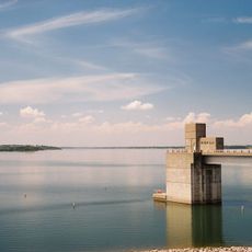
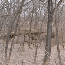
Eisenhower State Park is a 1,785-acre park combining tallgrass prairie with wooded sections along Melvern Lake. The grounds feature diverse natural environments suited for outdoor recreation and exploration.

The park was originally named Melvern State Park but was renamed in 1990 to honor Dwight D. Eisenhower, the 34th US President born in Kansas. The change recognized his significance to the state and the nation.

The park sits within the Flint Hills, a region where wide grassland stretches define the character of Kansas. Visitors experience the open prairie landscape that has shaped the area for centuries.

The park offers 163 utility campsites, four modern cabins, two yurts, and several primitive camping areas spread across the grounds. These varied lodging options accommodate different camping preferences and experience levels.

The park features specialized equestrian campsites with individual horse corrals, allowing visitors to stay overnight with their horses and explore the trail system. This setup makes it a destination for riders throughout the region.

The community of curious travelers

AroundUs brings together thousands of curated places, local tips, and hidden gems, enriched daily by 60,000 contributors worldwide.

Start exploring
Location
GPS coordinates
38.52030,-95.74890
Latest update
December 14, 2025 11:24
Around this place
National Teachers Hall of Fame
United States of America

National Teachers Hall of Fame

39.3 km
Melvern Lake
United States of America

Melvern Lake

3.1 km
David Traylor Zoo of Emporia
United States of America

David Traylor Zoo of Emporia

40.4 km
Dietrich Cabin
United States of America

Dietrich Cabin

43.1 km
Welch Stadium
United States of America

Welch Stadium

39.3 km
Old Depot Museum
United States of America

Old Depot Museum

43.2 km
Emporia Granada Theatre
United States of America

Emporia Granada Theatre

39.6 km
William Allen White House
United States of America

William Allen White House

39.1 km
Emporia State University Memorial Union
United States of America

Emporia State University Memorial Union

39.2 km
Trusler Sports Complex
United States of America

Trusler Sports Complex

38.4 km
United States of America

Atchison, Topeka, and Santa Fe Pratt Truss Bridge

10 km
Tauy Jones Hall
United States of America

Tauy Jones Hall

43.3 km
Ottawa High School and Junior High School
United States of America

Ottawa High School and Junior High School

43 km
Neosho River Bridge
United States of America

Neosho River Bridge

29.2 km
Franklin County Courthouse
United States of America

Franklin County Courthouse

43.2 km
Burlington Carnegie Free Library
United States of America

Burlington Carnegie Free Library

36.2 km
Lyndon Carnegie Library
United States of America

Lyndon Carnegie Library

11.3 km
Burlington Opry
United States of America

Burlington Opry

36.3 km
Arvonia School
United States of America

Arvonia School

11.4 km
St. Andrew's Episcopal Church
United States of America

St. Andrew's Episcopal Church

39.6 km
Walt Mason House
United States of America

Walt Mason House

40.2 km
Harris-Borman House
United States of America

Harris-Borman House

39.1 km
Osage County Courthouse
United States of America

Osage County Courthouse

11.5 km
Richard Howe House
United States of America

Richard Howe House

39.8 km
Karnes Stone Barn
United States of America

Karnes Stone Barn

37.5 km
McCauley Bridge
United States of America

McCauley Bridge

42.3 km
Soden's Grove Bridge
United States of America

Soden's Grove Bridge

40.6 km
Rocky Ford Bridge
United States of America

Rocky Ford Bridge

36.2 km
Show the full map
Reviews
Share your experience

No review yet

Discussions
Start a discussion...

No discussion yet

« Eisenhower State Park - State park in Osage Questas region, Kansas, United States » is provided by Around Us (aroundus.com). Images and texts are derived from Wikimedia project under a Creative Commons license. You are allowed to copy, distribute, and modify copies of this page, under the conditions set by the license, as long as this note is clearly visible.

Discover hidden gems everywhere you go!

From secret cafés to breathtaking viewpoints, skip the crowded tourist spots and find places that match your style. Our app makes it easy with voice search, smart filtering, route optimization, and insider tips from travelers worldwide. Download now for the complete mobile experience.

Around Us App Screenshot

A unique approach to discovering new places

Le Figaro

All the places worth exploring

France Info

A tailor-made excursion in just a few clicks

20 Minutes

Around Us
Travel Guide & Maps
Download

Send to your phone

QR Code
1

Open the camera app on your mobile.

2

Point at the QR code with your camera. A notification will appear.

3

Tap the notification to open the link.