Chest opened
+${chestReward.xp} XP
Explorer
NOUVEAU ×${chestReward.collectible.quantity}
tapez pour fermer
Chest locked

Open chests in the app

Around Us is built for your phone — chests unlock when you walk, explore and capture nearby places.

Enable Location

We need your location to show you interesting places around you

Discover nearby places

Find interesting locations and hidden gems around you

Precise directions

Get accurate directions and distances to places

Your location is never shared with other users. It's only used when you tap the location button.

Tiétar

Log in to your account

Start exploring — it's free

Trusted by 72,874 travelers worldwide

Continue with Google
Continue with Apple
or

We will send you a code to connect

By continuing, you accept our Terms and Conditions and our Privacy Policy

Check your inbox

We've sent a pincode in your inbox. Please enter the code below.

Tiétar
Discussion Reviews 1 Photos
12.6k Popularity

Tiétar, River in central Spain.

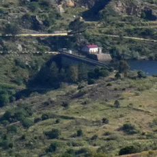
The Tiétar is a river in central Spain that flows approximately 170 kilometers across the provinces of Madrid, Ávila, Toledo, and Cáceres. It eventually merges with the Tagus River, passing through different landscapes and elevation zones along its course.

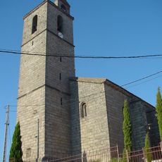
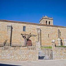
The river's name first appeared in Christian documents from the 12th century, with earlier mentions found in Arabic chronicles from the 10th century. This long historical record shows how important this waterway has been across different eras.

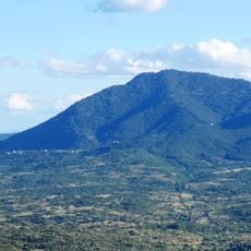
The river has shaped farming practices for generations in areas like La Vera and Campo Arañuelo, where farmers continue to use traditional irrigation methods. This water source remains essential to the local population for both agriculture and daily life.

Several campsites and recreational areas along the riverbanks provide good starting points for fishing, hiking, and nature watching. Water conditions and accessibility can vary depending on the season and water level, so checking local conditions beforehand is helpful.

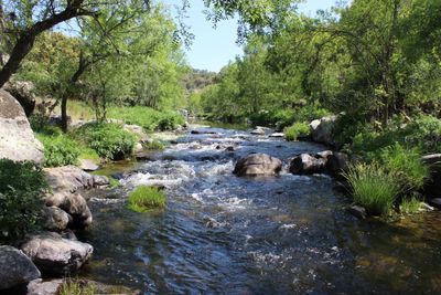
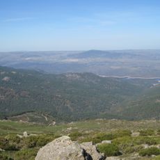
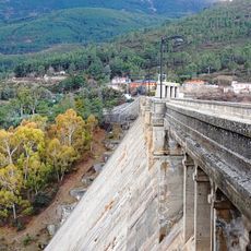
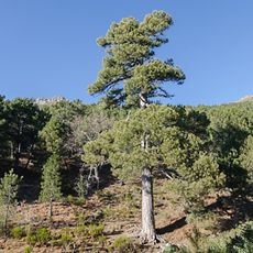
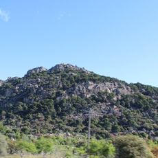
The river drops approximately 1,000 meters in elevation from its source in the Sierra de Gredos to where it meets the Tagus. These dramatic height changes create distinctly different natural and climate zones along the waterway that fascinate hikers and nature enthusiasts.

The community of curious travelers

AroundUs brings together thousands of curated places, local tips, and hidden gems, enriched daily by 60,000 contributors worldwide.

Start exploring
Location
GPS coordinates
40.30946,-4.52429
Latest update
December 7, 2025 20:44
Reviews
Share your experience

No review yet

Discussions
Start a discussion...

No discussion yet

« Tiétar - River in central Spain » is provided by Around Us (aroundus.com). Images and texts are derived from Wikimedia project under a Creative Commons license. You are allowed to copy, distribute, and modify copies of this page, under the conditions set by the license, as long as this note is clearly visible.

Discover hidden gems everywhere you go!

From secret cafés to breathtaking viewpoints, skip the crowded tourist spots and find places that match your style. Our app makes it easy with voice search, smart filtering, route optimization, and insider tips from travelers worldwide. Download now for the complete mobile experience.

Around Us App Screenshot

A unique approach to discovering new places

Le Figaro

All the places worth exploring

France Info

A tailor-made excursion in just a few clicks

20 Minutes

Around Us
Travel Guide & Maps
Download

Send to your phone

QR Code
1

Open the camera app on your mobile.

2

Point at the QR code with your camera. A notification will appear.

3

Tap the notification to open the link.