Chest opened
+${chestReward.xp} XP
Explorer
NOUVEAU ×${chestReward.collectible.quantity}
tapez pour fermer
Chest locked

Open chests in the app

Around Us is built for your phone — chests unlock when you walk, explore and capture nearby places.

Enable Location

We need your location to show you interesting places around you

Discover nearby places

Find interesting locations and hidden gems around you

Precise directions

Get accurate directions and distances to places

Your location is never shared with other users. It's only used when you tap the location button.

Perejil Islet

Log in to your account

Start exploring — it's free

Trusted by 72,922 travelers worldwide

Continue with Google
Continue with Apple
or

We will send you a code to connect

By continuing, you accept our Terms and Conditions and our Privacy Policy

Check your inbox

We've sent a pincode in your inbox. Please enter the code below.

Perejil Islet
Discussion Reviews 3 Photos
51.1k Popularity

Perejil Islet, Disputed territory islet in Tangier-Tetouan-Al Hoceima, Morocco

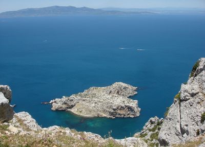
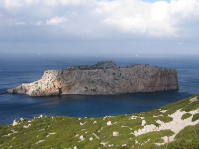
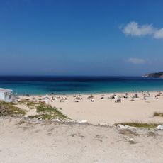
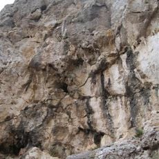
Perejil Islet is a small rocky landmass situated in the Mediterranean Sea between Spain and Morocco within the Strait of Gibraltar. The islet rises to approximately 74 meters in elevation and spans a limited area, currently remaining uninhabited with no visitor facilities.

The islet was first documented in navigation records during 1415 under the name Isla de Callez. Over the following centuries, it remained an important landmark for ships passing through the strait.

The islet's name derives from the Spanish word for parsley and is known by different names across cultures, reflecting its role in Mediterranean maritime connections. Visitors notice how this naming reflects the region's historical exchanges between European and North African communities.

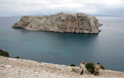
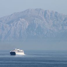
The islet remains inaccessible to regular visitors and requires specialized maritime transportation from nearby ports. Travelers should know that the area presents challenges for small boats due to its geographic location and water currents.

In 2002 a military incident occurred when one nation launched a landing operation, triggering a diplomatic crisis. The European Union had to intervene to help broker a peaceful resolution between the parties involved.

The community of curious travelers

AroundUs brings together thousands of curated places, local tips, and hidden gems, enriched daily by 60,000 contributors worldwide.

Start exploring
Elevation above the sea
74 m
GPS coordinates
35.91389,-5.41861
Latest update
December 21, 2025 16:02
Reviews
Share your experience

No review yet

Discussions
Start a discussion...

No discussion yet

« Perejil Islet - Disputed territory islet in Tangier-Tetouan-Al Hoceima, Morocco » is provided by Around Us (aroundus.com). Images and texts are derived from Wikimedia project under a Creative Commons license. You are allowed to copy, distribute, and modify copies of this page, under the conditions set by the license, as long as this note is clearly visible.

Discover hidden gems everywhere you go!

From secret cafés to breathtaking viewpoints, skip the crowded tourist spots and find places that match your style. Our app makes it easy with voice search, smart filtering, route optimization, and insider tips from travelers worldwide. Download now for the complete mobile experience.

Around Us App Screenshot

A unique approach to discovering new places

Le Figaro

All the places worth exploring

France Info

A tailor-made excursion in just a few clicks

20 Minutes

Around Us
Travel Guide & Maps
Download

Send to your phone

QR Code
1

Open the camera app on your mobile.

2

Point at the QR code with your camera. A notification will appear.

3

Tap the notification to open the link.