Enable Location

We need your location to show you interesting places around you

Discover nearby places

Find interesting locations and hidden gems around you

Precise directions

Get accurate directions and distances to places

Your location is never shared with other users. It's only used when you tap the location button.

Candeleda

Log in to your account

Start exploring — it's free

Trusted by 64,035 travelers worldwide

Continue with Google
Continue with Apple
or

We will send you a code to connect

By continuing, you accept our Terms and Conditions and our Privacy Policy

Check your inbox

We've sent a pincode in your inbox. Please enter the code below.

Discussion Reviews 1 Photos
35.9k Popularity

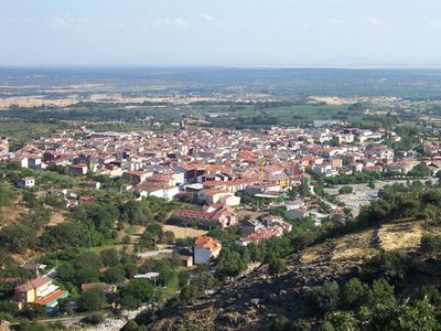
Candeleda, Municipality in Province of Ávila, Spain

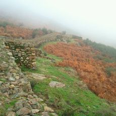
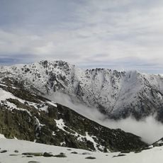
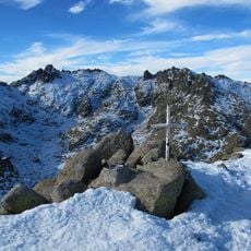
Candeleda is a municipality in the Province of Ávila, situated at the southern base of the Gredos Mountains. The area is bordered by three different provinces and autonomous communities, forming an important geographic zone in this region.

Humans have inhabited the area around Candeleda since approximately 3000 BC, according to archaeological findings. Cave paintings at Peña Escrita and Neolithic remains demonstrate that different cultures used this location across millennia.

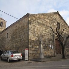
The Church of Nuestra Señora de la Asunción displays a Renaissance altarpiece and ceramic pieces created in the 15th century. This religious landmark reflects the artistic heritage that communities have maintained across generations.

In Poyales del Hoyo, a locality within this area, visitors can observe local artisans crafting traditional items. Woodwork, leather goods, and woven textiles showcase handcrafting techniques that have been common for generations.

Pimentón de la Vera, the regional paprika, developed into an important product from the 17th through mid-20th century in this area. A visitor centre explains the history of this spice production and its significance to the local economy.

The community of curious travelers

AroundUs brings together thousands of curated places, local tips, and hidden gems, enriched daily by 60,000 contributors worldwide.

Start exploring
Capital city
Candeleda
Elevation above the sea
428 m
Part of
Mancomunitat de Municipis «Bajo Tiétar»
Shares border with
Arenas de San Pedro, Zapardiel de la Ribera, Navalperal de Tormes, San Juan de Gredos, Bohoyo, Madrigal de la Vera, Oropesa, Calzada de Oropesa, Lagartera
GPS coordinates
40.15572,-5.24096
Latest update
December 17, 2025 11:20
Reviews
Share your experience

No review yet

Discussions
Start a discussion...

No discussion yet

« Candeleda - Municipality in Province of Ávila, Spain » is provided by Around Us (aroundus.com). Images and texts are derived from Wikimedia project under a Creative Commons license. You are allowed to copy, distribute, and modify copies of this page, under the conditions set by the license, as long as this note is clearly visible.

Discover hidden gems everywhere you go!

From secret cafés to breathtaking viewpoints, skip the crowded tourist spots and find places that match your style. Our app makes it easy with voice search, smart filtering, route optimization, and insider tips from travelers worldwide. Download now for the complete mobile experience.

Around Us App Screenshot

A unique approach to discovering new places

Le Figaro

All the places worth exploring

France Info

A tailor-made excursion in just a few clicks

20 Minutes

Around Us
Travel Guide & Maps
Download

Send to your phone

QR Code
1

Open the camera app on your mobile.

2

Point at the QR code with your camera. A notification will appear.

3

Tap the notification to open the link.