Enable Location

We need your location to show you interesting places around you

Discover nearby places

Find interesting locations and hidden gems around you

Precise directions

Get accurate directions and distances to places

Your location is never shared with other users. It's only used when you tap the location button.

Pied-de-Borne

Log in to your account

Start exploring — it's free

Trusted by 62,937 travelers worldwide

Continue with Google
Continue with Apple
or

We will send you a code to connect

By continuing, you accept our Terms and Conditions and our Privacy Policy

Check your inbox

We've sent a pincode in your inbox. Please enter the code below.

Discussion Reviews 2 Photos
5.3k Popularity

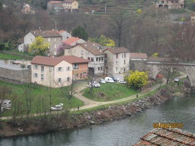
Pied-de-Borne, Rural commune in Lozère department, France.

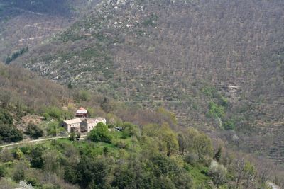
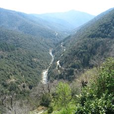
Pied-de-Borne spans approximately 27.89 square kilometers of mountainous terrain with elevations ranging from 276 to 960 meters above sea level in the Cévennes National Park region.

The commune was officially established on November 1, 1964, through administrative consolidation that merged neighboring hamlets including Planchamp and Saint-Jean-Chazorne into a single territorial entity.

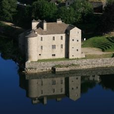
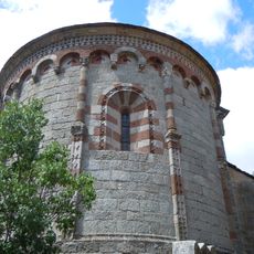
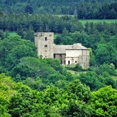
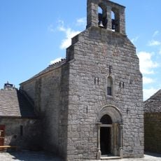
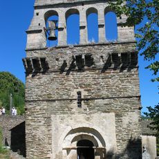
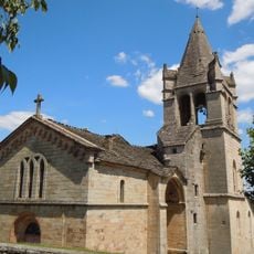
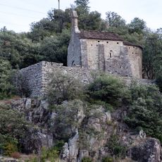
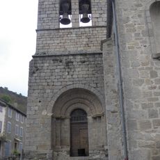
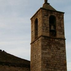
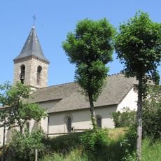
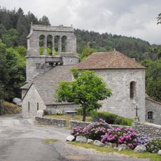
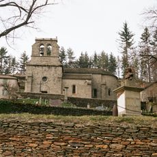
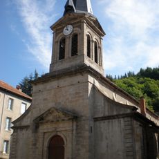
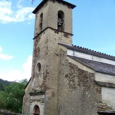
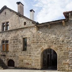
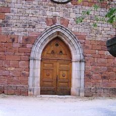
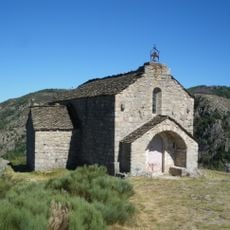
Two protected historical monuments grace the commune: the 13th-century Chapel of the Beaumes and the 16th-century Chapel of the Madeleine, both recognized as significant architectural heritage sites.

The village maintains essential municipal services through its town hall, which handles civil registration, urban planning, and administrative assistance for approximately 178 residents with postal code 48800.

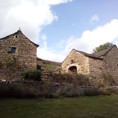
Pied-de-Borne forms part of the UNESCO World Heritage site 'Les Causses et les Cévennes,' recognizing its contribution to traditional Mediterranean pastoral landscapes and cultural practices.

The community of curious travelers

AroundUs brings together thousands of curated places, local tips, and hidden gems, enriched daily by 60,000 contributors worldwide.

Start exploring
Location
Location
Arrondissement of Mende
Inception
1964
Elevation above the sea
683 m
Shares border with
Montselgues, Sainte-Marguerite-Lafigère, Malons-et-Elze, Ponteils-et-Brésis, Saint-André-Capcèze, Villefort, Prévenchères
Address
48800 Pied-de-Borne, France
Phone
GPS coordinates
44.47556,3.98472
Latest update
August 11, 2025 08:08
Reviews
Share your experience

No review yet

Discussions
Start a discussion...

No discussion yet

« Pied-de-Borne - Rural commune in Lozère department, France » is provided by Around Us (aroundus.com). Images and texts are derived from Wikimedia project under a Creative Commons license. You are allowed to copy, distribute, and modify copies of this page, under the conditions set by the license, as long as this note is clearly visible.

Discover hidden gems everywhere you go!

From secret cafés to breathtaking viewpoints, skip the crowded tourist spots and find places that match your style. Our app makes it easy with voice search, smart filtering, route optimization, and insider tips from travelers worldwide. Download now for the complete mobile experience.

Around Us App Screenshot

A unique approach to discovering new places

Le Figaro

All the places worth exploring

France Info

A tailor-made excursion in just a few clicks

20 Minutes

Around Us
Travel Guide & Maps
Download

Send to your phone

QR Code
1

Open the camera app on your mobile.

2

Point at the QR code with your camera. A notification will appear.

3

Tap the notification to open the link.