·

Enable Location

We need your location to show you interesting places around you

Discover nearby places

Find interesting locations and hidden gems around you

Precise directions

Get accurate directions and distances to places

Your location is never shared with other users. It's only used when you tap the location button.

Marais breton

Log in to your account

Start exploring — it's free

Trusted by 62,658 travelers worldwide

Continue with Google
Continue with Apple
or

We will send you a code to connect

By continuing, you accept our Terms and Conditions and our Privacy Policy

Check your inbox

We've sent a pincode in your inbox. Please enter the code below.

Marais breton

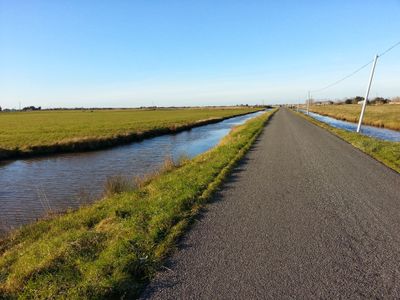
Marais breton, Protected wetland in Loire-Atlantique, France.

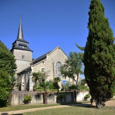
The Marais Breton is a wetland along the Atlantic coast that spreads across a large area and features a network of water channels and meadows. The landscape consists of gentle slopes and flat water surfaces crossed by embankments and pathways.

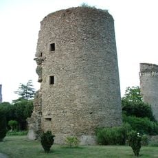
In ancient times the area formed the Gulf of Machecoul, a sea inlet that connected Noirmoutier to the mainland and gradually transformed into marshland. This long transformation created the wetland we see today.

The area is shaped by farmers who have raised cattle here for generations, managing the wetland according to methods passed down through time. This traditional use continues to define how the place looks and functions today.

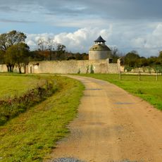
You can explore the wetland on designated paths by foot, bicycle, or horseback, with observation points offering views of water birds. Spring and autumn are the best times to visit, when bird activity is highest.

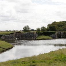
The area contains a water management system with valves that regulate saltwater levels, allowing farming in terrain below sea level. This hidden infrastructure makes agriculture possible in this unusual setting.

The community of curious travelers

AroundUs brings together thousands of curated places, local tips, and hidden gems, enriched daily by 60,000 contributors worldwide.

Start exploring
Location
GPS coordinates
46.83085,-2.02883
Latest update
December 6, 2025 16:04
What to do and see in Vendée

Vendée is a place where water, history, and nature meet in simple ways. The area stretches from the Atlantic coast through farmland and large marshes with water channels winding between grassy banks. As you cross Vendée, you move from one kind of world to another; from a beach or island to the...

« Marais breton - Protected wetland in Loire-Atlantique, France » is provided by Around Us (aroundus.com). Images and texts are derived from Wikimedia project under a Creative Commons license. You are allowed to copy, distribute, and modify copies of this page, under the conditions set by the license, as long as this note is clearly visible.

Discover hidden gems everywhere you go!

From secret cafés to breathtaking viewpoints, skip the crowded tourist spots and find places that match your style. Our app makes it easy with voice search, smart filtering, route optimization, and insider tips from travelers worldwide. Download now for the complete mobile experience.

Around Us App Screenshot

A unique approach to discovering new places

Le Figaro

All the places worth exploring

France Info

A tailor-made excursion in just a few clicks

20 Minutes

Around Us
Travel Guide & Maps
Download

Send to your phone

QR Code
1

Open the camera app on your mobile.

2

Point at the QR code with your camera. A notification will appear.

3

Tap the notification to open the link.