Rue du Mont-Cenis

Log in to your account

AroundUs is a community-driven map of interesting places, built by curious explorers like you. It grows with every review, story, and photo you share.
Connect to save your favorite spots, contribute locations, and create personalized routes.
Continue with Google
Continue with Apple
Continue with X
Continue with Facebook
Continue with email
By continuing, you accept our Terms and Conditions and our Privacy Policy
Create an account

Rue du Mont-Cenis

Add to collection
Map
Suggest a change
Share

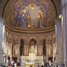
Rue du Mont-Cenis, Street in Montmartre, 18th arrondissement of Paris, France

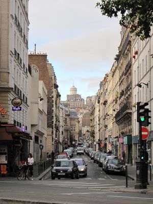
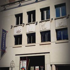
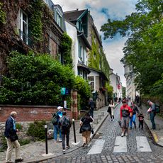
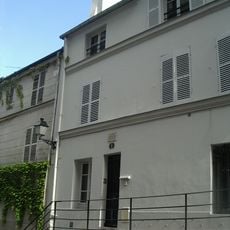
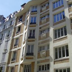
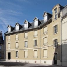
Rue du Mont-Cenis is a 1304-meter street running through Montmartre with steep sections containing 187 steps across different areas. It connects various elevation levels and reveals the neighborhood's typical architecture of 19th-century residential buildings.

Originally called rue Saint-Denis, it received its current name in 1868 to reference the Alpine range in northern France. This renaming reflected the neighborhood's evolving identity during the 19th century.

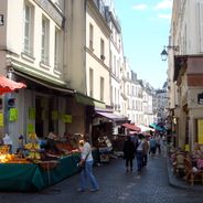
The street inspired artists who captured the neighborhood's character in their works, showing how people adapted to the steep terrain. Locals use the numerous passages and stairs as part of their everyday movement through the hillside.

The street connects metro stations Abbesses and Lamarck-Caulaincourt, making it easy to reach from different parts of the neighborhood. Wearing comfortable shoes is advisable, as the steep sections and numerous stairs require physical effort.

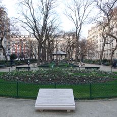
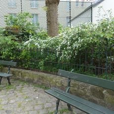
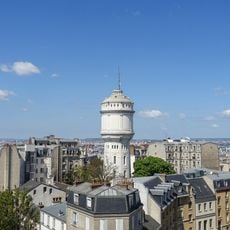
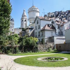
At number 14 stands the Montmartre water tower within Square Claude-Charpentier, a local infrastructure landmark that served the neighborhood's water management needs. Its placement in a public square creates an unusual blend of practical function and urban design.

Location: Paris

Location: 18th arrondissement of Paris

Location: Clignancourt

Inception: May 23, 1863

Length: 1,304 m

Width: 12 m

Part of: road network of Paris

Shares border with: passage du Mont-Cenis, passage Duhesme, Place Albert-Kahn, place du Tertre, place Jules-Joffrin, rue Aimé-Lavy, rue Belliard, rue Caulaincourt, Rue Cortot, rue Custine, rue du Baigneur, Rue du Simplon, rue Duc, rue Francœur, rue Joseph-Dijon, rue Lamarck, Rue Marcadet, Rue Ordener, rue Paul-Féval, rue Saint-Éleuthère, rue Saint-Rustique, rue Saint-Vincent, rue Versigny, place Jean-Marais, rue Azaïs, rue Norvins, rue du Chevalier-de-La-Barre

GPS coordinates: 48.89120,2.34377

Latest update: December 6, 2025 17:41

Photos
Historic streets and passages in France: medieval architecture, traditional markets, seaside walks

The streets of France tell stories that go back many centuries. Walking through the cobblestone alleys of Paris, you see old facades and small hidden cafes. In Strasbourg, the canals wind between colorful houses with typical timber-framed walls. Nice has palm-lined walkways where locals and visitors...

Reviews

Visited this place? Tap the stars to rate it and share your experience / photos with the community! Try now! You can cancel it anytime.

« Rue du Mont-Cenis - Street in Montmartre, 18th arrondissement of Paris, France » is provided by Around Us (aroundus.com). Images and texts are derived from Wikimedia project under a Creative Commons license. You are allowed to copy, distribute, and modify copies of this page, under the conditions set by the license, as long as this note is clearly visible.

Discover hidden gems everywhere you go!

From secret cafés to breathtaking viewpoints, skip the crowded tourist spots and find places that match your style. Our app makes it easy with voice search, smart filtering, route optimization, and insider tips from travelers worldwide. Download now for the complete mobile experience.

Around Us App Screenshot

A unique approach to discovering new places

Le Figaro

All the places worth exploring

France Info

A tailor-made excursion in just a few clicks

20 Minutes