Roc de Peyrole, Mountain summit in Vercors Massif, France
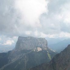
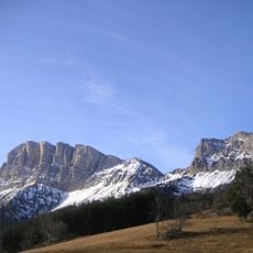
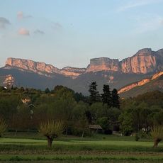
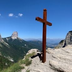
Roc de Peyrole is a mountain summit in the Vercors Massif, rising to 1,884 meters with limestone rock formations dominating its peaks and ridges. The surrounding slopes are steep and crossed by established trails that lead hikers to scenic viewpoints across the region.
The massif was formed through tectonic movements during the Alpine mountain-building period millions of years ago. These geological forces shaped the limestone structures that define the summit's appearance today.
The slopes around the summit feature open grasslands shaped by traditional pastoral use, where shepherds still graze their flocks across the high meadows. This agricultural practice remains a visible part of the mountain's character today.
Reaching the summit requires good fitness and careful planning, as the terrain is steep and involves significant elevation gain along the way. Marked trails aid navigation, but hikers should prepare for changing weather and some exposed sections.
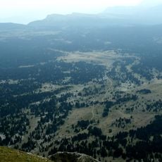
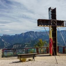
On clear days, the summit offers expansive views across multiple neighboring peaks and the Vercors Regional Natural Park below. Few visitors realize how much of the surrounding mountain landscape becomes visible from this vantage point.
Elevation above the sea: 1,884 m
GPS coordinates: 44.76944,5.45722
Latest update: December 15, 2025 13:24
Mount Aiguille
11 km
Grand Veymont
12.4 km
Cirque d'Archiane
4.6 km
Réserve naturelle nationale des hauts plateaux du Vercors
12.2 km
Abbaye de Valcroissant
3.3 km
Die Cathedral
7.1 km
Musée de Die
7.1 km
Temple protestant de Die
7.1 km
Remparts de Die
7.2 km
Altars for bull offers
7.1 km
La Ferme aux Papillons
6.6 km
Musée de la Préhistoire du Vercors
13.3 km
La Croix de Justin
8.9 km
La forêt Labyrinthe
12.1 km
Église Notre-Dame-de-Consolation de Marignac-en-Diois
10.5 km
Église Notre-Dame de Chichilianne
10.3 km
Église Saint-Roman de Saint-Roman
8.8 km
Chapelle de Trézanne
12.8 km
Église Saint-Julien de Châtillon-en-Diois
8.6 km
Église Sainte-Catherine de Ponet-et-Saint-Auban
11.3 km
Orbanne Viaduct
13 km
Piscine municipale
8.7 km
Pas de l'Aiguille
6.4 km
Temple de Marignac-en-Diois
10.5 km
Ermitage Notre-Dame d'Esparron
11.7 km
Chapelle Notre-Dame-d'Espérance de Die
6.6 km
Maison du notaire Chambron
7.1 km
Hôtel de ville de Châtillon-en-Diois
8.6 kmVisited this place? Tap the stars to rate it and share your experience / photos with the community! Try now! You can cancel it anytime.
Discover hidden gems everywhere you go!
From secret cafés to breathtaking viewpoints, skip the crowded tourist spots and find places that match your style. Our app makes it easy with voice search, smart filtering, route optimization, and insider tips from travelers worldwide. Download now for the complete mobile experience.
A unique approach to discovering new places❞
— Le Figaro
All the places worth exploring❞
— France Info
A tailor-made excursion in just a few clicks❞
— 20 Minutes