Enable Location

We need your location to show you interesting places around you

Discover nearby places

Find interesting locations and hidden gems around you

Precise directions

Get accurate directions and distances to places

Your location is never shared with other users. It's only used when you tap the location button.

Log in to your account

Start exploring — it's free

Trusted by 62,282 travelers worldwide

Continue with Google
Continue with Apple
or

We will send you a code to connect

By continuing, you accept our Terms and Conditions and our Privacy Policy

Check your inbox

We've sent a pincode in your inbox. Please enter the code below.

Gorubathan community development block

Gorubathan community development block, Administrative block in Kalimpong, India.

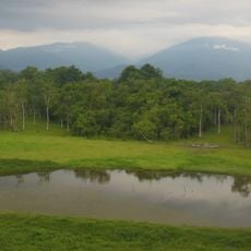
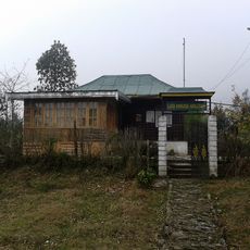
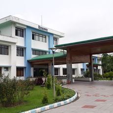
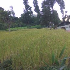
Gorubathan is a community development block within the Kalimpong subdivision of West Bengal, comprising villages and rural settlements spread across hilly terrain. The block contains schools at various levels serving the local population, along with tea gardens and farmland.

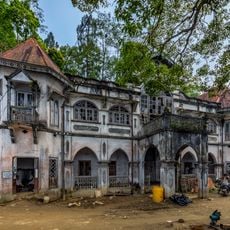
The region has roots in territorial conflicts, marked by defensive operations at Dalim Fort during regional disputes. This fortress represents an earlier period of military significance in the area.

Nepali is the dominant language heard in daily conversations throughout the block, shaping how locals interact and conduct business. This linguistic foundation gives the region its distinct cultural character in everyday life.

The hilly terrain requires using local transportation or guides to explore the scattered villages effectively. Visitors should allow time to navigate rural roads and adapt to local conditions.

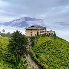
Six tea gardens operate within the block, forming a major part of the local economy and landscape. These terraced plantations are visible across the region and employ many residents in cultivation and processing.

The community of curious travelers

AroundUs brings together thousands of curated places, local tips, and hidden gems, enriched daily by 60,000 contributors worldwide.

Start exploring
Shares border with
Matiali community development block, Nagrakata community development block, Mal community development block, Kalimpong I community development block, Kalimpong II community development block
GPS coordinates
26.96000,88.69000
Latest update
December 12, 2025 16:43
« Gorubathan community development block - Administrative block in Kalimpong, India » is provided by Around Us (aroundus.com). Images and texts are derived from Wikimedia project under a Creative Commons license. You are allowed to copy, distribute, and modify copies of this page, under the conditions set by the license, as long as this note is clearly visible.

Discover hidden gems everywhere you go!

From secret cafés to breathtaking viewpoints, skip the crowded tourist spots and find places that match your style. Our app makes it easy with voice search, smart filtering, route optimization, and insider tips from travelers worldwide. Download now for the complete mobile experience.

Around Us App Screenshot

A unique approach to discovering new places

Le Figaro

All the places worth exploring

France Info

A tailor-made excursion in just a few clicks

20 Minutes

Around Us
Travel Guide & Maps
Download

Send to your phone

QR Code
1

Open the camera app on your mobile.

2

Point at the QR code with your camera. A notification will appear.

3

Tap the notification to open the link.