Log in to your account

AroundUs is a community-driven map of interesting places, built by curious explorers like you. It grows with every review, story, and photo you share.
Connect to save your favorite spots, contribute locations, and create personalized routes.
Continue with Google
Continue with Apple
Continue with X
Continue with Facebook
Continue with email
By continuing, you accept our Terms and Conditions and our Privacy Policy
Create an account
Add to collection
Map
Suggest a change
Share

Kalimpong district, Administrative district in West Bengal, India

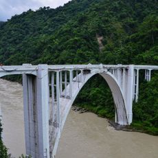
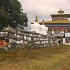
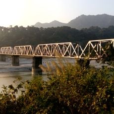
Kalimpong district sits in the Himalayan foothills and is marked by mountain ranges, valleys, and the Teesta River flowing through its terrain. The landscape displays steep slopes, dense vegetation, and water channels that define the region's natural character.

The region came under British control through the Treaty of Sinchula in 1865 after previously belonging to Sikkim. This agreement, which followed the conflict between Britain and Bhutan, permanently altered the area's political status.

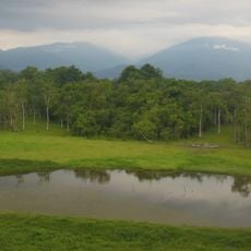
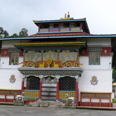
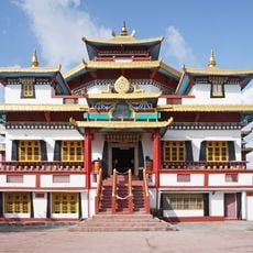
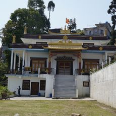
The Lepcha, Bhutia, and Nepali communities shape daily life through their festivals, monasteries, and social gatherings that visitors can witness throughout the district. Their distinct traditions remain visible in local practices and the way people celebrate seasonal events.

The climate is temperate with mild summers and cold winters, making the area accessible for activities throughout the year. Visitors should prepare for varying weather conditions since elevation significantly affects temperatures across different parts of the district.

The district has become known for growing orchids and flowering plants, with many nurseries producing and selling Himalayan bulbs across the region. This focus on floriculture shapes the local economy and creates distinctive planted landscapes throughout the area.

Location: Jalpaiguri division

Capital city: Kalimpong

Shares border with: Darjeeling district, Jalpaiguri district, Namchi district, East Sikkim district, Samtse District

Website: https://kalimpongdistrict.in

GPS coordinates: 27.06000,88.47000

Latest update: December 20, 2025 02:33

Photos
Reviews

Visited this place? Tap the stars to rate it and share your experience / photos with the community! Try now! You can cancel it anytime.

Administrative divisions
« Kalimpong district - Administrative district in West Bengal, India » is provided by Around Us (aroundus.com). Images and texts are derived from Wikimedia project under a Creative Commons license. You are allowed to copy, distribute, and modify copies of this page, under the conditions set by the license, as long as this note is clearly visible.

Discover hidden gems everywhere you go!

From secret cafés to breathtaking viewpoints, skip the crowded tourist spots and find places that match your style. Our app makes it easy with voice search, smart filtering, route optimization, and insider tips from travelers worldwide. Download now for the complete mobile experience.

Around Us App Screenshot

A unique approach to discovering new places

Le Figaro

All the places worth exploring

France Info

A tailor-made excursion in just a few clicks

20 Minutes