Mount Carleton, Summit and mountain in Northumberland County, Canada.
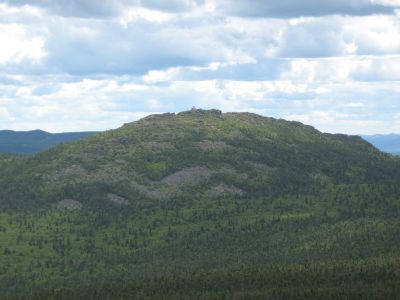
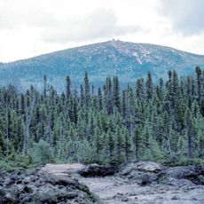
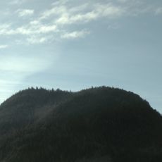
Mount Carleton is a mountain summit in Northumberland County, within Mount Carleton Provincial Park in New Brunswick, and stands as the highest point in Canada's Maritime provinces at 820 meters above sea level. The peak rises above a wide stretch of boreal forest, and on clear days the view from the top reaches far across the surrounding hills and lakes.
Long before European settlers arrived, Indigenous peoples used this mountain and the surrounding land for generations as part of their traditional territory. The peak was later named after Guy Carleton, a British general who served as governor of British North America in the 18th century.
The provincial park around this mountain is a recognized dark sky preserve where visitors can watch stars and the Milky Way without light pollution interfering. The sky here stays dark enough that even faint stars remain visible to the naked eye.
The main trail to the summit passes through mixed terrain, so sturdy footwear and enough water are important before starting the climb. Weather on the mountain can shift quickly at any time of year, and visitors should come prepared for rain or cold even on days that start sunny.
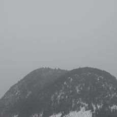
The provincial park surrounding the peak is a certified dark sky preserve, one of the few places in eastern Canada where the Milky Way can be seen with the naked eye on a clear night. In winter, the same trails used for hiking become routes for cross-country skiing, snowshoeing, and snowmobiling.
The community of curious travelers
AroundUs brings together thousands of curated places, local tips, and hidden gems, enriched daily by 60,000 contributors worldwide.