Enable Location

We need your location to show you interesting places around you

Discover nearby places

Find interesting locations and hidden gems around you

Precise directions

Get accurate directions and distances to places

Your location is never shared with other users. It's only used when you tap the location button.

Rouge National Urban Park

Log in to your account

Start exploring — it's free

Trusted by 61,912 travelers worldwide

Continue with Google
Continue with Apple
or

We will send you a code to connect

By continuing, you accept our Terms and Conditions and our Privacy Policy

Check your inbox

We've sent a pincode in your inbox. Please enter the code below.

Rouge National Urban Park

Rouge National Urban Park, National urban park in Toronto, Canada

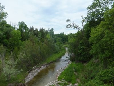
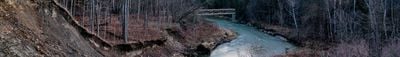
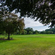
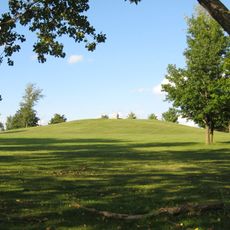
Rouge National Urban Park is a national park on the eastern edge of Toronto that stretches from the shores of Lake Ontario to the forested hills in the north. The park includes several river branches, farmland, dense deciduous forests, and open meadow areas that span three adjacent municipalities.

The land served as home to different communities over millennia before being protected from urban development in the 20th century. Official establishment as Canada's first urban national park came in 2015 after decades of conservation efforts.

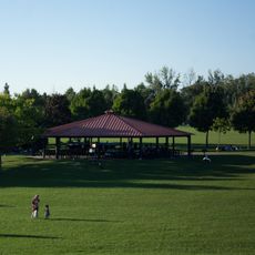
The area takes its name from the reddish clay along the banks that early French traders noticed. Today, families from across the region use the meadows for picnicking and the shallow waters for wading on warm days.

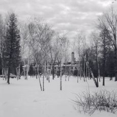
Several entrances lead to different areas of the park, with some sections better suited for short walks while others allow for longer hikes. In winter, many paths remain open for snowshoeing and cross-country skiing, though some sections may close depending on conditions.

Within the boundaries lie active farms that grow vegetables and fruit for local markets. Visitors can see fields of pumpkins and corn growing right next to hiking trails in autumn.

The community of curious travelers

AroundUs brings together thousands of curated places, local tips, and hidden gems, enriched daily by 60,000 contributors worldwide.

Start exploring
Location
Inception
May 15, 2015
GPS coordinates
43.80833,-79.15000
Latest update
December 5, 2025 22:30
« Rouge National Urban Park - National urban park in Toronto, Canada » is provided by Around Us (aroundus.com). Images and texts are derived from Wikimedia project under a Creative Commons license. You are allowed to copy, distribute, and modify copies of this page, under the conditions set by the license, as long as this note is clearly visible.

Discover hidden gems everywhere you go!

From secret cafés to breathtaking viewpoints, skip the crowded tourist spots and find places that match your style. Our app makes it easy with voice search, smart filtering, route optimization, and insider tips from travelers worldwide. Download now for the complete mobile experience.

Around Us App Screenshot

A unique approach to discovering new places

Le Figaro

All the places worth exploring

France Info

A tailor-made excursion in just a few clicks

20 Minutes

Around Us
Travel Guide & Maps
Download

Send to your phone

QR Code
1

Open the camera app on your mobile.

2

Point at the QR code with your camera. A notification will appear.

3

Tap the notification to open the link.