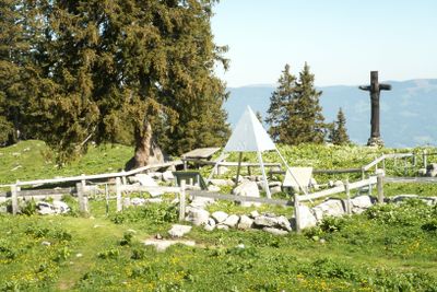
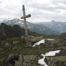
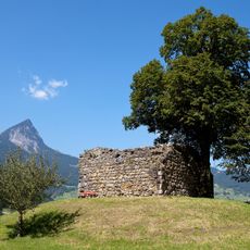
Geographical centre of Switzerland, Monument at Älggi-Alp in Sachseln, Switzerland
The geographical centre of Switzerland is a stone monument on Älggi-Alp in Sachseln that marks the mathematically calculated midpoint of the country. It stands at 1522 meters elevation and is accessible by hiking trails from the nearby village.
The centre was determined in 1988 by Switzerland's Federal Office of Topography through mathematical calculations based on the country's total landmass. This precision measurement took into account the exact shape and extent of all the nation's territory.
The stone marker displays a commemorative plaque honoring recipients of national recognition, linking this geographical focal point to the country's celebrated achievements. This connection between a physical center and human accomplishment gives the site personal significance for visitors.
The best time to visit is during the hiking season when trails are open and accessible. The monument itself is always reachable, though sturdy footwear and some fitness are needed for the ascent.
This site represents the mathematical balance point where Switzerland would equilibrate perfectly if made of uniform material with equal thickness throughout. Standing at this calculated fulcrum gives visitors a tangible sense of being at the nation's physical centre.
The community of curious travelers
AroundUs brings together thousands of curated places, local tips, and hidden gems, enriched daily by 60,000 contributors worldwide.