Enable Location

We need your location to show you interesting places around you

Discover nearby places

Find interesting locations and hidden gems around you

Precise directions

Get accurate directions and distances to places

Your location is never shared with other users. It's only used when you tap the location button.

Grafenau

Log in to your account

Join the adventure

Create your free account and start exploring

Save your favorite places
Create custom travel routes
Rate and review places
Access the full interactive map
Continue with Google
Continue with Apple
Continue with email
By continuing, you accept our Terms and Conditions and our Privacy Policy
Create an account

Grafenau, Urban municipality in Freyung-Grafenau district, Germany.

Description

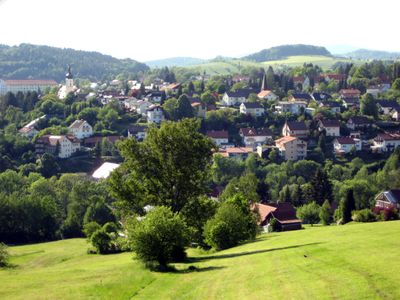
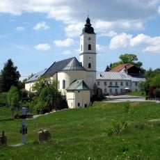
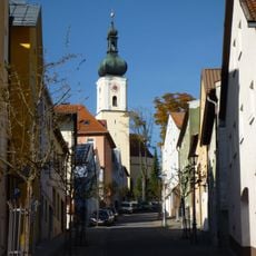
Grafenau is an urban municipality in the Freyung-Grafenau district in Lower Bavaria, located at about 600 meters elevation and surrounded by dense forest and rolling hills. The town center displays traditional architecture with the wooden facades and gables typical of the region.

History

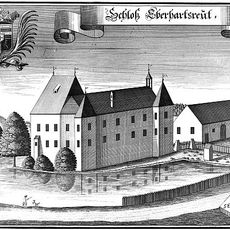
The settlement emerged during medieval times as a strategic point in Lower Bavaria and developed from a small village into an administrative center. Over the centuries, its role as a seat of administration for surrounding communities became established.

Culture

The area is known for its craft traditions, which visitors can observe in local workshops where glass and wood are worked using traditional methods. These crafts shape the local character and appear in shops and at regular markets throughout the year.

Practical

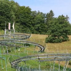
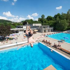
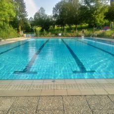
As an administrative center, the municipality is easy to reach and offers all essential services for visitors and residents. The surrounding area is good for hiking and exploring the Bavarian Forest, with the town center serving as a convenient starting point.

Did you know?

The municipality serves as the seat of Verwaltungsgemeinschaft Grafenau, coordinating multiple surrounding communes. This administrative role shapes the town's importance in the Bavarian Forest region, though it remains less visible to casual visitors.

i
Location
i
Elevation above the sea
609 m
i
Shares border with
Saldenburg, Perlesreut, Ringelai, Hohenau, Neuschönau, Sankt Oswald-Riedlhütte, Spiegelau, Schönberg
i
i
GPS coordinates
48.85624,13.39694
i
Latest update
December 20, 2025 14:53

AroundUs brings together thousands of curated places, local tips, and hidden gems, enriched daily by 60,000 contributors worldwide. Discover all places nearby (Freyung-Grafenau).

Reviews

Visited this place? Tap the stars to rate it and share your experience / photos with the community! Try now! You can cancel it anytime.

« Grafenau - Urban municipality in Freyung-Grafenau district, Germany » is provided by Around Us (aroundus.com). Images and texts are derived from Wikimedia project under a Creative Commons license. You are allowed to copy, distribute, and modify copies of this page, under the conditions set by the license, as long as this note is clearly visible.

Discover hidden gems everywhere you go!

From secret cafés to breathtaking viewpoints, skip the crowded tourist spots and find places that match your style. Our app makes it easy with voice search, smart filtering, route optimization, and insider tips from travelers worldwide. Download now for the complete mobile experience.

Around Us App Screenshot

A unique approach to discovering new places

Le Figaro

All the places worth exploring

France Info

A tailor-made excursion in just a few clicks

20 Minutes