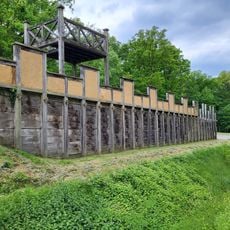
Oberaden, Roman military fortress in Bergkamen, Germany
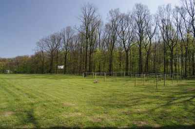
Oberaden is an excavated Roman military fortress that spans about 54 hectares and displays remnants of defensive structures including ditches and earthen ramparts. The remains of building foundations and structures allow visitors to understand how the camp was laid out and the engineering solutions used by Roman builders.
The fortress was built around 11 BCE under Emperor Augustus as a strategic base for Roman legions conducting operations east of the Rhine. This outpost was important to Roman expansion into Germanic territory during this early period of the empire.
The finds here reveal that Roman soldiers ate imported Mediterranean foods like figs and olives brought from distant lands. These discoveries show how Romans maintained their familiar way of living even at this remote outpost far from home.
The excavated sections of the camp are accessible for exploration where visitors can see stone remains and earthen ramparts. Wearing comfortable shoes is recommended since the ground is uneven and walking distances are considerable to view different parts of the site.
Scientists were able to determine the exact construction time of the fortress to autumn 11 BCE using analysis of tree rings from wooden remains. This precise dating makes this site invaluable for understanding the timeline of Roman history in the region.
The community of curious travelers
AroundUs brings together thousands of curated places, local tips, and hidden gems, enriched daily by 60,000 contributors worldwide.