Enable Location

We need your location to show you interesting places around you

Discover nearby places

Find interesting locations and hidden gems around you

Precise directions

Get accurate directions and distances to places

Your location is never shared with other users. It's only used when you tap the location button.

Rudow

Log in to your account

Start exploring — it's free

Trusted by 63,070 travelers worldwide

Continue with Google
Continue with Apple
or

We will send you a code to connect

By continuing, you accept our Terms and Conditions and our Privacy Policy

Check your inbox

We've sent a pincode in your inbox. Please enter the code below.

Discussion Reviews 1 Photos
20.4k Popularity

Rudow, Residential district in Neukölln, Germany

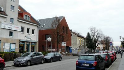
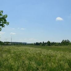
Rudow is a residential district in southern Berlin with varied soil types from sand and clay moraines. The area spreads across about 38 meters elevation and mixes green spaces with dense buildings from different phases of urban development.

The district was first mentioned in 1373 as a rural settlement and initially consisted of about 64 farms. With the administrative reform of 1920, it became part of Greater Berlin and experienced rapid growth afterward.

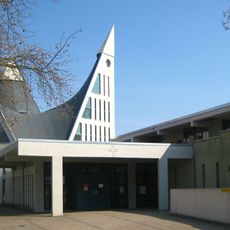
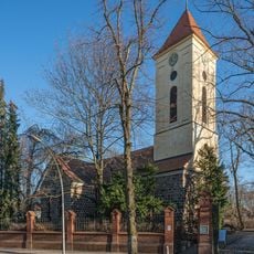
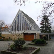
The old village church with its fieldstone walls shapes the local identity and reflects the area's medieval roots. It stands today among modern residential blocks, showing how the historical settlement expanded over time.

The U7 subway line connects the district to central Berlin via two stations, making it easy to reach other parts of the city. The A113 motorway provides direct access for drivers heading to neighboring areas.

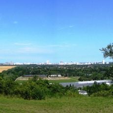
The Rudower Höhe is a hill about 70 meters high, built from rubble after World War II. Today it attracts people for sledding and winter sports, creating a green space within the built-up area.

The community of curious travelers

AroundUs brings together thousands of curated places, local tips, and hidden gems, enriched daily by 60,000 contributors worldwide.

Start exploring
Location
Elevation above the sea
38 m
Shares border with
Britz, Buckow, Gropiusstadt, Johannisthal, Altglienicke, Baumschulenweg
GPS coordinates
52.41670,13.50000
Latest update
December 7, 2025 10:06
Reviews
Share your experience

No review yet

Discussions
Start a discussion...

No discussion yet

« Rudow - Residential district in Neukölln, Germany » is provided by Around Us (aroundus.com). Images and texts are derived from Wikimedia project under a Creative Commons license. You are allowed to copy, distribute, and modify copies of this page, under the conditions set by the license, as long as this note is clearly visible.

Discover hidden gems everywhere you go!

From secret cafés to breathtaking viewpoints, skip the crowded tourist spots and find places that match your style. Our app makes it easy with voice search, smart filtering, route optimization, and insider tips from travelers worldwide. Download now for the complete mobile experience.

Around Us App Screenshot

A unique approach to discovering new places

Le Figaro

All the places worth exploring

France Info

A tailor-made excursion in just a few clicks

20 Minutes

Around Us
Travel Guide & Maps
Download

Send to your phone

QR Code
1

Open the camera app on your mobile.

2

Point at the QR code with your camera. A notification will appear.

3

Tap the notification to open the link.