Steinach, Brook in Nürtingen, Germany
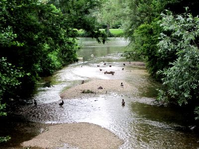
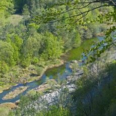
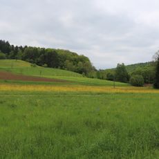
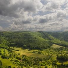
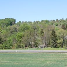
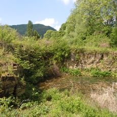
The Steinach is a brook that winds through the landscape near Nürtingen in Baden-Württemberg, flowing from springs near Neuffen until it joins the Neckar River. The water carves a valley that passes through several villages and creates different habitats for plants and wildlife along its course.
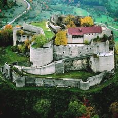
This brook has flowed through the region for centuries, serving communities as a water source and natural border from early times. Over the ages, people have adapted to its presence and occasionally redirected its power, while it shaped the settlement patterns of nearby villages.
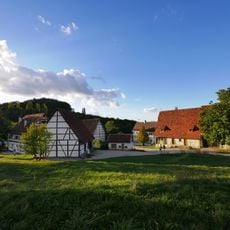
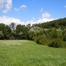
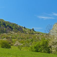
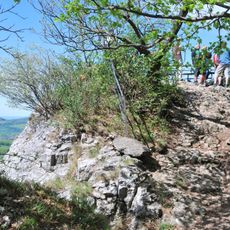
The water shapes how people in the surrounding villages relate to the landscape, serving as a natural gathering space for locals and visitors alike. You can see how the communities have organized their daily routines around the seasonal changes of the water.
Spring and autumn are good times to visit, when water flow is visible and the paths are easy to walk. You can explore the valley on foot and reach the water's edge in many places, with sturdy shoes recommended for the wetter sections.
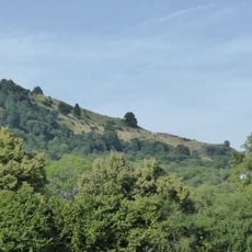
In certain spots, the water has carved pools and small cascades that glow beautifully on sunny days. These natural features are not found everywhere, but at the right sections they feel like small surprises hidden in the valley.
Location: Nürtingen
GPS coordinates: 48.58203,9.36497
Latest update: December 14, 2025 17:00
Hohenneuffen Castle
3.6 km
Freilichtmuseum Beuren
3.7 km
Jusiberg
4 km
Neuffener Hörnle-Jusenberg
4.2 km
Evangelische Martinskirche Neuffen
3.2 km
Burgstelle Tiefenbach
4.5 km
Neuffener Heide
4 km
LSG 'Tiefenbachtal' vom 15.10.1958
3.3 km
Großes Haus
3.2 km
Albvorland Nürtingen-Kirchheim
3.5 km
Neuffen auf Gemarkungen Neuffen und Kappishäusern
3.3 km
Albtrauf Beuren
3.3 km
LSG 'Autmuttal bei Großbettlingen, Geigersbühl und Gewann Gelber Brunnen' (3 Teilgebiete) vom 24.07.1981
4.4 km
Gebiete um Nürtingen und Reudern
3.9 km
LSG 'Gebiete um Frickenhausen, Linsenhofen und Tischardt' (4 Teilgebiete) vom 02.03.1982
1.2 km
LSG 'Albtrauf Kohlberg' 10.07.1984
3.5 km
LSG 'Beuren' vom 09.04.2001
2.2 km
Jusi - Auf dem Berg
4.2 km
Rathaus Neuffen
3.1 km
St. Nikolaus (Beuren)
3.2 km
Steinbruch im Gewann Dentel
3.1 km
St. Theodors Buckel
3.7 km
Beurener Fels
4.2 km
1 Birnbaum
4.1 km
Vulkanembryo Geigersbühl mit 3 Linden
4 km
Lindenallee im Tiefenbachtal
3.6 km
Vulkanembryo Hochbölle
3.9 km
Hecke im Gewann Börlenbergegert
3.9 kmVisited this place? Tap the stars to rate it and share your experience / photos with the community! Try now! You can cancel it anytime.
Discover hidden gems everywhere you go!
From secret cafés to breathtaking viewpoints, skip the crowded tourist spots and find places that match your style. Our app makes it easy with voice search, smart filtering, route optimization, and insider tips from travelers worldwide. Download now for the complete mobile experience.
A unique approach to discovering new places❞
— Le Figaro
All the places worth exploring❞
— France Info
A tailor-made excursion in just a few clicks❞
— 20 Minutes