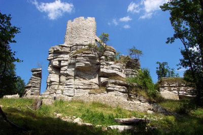
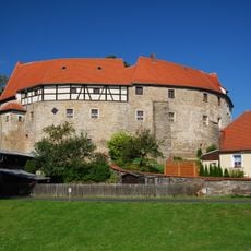
Burg Weißenstein, Medieval castle ruins in Waldershof, Germany
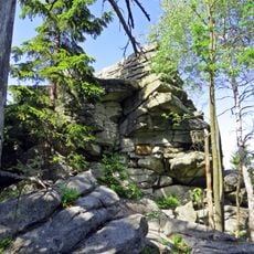
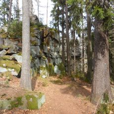
Burg Weißenstein is a castle ruin in the Oberpfälzer Wald region near Waldershof, perched on a rocky outcrop at about 863 meters elevation. The structure measures roughly 50 meters long and 30 meters wide, with walls built directly into the rock formation of the hillside.
The castle was first documented in 1279 as Wisstenstein and originally belonged to the Weißensteiner family. Around 1300 the property came under the control of the powerful Nothafft family, who held it for centuries afterward.
The ruins show how a medieval noble stronghold was built to blend with its surroundings. Visitors can still see today how the structure merged with the natural landscape.
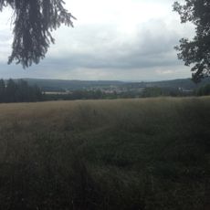
The ruins are reachable by a roughly 30-minute walk from the Weißenstein parking area in Hohenhard, following the yellow-marked Goldsteig hiking trail. The site is accessible on foot, though sturdy shoes are important because of the rocky terrain.
The castle walls are so skillfully integrated into the rock formation that it is sometimes hard to tell where human construction ends and nature begins. This merging shows how medieval builders used the local geology to their advantage.
Location: Waldershof
Elevation above the sea: 863 m
Length: 50 m
Width: 30 m
Address: Hopfenwinkel,Ruine Weißenstein
GPS coordinates: 49.91385,12.08328
Latest update: December 8, 2025 19:44
Steinwald
239 m
Upper Palatinate Tower
2.2 km
Platte
2.2 km
Schloss Reuth
8.3 km
Burg Waldershof
7.3 km
Teichelberg
7.1 km
Schloss Poppenreuth
3.8 km
Schloss Hopfau
7.6 km
Katzentrögel
2.6 km
St. Wolfgang
8.4 km
Schlosskirche (Poppenreuth)
3.8 km
Kreuzbergkirche
6.7 km
Sankt Michael
6.7 km
Schloss Riglasreuth
8.4 km
St. Martin
6.3 km
Heilig Kreuz
6.1 km
Kirche St. Katharina
8.4 km
Katholische Expositurkirche
3.9 km
Maria Immaculata
3.7 km
Katholische Pfarrkirche Herz Jesu
7 km
Katholische Wallfahrtskirche Unserer Lieben Frau
4.5 km
St. Wendelin
8.3 km
St. Sebastian
7.4 km
Kriegergedächtniskapelle für die Gefallenen von 1914/18
7.9 km
Fuchsmühler Waldbadeweiher
4.4 km
LSG innerhalb des Naturparks Steinwald (ehemals Schutzzone)
2.7 km
Rathaus, ehemaliges Schulhaus
6.4 km
Hackelstein-Gipfel W von Fuchsmühl
2.7 kmVisited this place? Tap the stars to rate it and share your experience / photos with the community! Try now! You can cancel it anytime.
Discover hidden gems everywhere you go!
From secret cafés to breathtaking viewpoints, skip the crowded tourist spots and find places that match your style. Our app makes it easy with voice search, smart filtering, route optimization, and insider tips from travelers worldwide. Download now for the complete mobile experience.
A unique approach to discovering new places❞
— Le Figaro
All the places worth exploring❞
— France Info
A tailor-made excursion in just a few clicks❞
— 20 Minutes