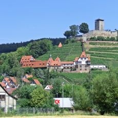
Wunnenstein, Mountain summit in Großbottwar, Germany
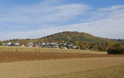
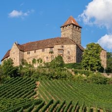
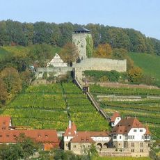
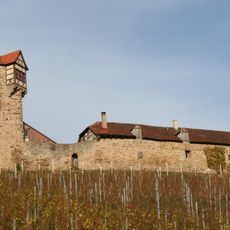
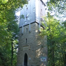
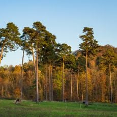
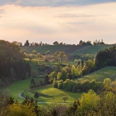
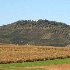
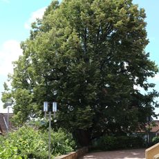
Wunnenstein is a mountain summit near Großbottwar that rises to about 394 meters elevation and features an observation tower at its peak. From this vantage point, visitors can see across the Baden-Württemberg landscape on clear days and take in the wine-growing region below.
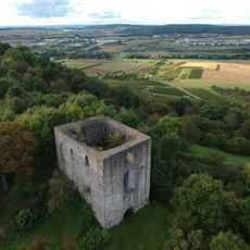
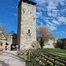
During the German Peasants' War in 1525, this mountain served as a gathering place for rebellious farmers from the Württemberg region. The church that once crowned the peak was demolished during the 16th century.
The tower on this peak marks where the Michaeliskirche church once stood before its demolition in 1556. Visitors today use this spot to look out across the landscape and connect with the layers of history beneath their feet.
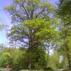
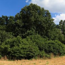
The summit can be reached on foot via several hiking trails that approach the mountain from different directions. Weather and time of day should be considered for the best views and most comfortable conditions during the walk.
This peak played a notable role during the peasant uprisings, shaping how locals understand their region's past. The mountain's connection to this turbulent period adds depth to what visitors experience when standing at the summit.
Location: Großbottwar
Elevation above the sea: 393.5 m
GPS coordinates: 49.02916,9.27809
Latest update: December 11, 2025 18:07
Burg Lichtenberg
3.9 km
Burg Hohenbeilstein
3.2 km
Burg Wildeck
5.4 km
Burg Helfenberg
4.5 km
Johanneskirche Oberstenfeld
3 km
Unteres Schloss
3 km
Bartholomäuskirche
3.8 km
St.-Anna-Kirche
3 km
Stephanuskirche (Abstatt)
4.5 km
Alte Kelter (Helfenberg)
4.2 km
Stadtschänke (Großbottwar)
3.3 km
Wunnenstein Tower
29 m
City hall Großbottwar
3.3 km
Martinskirche Großbottwar
3.3 km
Wunnenstein, Forstberg und Köchersberg mit angrenzenden Gebieten (Landkreis Ludwigsburg)
769 m
Burg Hohenbeilstein
3.1 km
Fohlenberg und Umgebung
3.7 km
Rathaus Beilstein
3 km
Kälbling und Umgebung
4.1 km
Anna-Linde (Beilstein)
3 km
Krugeiche
5.4 km
Wunnenstein, Forstberg und Köchersberg mit angrenzenden Gebieten (Landkreis Heilbronn)
756 m
Halbtrockenrasen "Heidäcker"
5 km
1 Mostbirnbaum
2.8 km
Feuchtgebiet "Bustadt"
3.9 km
FND Ilsfeld Feuchtgebiet am Tiefenbach
3.3 km
Schiefes Haus (Großbottwar)
3.3 km
1 Linde
3.8 kmVisited this place? Tap the stars to rate it and share your experience / photos with the community! Try now! You can cancel it anytime.
Discover hidden gems everywhere you go!
From secret cafés to breathtaking viewpoints, skip the crowded tourist spots and find places that match your style. Our app makes it easy with voice search, smart filtering, route optimization, and insider tips from travelers worldwide. Download now for the complete mobile experience.
A unique approach to discovering new places❞
— Le Figaro
All the places worth exploring❞
— France Info
A tailor-made excursion in just a few clicks❞
— 20 Minutes