Enable Location

We need your location to show you interesting places around you

Discover nearby places

Find interesting locations and hidden gems around you

Precise directions

Get accurate directions and distances to places

Your location is never shared with other users. It's only used when you tap the location button.

Linden-Berg

Log in to your account

Start exploring — it's free

Trusted by 62,883 travelers worldwide

Continue with Google
Continue with Apple
or

We will send you a code to connect

By continuing, you accept our Terms and Conditions and our Privacy Policy

Check your inbox

We've sent a pincode in your inbox. Please enter the code below.

Linden-Berg

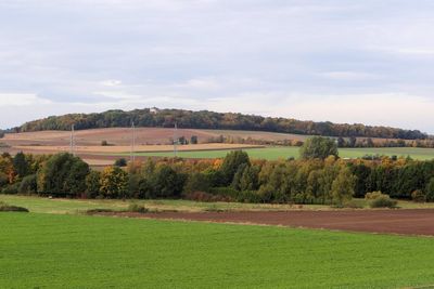
Linden-Berg, Hill in Ostbraunschweigisches Hügelland, Lower Saxony, Germany.

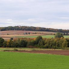
Linden-Berg rises to an elevation of 122 meters above sea level, forming part of the gently rolling hills that characterize the Ostbraunschweigisches Hügelland landscape in Lower Saxony.

The region around Linden-Berg has been shaped by geological processes dating back to the Trias, Jura, and Kreide periods, with the area historically serving as part of the inner-German border during Germany's division.

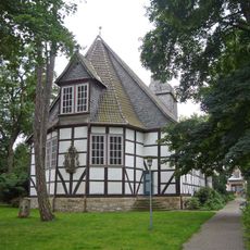
The surrounding region maintains traditional East German customs and rural festivals that celebrate local agricultural heritage, with farms and orchards continuing to influence the cultural landscape of the lower slopes.

Visitors can access Linden-Berg via local roads connecting towns like Schöningen and Helmstedt, with parking facilities available near trailheads and public transportation options from nearby settlements.

Ancient tribes reportedly used Linden-Berg as a strategic lookout point, taking advantage of its commanding views over the North German Plains for defensive and surveillance purposes during medieval times.

The community of curious travelers

AroundUs brings together thousands of curated places, local tips, and hidden gems, enriched daily by 60,000 contributors worldwide.

Start exploring
Location
Elevation above the sea
122 m
Part of
Ostbraunschweigisches Hügelland
GPS coordinates
52.19224,10.49398
Latest update
July 25, 2025 19:35
« Linden-Berg - Hill in Ostbraunschweigisches Hügelland, Lower Saxony, Germany » is provided by Around Us (aroundus.com). Images and texts are derived from Wikimedia project under a Creative Commons license. You are allowed to copy, distribute, and modify copies of this page, under the conditions set by the license, as long as this note is clearly visible.

Discover hidden gems everywhere you go!

From secret cafés to breathtaking viewpoints, skip the crowded tourist spots and find places that match your style. Our app makes it easy with voice search, smart filtering, route optimization, and insider tips from travelers worldwide. Download now for the complete mobile experience.

Around Us App Screenshot

A unique approach to discovering new places

Le Figaro

All the places worth exploring

France Info

A tailor-made excursion in just a few clicks

20 Minutes

Around Us
Travel Guide & Maps
Download

Send to your phone

QR Code
1

Open the camera app on your mobile.

2

Point at the QR code with your camera. A notification will appear.

3

Tap the notification to open the link.